Item is a computer print-out of PSP data from Aleza Lake Research Forest.
File contains reports on the analysis of permanent sample plots in the Aleza Lake Research Forest.
File contains information, including diagrams, measurement charts, and a map, for experimental plot 45.
File contains information, including diagrams, measurement charts, and a map, for experimental plot 112.
File contains information, including diagrams, measurement charts, and a map, for experimental plot 118.
File contains information, including measurement charts and a map, from experimental plot 150.
File contains handwritten tables and graphs of measurements of plots, photocopied reports, 9 black and white photos, and handwritten notes.
File contains photocopies of data sheets and charts, handwritten ledger pages, and a photocopied study of plot 106.
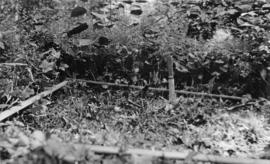
Photograph is one of six relating to Plot 108. Multiple copies of the photographs exist.
File contains handwritten measurements and charts for Plot 114.
File contains original handwritten notes and photocopied data listing reports for Plot 116.
File contains photocopies of measurement charts, and the report for Plot 115.
File contains handwritten and photocopies of measurement charts, and a photocopy of the the related study for Plot 118.
Item is the field copy of a 1929 BC Forest Service report from Myra, BC titled "Southern Interior District Experimental Plot No. 160: Conditions After Logging of a Spruce-Balsam Forest in Relation to Spruce Reproduction and to the Rate of Growth of the Second Story".
Item is the office copy of a 1929 BC Forest Service report from Myra, BC titled "Southern Interior District Experimental Plot No. 160: Conditions After Logging of a Spruce-Balsam Forest in Relation to Spruce Reproduction and to the Rate of Growth of the Second Story".
Item is the 1958 BC Forest Service report from Myra, BC titled "E.P. 160 & 503: Development of a Residual Stand of Interior Spruce-Alpine Fir During the First 28 Years Following Cutting". This report is the follow-up to the 1926 and 1936 reports titled "Conditions After Logging of a Spruce-Balsam Forest in Relation to Spruce Reproduction and to the Rate of Growth of the Second Story".
No. 2 Rail Car Chip Dumper Tunnel excavation looking N.E.
"A" Mill Bleached Stock Spill near "B" Mill Machine Room Reactor Pit looking S.E.
Heating registers thru W. wall "A" Mill Machine Room into "B" Mill Machine Room looking S.E.
Heating registers thru W. wall "A" Mill Machine Room into "B" Mill Machine Room looking S.E.
"B" Mill Machine Room, S. wall looking N.E.
No. 2 Rail Car Chip Dumper Tunnel excavation looking.
No. 2 Rail Car Chip Dumper abandoned blow line sections looking N.E.
No. 2 Rail Car Chip Dumper Tunnel Excavation looking N.W.
No. 2 Rail Car Chip Dumper Tunnel Excavation looking N.E.
No. 2 Rail Car Chip Dumper Tunnel Excavation looking N.
No. 2 Rail Car Chip Dumper Tunnel Excavation looking S.
"B" Mill Machine Room looking N.W.
"B" Mill Machine Room Sample Storage Room looking S.W.
"B" Mill Pulping Group. 13'-6X26'-0 Bleached stock vacuum washer drum.
"B" Mill Pulping Group. Impco single shaft steam mixers.
"B" Mill Power Group looking S.W.
"B" Mill Pulping Group looking N.E.
Water Treatment Clarifier looking S.E.
"B" Mill Power Group from Track #14 looking N.
"B" Mill Power Group E. Wall looking N.W.
"B" Mill Power Group looking N.W.
Lime Kiln Piers from track #14 looking N.W.
"B" Mill Machine Room from N-S road looking N.E.
"B" Mill Pulping Group from N-S road looking N.E.
Roof beams for "B" Mill Pulping Group looking N.W.
"B" Mill Pulping Group from track #9 looking N.W.
"B" Mill Pulping Group from near Woods Div. Bldg. looking South E.
Weather protection cover for welding digester sections.


