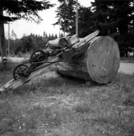
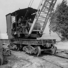
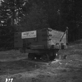
Photograph depicts a mine ore car exhibited on the site of the Granby Mine at the ghost town of Phoenix, near Grand Forks.
Photograph depicts the coking ovens at Union Bay on Vancouver Island. They belong to the Canadian Collieries Ltd. and the date last used is unknown.
Photograph depicts the coaling wharf at Union Bay on Vancouver Island. It is the property of the Canadian Colliery Resources Ltd. It was last used on August 15, 1960. Thereafter, all equipment and railways were dismantled but the water tank is still standing.
Photograph depicts loading coal at Buckley Bay. Coal is from Tsable Mine belonging to the Comox Colliery Co. The view is looking north.
Photograph depicts the Cominco Ltd. In Kimberley, near Cranbrook. There is a 3' gauge overhead electric railway serving the underground workings of Sullivan mine. The view shows the C.P.R. access in the valley and the old mine portal, still used for in-going materials and supplies, at the right center of the photo.
Government map depicts railway lands, lands "disposed of", grazing leases, and timber berths. Shows the British Columbia 'railway belt' running from Greater Vancouver to Field, B.C.
Map depicts all current rail lines in Western Canada and Alaska and major railway stations. Includes insets for Alaska & Yukon, Edmonton area, Winnipeg area, and the Vancouver area.
Map depicts the Abbotsford area, including railway lines.
Map depicts rail trackage in the Greater Vancouver area, showing dates of completion and abandonment of railway lines. Also shows proposed rail lines.
Map depicts the city of Richmond and Lulu Island, including rail trackage.
Tourist map of Prince George depicts city area, with annotations by Davies to emphasize locations of rail lines.
Map depicts the route of BC Rail and its connecting rail lines.
Technical drawing of Kettle Valley Railway depicts trackage and a gradient profile for the line.
Map depicts area around Kelowna, with annotated Kettle Valley Railway Carmi subdivision line, Hydraulic Lake, and McCulloch.
Map depicts the cities of Summerland, Penticton, and Naramata. Annotated by Davies to emphasize the rail lines in the area.
Plan depicts the CNR rail yard in Kamloops. The plan was originally drafted on March 6, 1928 and updated to July 1937.
Plan depicts a proposed location for a CNR station and crossing in Kelowna.
Plan depicts Granville Island industrial sites in False Creek, Vancouver. Shows revised trackage from 1955 annotated in colour by Davies.
Sign says "Pacific Great Eastern Railway Company - Explosives - Handle Carefully - Keep Fire Away - North Vancouver Station June 25 1969". Also includes condensed rules for handling cars with explosives.
Map depicts the City of Squamish, Howe Sound, and the Britannia Mine.
Technical drawing depicts a condensed profile of the CN Albreda subdivision.
Subseries consists of prints and negatives depicting railways in British Columbia separated from the textual records of the David Davies Railway Collection.
Photograph depicts the Tsable coal pit on Vancouver Island as the first coal of the afternoon shift being hauled up.
Photograph depicts a mill on the north stream of the north arm of the Fraser River, looking east from the Fraser St. bridge.
Photograph depicts an early type of spool donkey circa 1890-1900, on display at Promised Land Park on the Olympia Peninsula in Washington state.
Photograph depicts a steam donkey located in the Crown Zellerbach Museum at Ladysmith on Vancouver Island.
Photograph depicts an early type of steam donkey mounted on a flatcar and attached to a Shay Tank. It is displayed on the roadside at Promised Land Park, probably near Forks, on the Olympic Peninsula in Washington state.
Photograph depicts a saw on the outskirts of Courtenay on the road to Cumberland.
Photograph depicts a donkey engine at the Cowichan Valley Forest Museum
Photograph depicts a view of the main saw and bull chain of the Horne Bros. Ltd. Shingle mill on #305 West Esplanade Rd. in North Vancouver.
Photograph depicts a steam crane in the yard of the Lions Gate Lumber Co. at the foot of Lloyd St. in North Vancouver. The crane was made by the Brown Hoisting Machinery Co. in Cleveland, Ohio and is undated. It has a 20 ton capacity, is well maintained, and freshly painted.
Photograph depicts a steam crane in a lumber yard on the north side of Porpoise Bay in Sechelt on the Sechelt Peninsula. The steam crane has been converted to diesel and was made by the Brown Hoisting Co. from Cleveland, Ohio. It lifts 21 tons at a 12ft radius and 5 tons at 35ft radius, and is in daily use. The 200 yards of rail track form a "Y" with the bottom piece onto the wharf.
Photograph depicts a small coal drift mine which worked perhaps 6 months prior to the picture being taken. Timber lands # 8, Cranberry, about 17 miles south of Nanaimo.
Photograph depicts a derelict gold mine at Hedley, BC.
Photograph depicts the pit head refuse at Extension Coal Mine, 5 miles southwest of Nanaimo. It worked between 1901 and 1931.
Photograph depicts a mine 200 yards south of Moyie village, which is 20 miles south of Cranbrook. It produced silver, zinc, and lead from 1900-1910 and had a smelter a quarter mile away. The shaft was 900 ft. deep, with levels going under Moyie Lake. The head gear dates from 1925-1935 and has electric winding.
Photograph depicts a derelict shovel beside the coaling wharves at Union Bay.
Photograph depicts a Ruston steam roller owned by Gary Wellburn in Duncan, BCIt was previously owned by the Oak Bay municipality.
Photograph depicts a steam crane at the Allied Shipbuilders Ltd. on 145 West First Ave in Vancouver, BC
Photograph depicts an old pelton wheel at a former quarry at Granite Falls on the northeast head of the Indian Arm.
Map depicts Canadian railways in operation at 2011.
Map depicts historical rail lines in the BC lower mainland, including trackage for the BC Electric Railway, the Canadian Northern Pacific Railway, the Canadian Pacific Railway, the Great Northern Railway, and the Pacific Great Eastern Railway, among others.
Map depicts the Cowichan Lake area, including rail trackage for the Western Forest Industries Logging Railway, the Canadian National Railway, and the BC Forest Products Logging Railway.
Plan depicts the proposed CNR rail yard layout in Kelowna. A later plan, dated May 30th 1925, shows drastically reduced trackage and no barge slip.
Plan depicts the Canadian Pacific Railway yards in Kamloops and the proposed connection between CPR and CNR. Includes a CPR track profile, profiles of street crossing, and enlargements.
Plan depicts architectural drawings of the Canadian National Railway station in Kamloops. Includes an elevation of the building and floor plans.
Plan depicts sections, elevations, and floor plans for the addition to the Kamloops roundhouse.
Plan depicts "scheme B" of the proposed 6 stall addition to the roundhouse at Kamloops, BC.
Map depicts locations of all mining properties in British Columbia. Includes index with names of owners of properties.
Contour plan shows layout of a water tunnel near Lyon's Creek in the CNR Clearwater subdivision.