File consists of material regarding railway passenger fares. Predominantly consists of photocopy reproductions, excerpts from books, and clippings from periodicals. Includes past passenger rates for E&N, CN, BC Rail, PGE, CPR, GNR, VIA Rail, and BCER Interurbans.
File consists of records created and accumulated by Gary Runka over the course of his consultancy work for First People's Law for the "Taseko Mine Review" project. This file was numbered as G.G. Runka Land Sense Ltd. client file #670; that client number may be seen referenced elsewhere in the G. Gary Runka fonds. The Land Sense Ltd. client files generally include records such as correspondence, contracts, invoices, project reports, publications, ephemera, memoranda, maps or map excerpts, legal documents, meeting materials, clippings, and handwritten notes.
File consists of records created and accumulated by Gary Runka over the course of his consultancy work for Tides Canada Initiatives Society for the "Marine Area Planning Partnership" project in Central Coast. This file was numbered as G.G. Runka Land Sense Ltd. client file #673; that client number may be seen referenced elsewhere in the G. Gary Runka fonds. The Land Sense Ltd. client files generally include records such as correspondence, contracts, invoices, project reports, publications, ephemera, memoranda, maps or map excerpts, legal documents, meeting materials, clippings, and handwritten notes.
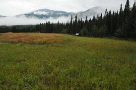
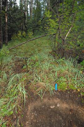
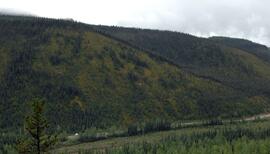
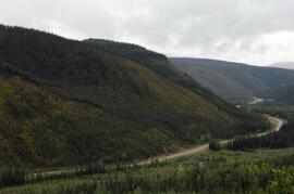
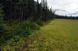
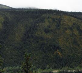
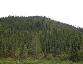
Image is a panoramic view of north-facing slope (sites BC12-08 and BC12-09) overlooking the Tetsa River crossing of the Alaska Highway, taken from across the valley.
Image is a panoramic view of north-facing slope (sites BC12-08 and BC12-09) overlooking the Tetsa River crossing of the Alaska Highway, taken from across the valley.
File consists of background articles on railway passenger time tables.
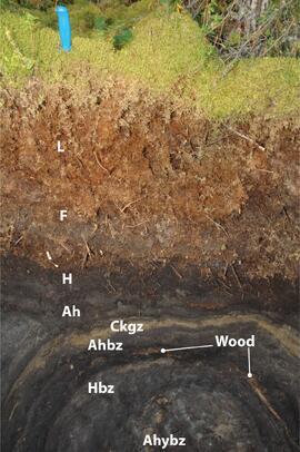
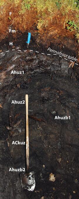
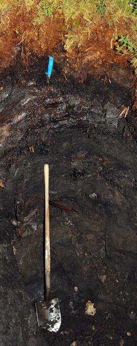
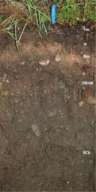
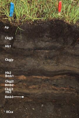
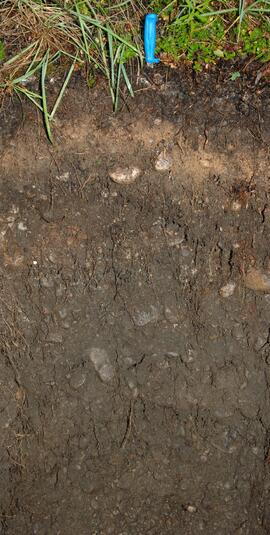
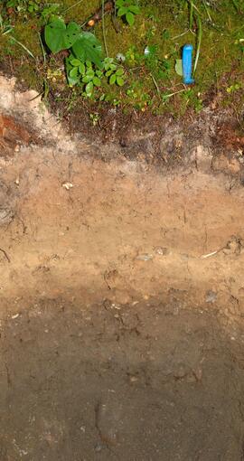
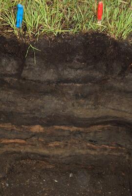
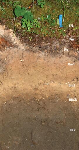
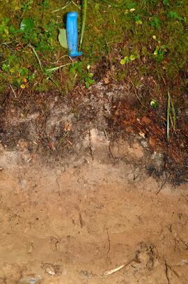
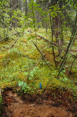
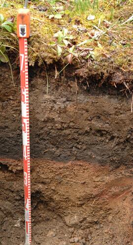
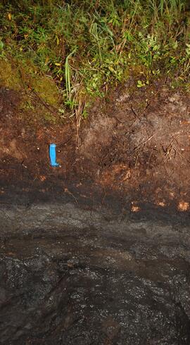
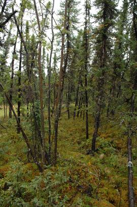
For this Northern Rockies pedological study, Dr. Paul Sanborn conducted field work jointly with researchers from the Ministry of Forests and Agriculture Canada from August 21-24, 2012, at two clusters of sites along the Alaska Highway west of Fort Nelson: near the Tetsa River crossing at km 585, and ~4.5 km west of Toad River at the "Poplars" campsite.
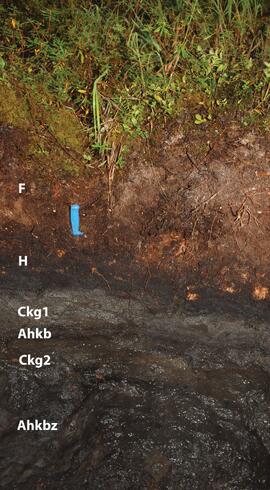
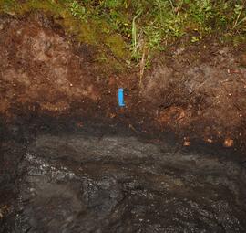
The focus of the study was on soils currently or recently containing permafrost as well as associated soils on nearby sites with warmer microclimates, with a total of 6 pedons described and sampled. One of these, an Organic Cryosol (pedon BC12-08), was documented in a short paper:
Sanborn, P., C. Bulmer, M. Geertsema, and S. Smith. 2022. A proposed Folic subgroup for the Organic Cryosols. Canadian Journal of Soil Science 102: 811–816. https://doi.org/10.1139/cjss-2021-0182
Associated soil microclimate monitoring occurred at this site, and is documented in:
Hasler A., Geertsema M., Foord V., Gruber S., Noetzli J. 2015. The influence of surface characteristics, topography and continentality on mountain permafrost in British Columbia. The Cryosphere 9: 1025–1038. https://doi.org/10.5194/tc-9-1025-2015
Some of the data from both papers was presented as a poster at the Canadian Society of Soil Science annual conference in 2013.
The highlights of the 2022 paper were presented at an online meeting of the Soil Classification Working Group of CSSS on January 20, 2023.
The sequence of site numbers is BC12-08, -09, (-10 was not used), -11, -12, -13, -14, and -15. Note that BC12-13 was described and sampled, but not photographed. An additional pedon designated as BC12-13A was located within ~10 m of BC12-13 on the same terrace, and had what appeared to be a buried fire-reddened layer under a possible buried Ah horizon. This pedon was photographed but not described or sampled.
File contains the following data sets:
- S1292Final.xlsx [chemical analysis data for mineral horizons, Ministry of Forests & Range, Analytical Chemistry Laboratory]
- S1293Final.xlsx [chemical analysis data for organic horizons, Ministry of Forests & Range, Analytical Chemistry Laboratory]
- B299530-R2013-02-18_15-47-21_N001.xls [particle size analysis data for mineral horizons, Maxxam Laboratories]
- B299530-R2013-02-18_15-47-21_R014.pdf [particle size analysis data for mineral horizons, Maxxam Laboratories]
- Northern Rockies 2012 sample list - Maxxam.xls [list of samples submitted to Maxxam Laboratories for particle size analysis; indicates which samples needed carbonate removal pretreatment]
- N Rockies 2012 - master data file.xlsx [working copy of combined chemical and particle size data in report format]
Image is a panoramic view of north-facing slope (sites BC12-08 and BC12-09) overlooking the Tetsa River crossing of the Alaska Highway, taken from across the valley.
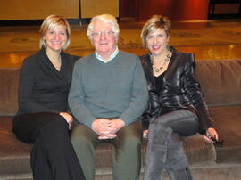
Photograph depicts Cayla Runka, Gary Runka, and Shaundehl Runka.
File consists of records created and accumulated by Gary Runka over the course of his consultancy work for B.C. Women's Institutes for the "Site C - Environmental Impact Statement Technical Review" project in Site C. This file was numbered as G.G. Runka Land Sense Ltd. client file #671; that client number may be seen referenced elsewhere in the G. Gary Runka fonds. The Land Sense Ltd. client files generally include records such as correspondence, contracts, invoices, project reports, publications, ephemera, memoranda, maps or map excerpts, legal documents, meeting materials, clippings, and handwritten notes. Also includes an oversize bound map book by BC Hydro entitled "Preliminary Impact Lines and Preferred Highway 29 Realignments Maps" for the Site C project, published April 2012.
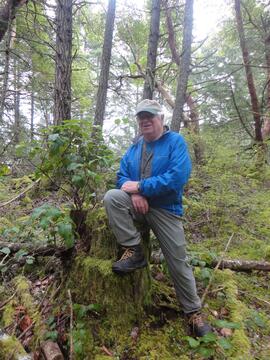
Photograph depicts Gary Runka hiking on Southern Vancouver Island.
File consists of materials for a presentation given by the BC Ministry of Forests, Lands and Natural Resource Operations in June 2012. File consists of an information package entitled "Timber Tenures in British Columbia: Managing Public Forests in the Public Interest" and a printed slide presentation entitled "Overview of BC Forest Tenures".
Image is a panoramic view of north-facing slope (sites BC12-08 and BC12-09) overlooking the Tetsa River crossing of the Alaska Highway, taken from across the valley.
File consists of:
- Program for 6th Annual UNBC Graduate Conference (March 2011)
- Program for 8th Annual UNBC Graduate Conference (March 2013)
- Program for 9th Annual UNBC Graduate Conference (Feb. 2014)
File consists of research material regarding the CPR's Kettle Valley Railway Osoyoos Branch (Penticton to Osoyoos). Predominantly consists of photocopy reproductions, excerpts from books, and clippings from periodicals.
File consists of Board Budget Monthly usage records.
File consists of Board of Governors Budget for Food Services records.
File consists of Master Card records.
Photograph depicts a weathered barn along a body of water, presumed to be in the North Thompson area.
Photograph depicts a weathered barn along a body of water, presumed to be in the North Thompson area.
Photograph depicts a residential building in the North Thompson region.
Photograph depicts a wooden building presumably at the Fort St. James historic site.
Photograph depicts a wooden and abandoned building, the roof caving in and the sides tarnishing. Photograph taken in an unknown location.
Photograph depicts a wooden and abandoned building, the roof caving in and the sides tarnishing. Photograph taken in an unknown location.
Photograph depicts a wooden and abandoned building, the roof caving in and the sides tarnishing. Photograph taken in an unknown location.
Photograph depicts an abandoned and worn out grain elevator, with three buildings in a row and the elevators going down towards the ground.
Photograph depicts an abandoned and worn out wooden building in a flat field.
