2013.6.36.1.013.63
·
Item
·
[29 June 1965]
Part of David Davies Railway Collection
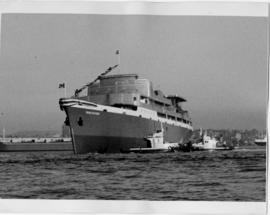
Photograph depicts the C.C.G.S. "Vancouver" launched about two minutes previously and about 400 yards from Burrard Dry Dock in North Vancouver. The photograph was taken from the sailing dinghy "Ceiriog".