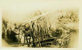
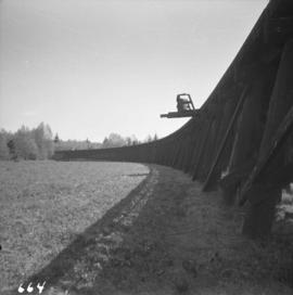
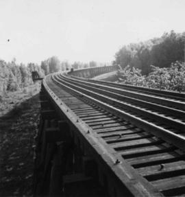
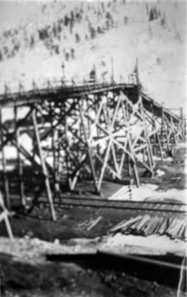
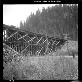
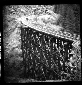
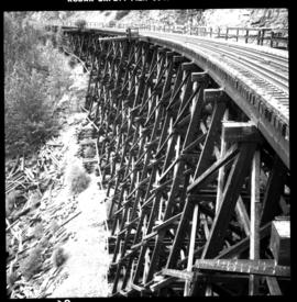
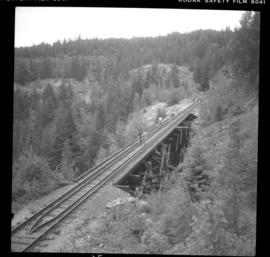
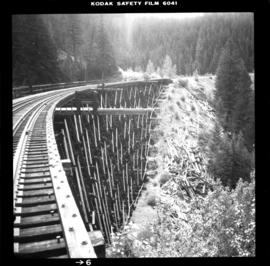
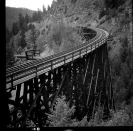
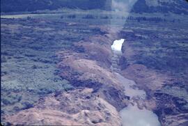
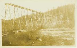
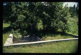
Photograph depicts a wooden trestle designed for carrying water flumes. Annotation on verso of photograph states: "Trestle work for carrying water flume - Germansen Placer Ltd"
Photograph depicts a wood trestle constructed in a cleared forest area. Handwritten annotation on verso of photograph reads: "Trestle nearing completion across valley of south fork of Germansen Creek".
Photograph depicts a wooden trestle under construction along a hillside within a forested landscape. Handwritten annotation on verso of photograph reads: "Trestle work three (?) Upper Canyon 200 yards below intake, Germansen Placer Ltd."
Photograph depicts a trestle on the ex CPR Coquihalla line of the Kettle Valley Railway. It is a famous view spot because the trestle has a waterfall behind it. It is now the only intact trestle on the line because even the very small ones were demolished after the line closed on 23 November 1959. It is located about mile 21.7 from Brookmere. The grade here is about 1 in 53.
Photograph depicts a trestle of the Great Northern Railway, main line to Blaine, curving towards the southwest from the south end of the New Westminster rail bridge.
Photograph depicts the trestle leading to the Canadian National Railway (CN) swing bridge across the north arm of the Fraser River. The view was taken on Lulu Island, looking northeast. The ground on each side of the trestle is peaty and springy when walked on.
Photograph depicts a trestle on the south bank of the north arm of the Fraser River leading from the C.N.R. swing bridge, approximately 5 miles southeast of New Westminster, looking south.
Photograph depicts a trestle over railroad tracks in an unknown snowy location. (Possibly Mountain Park?)
Photograph depicts a trestle bridge on the old CPR Kettle Valley Railway. It is about 5 miles southeast of Brookmere, between Thalia and Spearing on the Princeton Subdivision.
Photograph depicts the CPR Kettle Valley Railway in Myra Canyon. This is one of the nine wooden trestles between mile 85 and mile 86.4
Photograph depicts the CPR Kettle Valley Railway in Myra Canyon. It shows the a wooden trestle fitted with a sidewalk, which at 434 ft. long is the longest one in the canyon. It is located at mile 85.9. The view is looking south.
Photograph depicts the CPR Kettle Valley Railway in Myra Canyon. The view is looking north at the trestle located at mile 85.4
Photograph depicts the CPR Kettle Valley Railway in Myra Canyon. It shows the a wooden trestle fitted with a sidewalk, which at 434 ft. long is the longest one in the canyon. It is located at mile 85.9. The view is looking south.
Photograph depicts the CPR Kettle Valley Railway in Myra Canyon. It shows the a wooden trestle fitted with a sidewalk, which at 434 ft. long is the longest one in the canyon. It is located at mile 85.9. The view is looking north.
Photograph depicts a trestle bridge for road traffic leading to the Second Narrows Bridge in Vancouver, BCThe shot is taken from the south bank.
File contains correspondence to Brian Fawcett from Trent University. Includes a letter to Brian Fawcett from Trent University regarding a goods and service tax small supplier declaration form. Faxed copy dated September 19, 1993.
File consists of a paper by Michael Bradford entitled "Trends in the Abundance of Chinook Salmon of the Nechako River, British Columbia".
Aerial view, Yellowknife, Northwest Territories
Sunset and darkness on Trembleur Lake, Northern British Columbia
Image depicts a west-looking view of Trembleur Lake.
File consists of audio and visual material relating to the interview of Trelle Morrow conducted by Kent Sedgwick. Also includes an audio cassette entitled "Trelle Morrow interview"; an audio microcassette entitled "Kent - CBC -Trelle"; and a CD-ROM entitled "Trelle Morrow interview colour photos" depicting photographs of the interview.
The item is an audio cassette recording an interview with Trelle Morrow.
The item is an audio compact disc interview with Trelle Morrow.
Includes an audiocassette and a CD copy of an interview conducted by Kent Sedgwick with Trelle Morrow on the history of architectural design in Prince George.
Morrow, TrellePhotograph depicts Trelle Morrow standing in the Soda Creek cemetery. Annotation on verso: "Trelle M. at cemetery, Soda Creek, 2010.'
Photograph depicts Trelle Morrow and Jim Rankin at the Soda Creek cemetery. Annotation on verso: "Trelle M. and Jim Rankin at Soda Creek cemetery, 2010."
Habitat of Populus deltoides ? at Cottonwood Island Park
Photograph depicts trees standing in foreground, river and hills visible in distance.
Image depicts a stand of trees and a shed at Island Cache.
Image depicts two old houses surrounded by numerous trees at an uncertain location.
Image depicts a green car among some trees on Cottonwood Island.
Bench visible in left foreground.
Image depicts numerous trees in an uncertain location; the slide itself is labelled "T.T. Cutting," possibly meaning "Telegraph Trail Cutting."
Image depicts a few trees, with what is possibly the Northwood Pulpmill in the background, in Prince George, B.C.
Image depicts a small copse of trees boxed in by very small concrete barriers somewhere in Kettle Valley, B.C.
Item is a photograph of a tree stump apparently eaten through by beavers.
Large tree trunk and smaller saplings silhouetted against Summit Lake, forest visible on opposite shore. Handwritten caption beside this photo reads: "Sumit Lake."