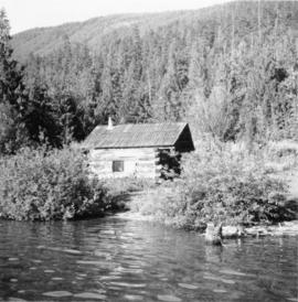
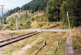
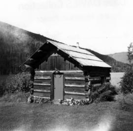
Photograph depicts an original trappers cabin on Staubert Lake.
Photograph depicts a trappeers cabin on the northend of Trout Lake and Trout Lake City. It was maintained in good condition by present owners who valued its age.
Photograph depicts a cattle shed located 3 miles east of Pavilion Lake, which is 15 miles northeast of Lillooet. It may have been a settler's cabin at one time.
Photograph depicts the yard at the Hat Creek Ranch. Hat Creek used to be a staging post on the Cariboo Road.
Photograph depicts an abandoned cabin about 100 yards from the Fraser River on Bridge River road, about 2 miles out of Lillooet.
Photograph depicts a new CN overpass in Campbell Creek. Looking at new eastbound lane of the Trans Canada Highway. It was all paid for by the Provincial Department of Highways in order to convert the 2 lanes into 4 in order to improve visibility and stretch the highway.
Photograph depicts a new bridge on the CNR Okanagan Branch. The old steel bridge on the right had been dismantled.
Photograph taken looking north, with a spur in the foreground. It was used by ore mixed freight daily. It was believed that at the bottom of the grade was a junction with a GNR branch that ran from the US border south of Creston to Kootenay Lake (built in 1904, then was hardly used, finally ceased in 1910).
Photograph depicts a CNR bascule bridge across the upper waters of Victoria Harbour. The rest of the trackage had been removed, except for the bridge itself.
Photograph depicts the CPR Pitt River swing bridge in an open position.
Photograph depicts a CPR swing bridge in Harrison Mills. Looking west, on the upstream side of the Harrison River.
Photograph depicts a swing bridge in Harrison Mills. It was rarely used, but all its controls were modern and maintained.