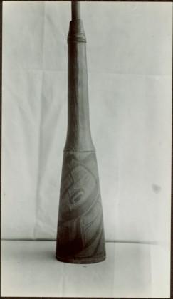
2009.7.1.216
·
Item
·
[ca. 1939]
Part of Archdeacon W. H. Collison fonds
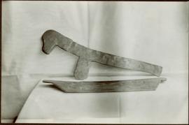
Unidentified tool leaning against a sheeted backdrop. Carved wooden bark shredder, used to soften and break up fibres of cedar bark lying on sheet covered table. Stamped annotation on verso reads: “Department of Mines and Resources, Photographic Section. Oct. 6, 1939”. Numeric annotation on verso: “48-3”