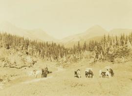
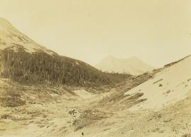
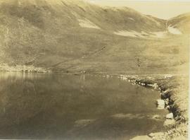
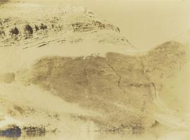
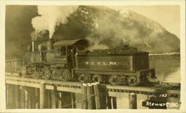
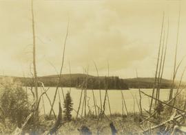
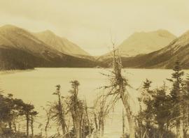
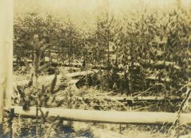
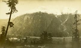
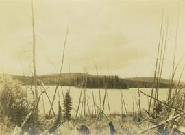
Photograph depicts a forested island in Bear Hole Lake as seen from the shore. In the foreground of the image is a barren tree line.
Photograph depicts a forested island in Bear Hole Lake as seen from the shore. In the foreground is a barren tree line.
Photograph depicts Carrol Paul (right) and Harry Snyder (left) sitting on the ground during a tea break. In the background is a forested area filled with coniferous trees.
Photograph depicts an unidentified creek with a bush covered shoreline on either side. In the background a densely forested area is visible.
Photograph depicts a pack horse team making its way across a area covered by fallen trees due to windfall.
Photograph depicts an unidentified forested landscape with leafy bushes in the foreground.
Photograph depicts a pack horse team slowly making their way across an area covered with windfall near Kinoosao Falls. In the background a tree-covered hillside is visible.
Photograph depicts Onion Lake as seen through a barren tree line. In the background a mountain range surrounds the shores of the lake.
Photograph depicts Pete Callao on horseback looking through binoculars in order to determine his course through a forested valley to Pine River. In the background the peak of a mountain is visible.
Photograph depicts regenerating pine trees in a burn area.
Photograph depicts a river running through an old burn site with barren trees lining the shores of the river. In the background a mountain range is visible with forested foothills at the base.
Photograph depicts a mountain vista seen through tall coniferous trees.
Photograph depicts a mountain vista as seen over the tree tops of a densely forested environment.
Photograph depicts a close perspective of a waterfall falling down a rocky cliff side. In the background a burnt forest environment is visible. The waterfall is know as both Kinuseo Falls and Kinoosao Falls.
Photograph depicts Pete Callao using an axe to cut a trail through an area covered with windfall.
Photograph depicts Frank Dewing cutting a trail through an area covered with windfall consisting of fallen trees.
Photograph depicts Prentiss Gray climbing over fallen logs in an area of windfall.
Photograph depicts Carrol Paul standing with rifle on top of felled bull moose. In the background a sparse forest is visible.
Photograph depicts Carrol Paul standing to the left beside a felled bull moose while George Bates sits on top of a felled bull moose.
Photograph depicts two men on horseback and a full laden pack horse riding across a grassy slope with a forested mountain range in the background. The location of photo is between Wapiti Lake and Red Deer Valley.
Photograph depicts a tree-covered valley with a snow-covered mountain range in the background. The location of photo is between Wapiti Lake and Red Deer Valley.
Photograph depicts a mountain goat lying on a rocky mountain slope.
Photograph depicts a distance perspective of a herd of mountain goats grazing across a rocky mountain slope.
Photograph depicts a distant perspective of a herd of mountain goats grazing across a rocky mountain slope.
Photograph depicts a distance perspective of a herd of mountain goats grazing across a rocky mountain slope.
Photograph depicts seven pack horses grazing in grass by a stream. In the background the tree line of a forest is visible with mountain peaks rising in the distance.
Photograph depicts a pack horse train walking through a mountain valley. In the background forested foothills are visible with a mountain peak rising in the distance.
Photograph depicts pack horses and crewmen walking along the shore of an alpine lake with a hillside rising up in the background. The location is the Mt. Petrie area from the north and northwest.
Photograph depicts a mountain peak rising above an alpine lake. The photograph location is the Mt. Petrie area from the north and northwest.
Photograph depicts a mountain ridge rising our of an alpine lake that is visible in the foreground. The photograph location is the Mt. Petrie area from the north and northwest.
Reproduced map on mylar depicts a proposed railway spur for the Aleza Lake Forest Experiment Station.
File consists of photocopied material regarding the Aleza Lake Experimental Station from BC Archives.
Reproduced map on mylar depicts the Aleza Lake timber reserve near Aleza Lake, BC.
Photograph of a large explosion on what appears to be a shoreline. Printed annotation on recto reads: "'Big Blast' Prince Rupert. B.C."
Photograph of a team of sled dogs pulling a load, followed by a group of men. Mountains are visible in the background. Printed annotation on recto reads: "Trail Over Bitter Creek Glacier to the Naas."
Photograph of a stretch of railroad passing by a small body of water. Mountains are visible in the background.
Photograph of a train passing through a forested area.
Photograph of a train passing over a bridge near Stewart, BC. Printed annotation on recto reads: "103 Stewart BC."
Head on photograph of a trapper standing in front of his cabin in Prince Rupert, BC. The front of the cabin is covered in various pelts. Printed annotation on recto reads: "A Trappers Cabin near Prince Rupert."
Lofty view of Kaien Island, with other islands in the background. Printed annotation on recto reads: "Kaien Island, Prince Rupert, B.C., showing Water Front of four miles on Prince Rupert Harbor."
Front view of two men sitting on a pile of supplies with a mountain in the background. Printed annotation on recto reads: "On the Divide Enroute to Naas #96."
Photo of a mountain with what appears to be Stewart, BC at its foot. Printed annotation on recto is partially obscured by fading and reads: "[Illegible] Stewart, BC."
Photograph of two men posing with large surveyor's measuring sticks in a forested area during winter.
Photograph of a small creek traveling through several rocky embankments.
Photograph of a team of sled dogs and resting men silhouetted against snowy mountaintops. Printed annotation on recto reads: "#92 Enroute to Naas On the Big Glacier."
Photograph of a team of sled dogs resting while a group of people rest around them. Printed annotation on recto reads: "First White Woman to Cross to the Naas #97."
Photograph of a large glacier. Printed annotation on recto reads: "Bitter Creek Glacier."
Photo of a mountain with what appears to be Stewart, BC at its foot. Printed annotation on recto is partially obscured by fading and reads: "[Illegible] Stewart, BC."
Photograph of a large pile driver working on the waterfront at the foot of a forested slope. Printed annotation on recto reads: 'Pile-driver working on Government Wharf Hughes #55."
Photograph of a bridge along a rocky shoreline. Printed annotation reads: "Colloway Rapids Bridge Prince Rupert Highway W.W.W." Handwritten annotation on verso is heavily obscured by residual album paper and reads: "PO Box 777 Prince Rupert BC. [Illegible] Lal. This[??] is a piece of our new bridge which [obscured] neats our Island with the mainland. We have had picnics on the other side & [illegible] is open for [illegible] to [illegible]ve ours this side of the [obscured] our stuff to the little [obscured] patronize[??]. Mrs. [illegible] are back again in Rupert [obscured] Kamloops office closed down [obscured] was no chance of transfer. Have not."