Photograph depicts ballast car #3013.
Photograph depicts the a weighbridge, just to the north of the city centre of Abbotsford.
Photograph depicts one of six former sub-stations of the BC Electric Railway's 64 mile interurban railway between New Westminster and Chilliwack. It opened in 1910, but was closed in the 1950's due to electric traction. The interior had been vandalized, but the building (made out of concrete) was so well built that the structure itself was quite sound.
Photograph taken at the west end of Johnston Street at the plant of Arrow Transfer Company Ltd.
Photograph taken looking southwest at the Granville Island to the mainland connection.
Photograph taken looking eastward, down a service rail track way, from Granville Bridge.
Photograph taken looking westward, down Johnston Street from the Granville Bridge. Davies notes minimal clearance on the left side of the track.
Photograph taken looking eastward, down Johnston Street.
Photograph taken looking eastward on Johnston Street.
Photograph depicts the northwest part of Granville Island, taken from the Granville bridge. A spur was covered with parked cars.
Photograph taken near downtown Vancouver. Image captured the south side, just east of the centre line.
Photograph depicts an unused spur leading southward to Morrison Steel and Wire Company Ltd. The spur crosses a disused line running on the south side of Cartwright Street.
Photograph taken looking southward under the arches of Granville Bridge along the rail road entry as well as exit to the Island.
Photograph taken looking westward along Johnston Street.
Photograph taken on the southwest side of Granville Island. After 2 years of hassle with owner Clay, Davies notes, the city of Vancouver purchased his property so as to re-develop the whole area as part of the False Creek clean up. There was opposition coming from moorage renters.
Photograph depicts BCER freight switching on the Island's trackage with B.C. locomotive #901 and tank car, property of Union Tank Car Company, built in 1926. Image captured directly underneath Granville Bridge.
Photograph taken on Cartwright Street, looking eastward. Track to the right is unusable because the switch towards the right is blocked over.
Photograph taken looking westward, down Cartwright Street. Trackage seen was not usable. Switch was blacktopped into position. The far end of the spur was used to lead to Columbia Bitolithic Ltd. Unseen track on the right side of the road was still in use.
Photograph taken looking southeast at the trackage underneath Granville Bridge.
Photograph depicts the passing loop and goods shed found at the Milner Siding. The main line had just been uprgaded to take coal units trains to Roberts Bank.
Photograph depicts former BC Electric car barns in New Westminster. In the foreground remained an old flat and possibly a hoist for battery plates.
Photograph depicts a steam crane with a jib in a gondola car. It is en route to an iron works in Burnaby.
Photograph depicts a BCER rail bridge at the entrance to False Creek, Vancouver.
Photograph depicts old BC Electric Railway interurbans purchased for restoration by the government of BC from an Oregon owner. They stood in the CPR Duke Street Yards in Vancouver.
Image depicts the BCR tracks passing through a mill somewhere near the 100 Mile.
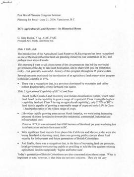
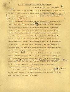
File consists of a speech given by Gary Runka entitled "BC's Agricultural Land Reserve - Its Historical Roots" at the Post World Planners Congress Seminar.
Commentary on this speech by Barry Smith of the Ministry of Agriculture and Lands:
"Vancouver hosted the World Planners Congress in June 2006 and the day following the Congress the BC Ministry of Agriculture and Lands and Agriculture and Agri-Food Canada hosted a full day seminar entitled "Planning for Food".
GGR provided an important overview of the BC farmland preservation program. The speech begins with comments outlining the factors motivating the government of the day to enact legislation to preserve agricultural land. The presentation was then broken into three time periods including:
The Formative Years (1972-1975)
The Refinement Years (1976-1996)
The Uncertain Years (1996-????)
GGR in his summary poses some less than optimistic questions and observations. He states that despite successes "there are growing
concerns that, over its history, the focus of the program has subtly shifted - from an agency devoted to farmland preservation, to a rationing board." He sees the focus on application review as being detrimental to the Commission's role of promoting and encouraging farming in the ALR. Given this shift in direction he presents several suggestions to get the program back on track.
The presentation ends with a challenge to the people of B.C. to decide whether the next segment of the B.C. farmland preservation history is entitled 'The Rebuilding Years' or not."
File consists of a speech given by Gary Runka entitled "BC's Land Use and the Current Land Inventory".
Commentary on this speech by Barry Smith of the Ministry of Agriculture and Lands:
"Although page 4 of this speech is missing (or possibly intentionally deleted), this document provides a detailed explanation of the CLI ratings and may well have been the basis of interpretation guidelines for agricultural capability mapping used by the ALC.
GGR at the time was the B.C. Land Inventory Field Coordinator.
It appears that slides at one point accompanied this speech."
Item is an photograph of a woman, B.D. Hodsdon sitting on the stairs to a house next to a rocky garden.
Caption: Note the rock and box garden. Item is an photograph of a woman, B.D. Hodsdon sitting on the stairs to a house next to a rocky garden.
Caption: On the "Only Way". Item is an photograph of a woman, B.D. Hodsdon walking.
Photograph depicts Bea (nee Baxter) Skaret and Margaret (nee Baxter) Lund wearing fur coats in snowy area. Tree and building semi-visible in background.
Photograph depicts Beach Ave. in Vancouver, with the photo taken near the swimming pool and looking west. Photo was taken after a storm.
Handwritten annotation on slide casing reads: “behind hotel Costa do Sol”.
Photograph is one of seven images believed to have been taken on a Canadian University Service Overseas (CUSO) mission in Mozambique; see also items 2009.6.1.483 - 2009.6.1.489.
Photograph depicts a road and walkway that borders the beach. Handwritten annotation below photograph reads, "beach on 1st narrows, Vancouver Jan. 1926".
Image depicts a bear located at the Bear Lake Dump.
Photograph depicts a cinnamon bear and Andre Beguin with camera on a rocky hill. Mountains in background.
Photograph of a long wooden bridge spanning a river. Forest and hills are visible in the background. Printed annotation on recto reads: "#46 Bear Creek Bridge, Stewart, BC."
Photograph depicts bears in captivity.
Photograph depicts bears in captivity. The large bear is chained by a neck collar.
Image depicts a small section of the Bear Glacier.
Image depicts a close-up of a cave-like opening in the Bear Glacier.
Image depicts the Bear Glacier in Bear Glacier Provincial Park, as well as what is possibly Strohn Lake.
Image depicts the Bear Glacier in Bear Glacier Provincial Park.
Image depicts a close-up of the Bear Glacier in Bear Glacier Provincial Park.
Image depicts Bear Glacier in the foreground and a mountain in the background, somewhere in Bear Glacier Provincial Park.
Image depicts the Bear Glacier with a cave-like opening.
Image depicts Bear Glacier in the foreground and numerous mountain peaks in the background in Bear Glacier Provincial Park.
Image depicts Sue and Kent Sedgwick with two dogs, standing with the Bear Glacier in the background.
Image depicts Sue Sedgwick with a dog, standing with the Bear Glacier in the background.