2023.2.2.15.3.2
·
Dossiê
·
1998-2010
Parte de Dr. Paul Sanborn fonds
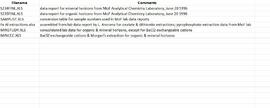
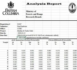
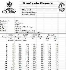
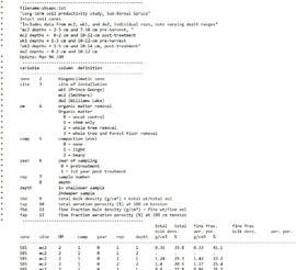
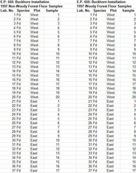
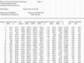
The following Excel files are the primary lab reports from the Ministry of Forests analytical laboratory. At the time of this study, the lab reports would only use a minimal sample identification consisting of a sequential number (1, 2 … etc.) for each sample in a job. The submitter had to maintain their own records to link that sequential number in the report to something more meaningful – in this case, the tag number on the litterbag, the litter type, and the plot number – as recorded in my consolidated file Kenneth Creek Litterbag Sample Numbering.xlsx
- T458FINL.xls [Most of the data in this file – samples 7-31 – are for litter trap samples in the fall 1997 collection, but the first 6 are triplicate analyses of the initial pine needle litter materials used in the litterbags: #1-3 are Control, and #4-6 are ON2.]
- T483FINL.xls [Litterbags recovered May 5, 1998]
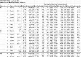
- T508FINL1.xls [Samples 19-42 are from the Kenneth Creek litterbags, recovered Oct. 20, 1998; samples 1-18 are from the EP 1148 (Bobtail) litterbag experiment, recovered Oct. 1998]
- T551FINL.xls [Litterbags recovered April 30, 1999]
- T589F.xls [Litterbags recovered October 12, 1999]
- T613FINL.xls [Litterbags recovered May 4, 2000]
- T650FINL.xls [Litterbags recovered October 11, 2000]
- T700FINL.xls [Litterbags recovered September 27 – October 5, 2001]
- T765FINL.xls [Litterbags recovered September 21, 2002]
- T830FINL.xls [Litterbags recovered October 15, 2003]
- T901FINL.xls [Litterbags recovered October 1, 2004]
Two files contain the complete records of initial litter materials and recovered litterbag contents, with some limited summaries of mean values by treatment and recovery date:
- BowDcomp.xls [complete record of weights of recovered litterbag contents in “Raw Data” tab]
- Bowron Litterbag Chemistry (update Aug 2010).xls [complete compilation of chemical analyses of initial and recovered litterbag materials]