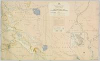
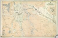
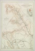
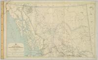
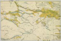
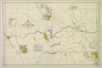
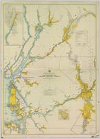
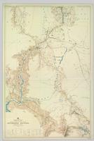
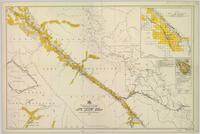
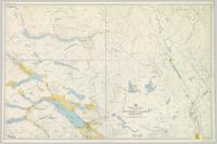
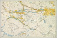
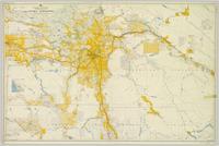
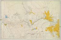
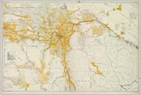
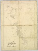
Large-format map depicts the Monkman Public Sustained Yield Unit (PSYU) and Tree Farm Licence 30 east of Prince George.
Large-format map depicts the Monkman Public Sustained Yield Unit (PSYU) east of Prince George.
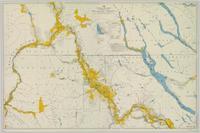
Large-format map depicts Northwood Pulp & Timber operating areas in 1975.
Map reflects boundaries for the Aleza Lake Experiment Station, permanent sample plots, timber sales locations, and the Ecological Reserve.
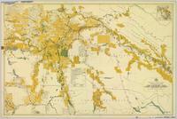
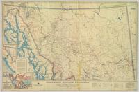
Colour-coded map depicting lands open for preemption, in “University Reserve,” or reserved for public auction. Depicts land recording divisions, communities, bodies of water, and transport routes.
Colour-coded map depicting lands open for pre-emption, lands in “University Reserve,” and lands reserved for public auction. Depicts land recording divisions, communities, bodies of water, transport routes, and game reserves.
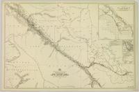
Topographic map depicting regions, communities, unexplored areas, bodies of water, transport routes, and glaciers.
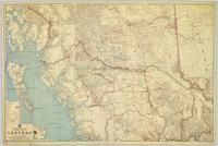
Regional map depicting land recording divisions, communities, bodies of water, transport routes, elevation, and lighthouses.
Map depicting surveyed lands, statutory timber lands, land recording divisions, game reserves, communities, bodies of water, and transport routes. Includes inset of McBride townsite.
Colour-coded map depicting lands surveyed as alienated, reserved, Statutory Timber Lands, B.C. Land Settlement Board Area, or open for pre-emption. Depicts land districts, land recording divisions, communities, game reserves, bodies of water, transport routes, and communication lines.
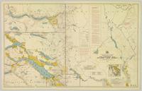
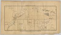
Colour-coded topographic map depicting lands surveyed as alienated, reserved, or statutory timber land. Depicts land district boundaries, land recording divisions, HBC posts, triangulation stations, telephone lines, communities, bodies of water, and transport routes. Defines resource type areas (“Land Form,” “Soil,” “Forest Cover,” “Grazing,” “Geological & Mineralogical,” “Fur-Bearing Animals & Game”). Includes explanatory “Natural Resources Reference.”
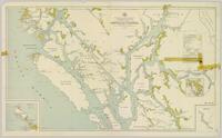
Colour-coded map depicting lands surveyed as alienated, reserved, and having a timber license, lease, or sale. Depicts land recording divisions, land district boundaries, communities, bodies of water, and transport routes. Includes insets of Stephens Island and Egeria Reach.
Colour-coded map depicting surveyed lands alienated, reserved, in B.C. Land Settlement Board Area, or open for preemption. Depicts land districts, land recording divisions, communities, bodies of water, transport routes, and communication lines.
Colour-coded topographic map depicting lands surveyed as alienated, reserved, or open to preemption. Depicts land districts, land recording divisions, communities, bodies of water, communication lines, and transport routes.
Colour-coded map depicting surveyed lands respectively open and closed to preemption. Depicts land recording divisions, land district boundaries, government reserves, communities, bodies of water, and transport routes. Includes topographical inset.
Topographic map depicting regions, communities, government posts. bodies of water, transport routes, surveyed areas, and reserves.
Colour-coded map depicting surveyed lands respectively open and closed to preemption. Depicts land recording divisions, game reserves, communities, bodies of water, and transport routes. Includes inset of McBride townsite.
Regional map depicting communities, parks, customs posts, airports, radio stations, hatcheries, bodies of water, transport routes, communication lines, elevation points, and lines of batholith contacts. Includes an inset of St. Elias Mountains. Includes “Special Note on the Mineralization of this Map Area” from Bureau of Mines, Victoria, B.C.
Colour-coded map depicts lands surveyed as alienated, available for purchase or lease under Taxation Act, or reserved. Depicts land district boundaries, land recording divisions, triangulation stations, telegraph/telephone lines, communities, bodies of water, and transport routes.
Topographic map depicts communities, bodies of water, transport routes, parks, game reserves, posts, ports, radio stations, power sites (figures in horse power), steamship routes (distance in nautical miles), and precipitation. Mineral resources summarized locally in red ink.
Colour-coded topographic map depicting lands surveyed as alienated, available for purchase or lease under Land Act, or reserved. Depicts land district boundaries, land recording divisions, provincial forest boundaries, HBC posts, triangulation stations, telephone lines, communities, bodies of water, and transport routes.
Colour-coded topographic map depicts surveyed lands alienated, available for purchase or lease under Land Act, and available for pre-emption. Depicts land districts, land recording districts, provincial forests, parks, triangulation stations, communities, bodies of water, transport routes, and communication lines.
Colour-coded map depicting surveyed lands alienated, available for purchase or lease under Land Act, and available for pre-emption. Depicts land districts, land recording districts, provincial forests, parks, game reserves, communities, bodies of water, transport routes, communication lines, and triangulation stations.
Colour-coded topographic map depicting surveyed lands alienated, available for purchase or lease, or available for pre-emption. Depicts land districts, land recording districts, parks, communities, bodies of water, transport routes, communication lines, and triangulation stations.
Colour-coded map depicts surveyed lands alienated, available for purchase or lease under Land Act, or available for pre-emption. Depicts land districts, land recording districts, provincial forests, parks, game reserves, communities, bodies of water, transport routes, communication lines, triangulation stations, and government reserves.
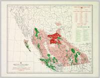
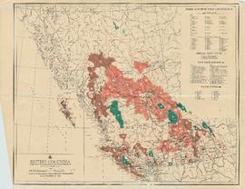
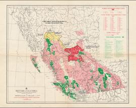
Colour-coded B.C. provincial map depicting sustained-yield units and tree-farm licenses. The area and company names of sustained-yield units (red) and tree-farm licences (green) are explicated in a table.
File consists of recorded DVD, containing the following video recordings:
- Harkins! - Nov. 23, 1990
- CKPG-TV excerpt- Oct. 3, 1992
- CKPG-TV: Bob Harkins Comments- Dec. 18, 1992
- CKPG-TV: Bob Harkins Comments- April 5, 1993
- UNBC Convocation Address by Bridget Moran – May 26, 1995
DVD Summary
Context: DVD contains recordings originally broadcast on CKPG-TV News, the Prince George CBC affiliate station. It contains multiple recordings of either interviews with Bridget Moran or TV broadcast announcements and news stories relating to Moran’s publications and awards; as well as an excerpt from the May 1995 UNBC Convocation Ceremony featuring Moran’s Convocation Address.
Individual video segments as follows:
(1) Harkins!
Date: 23 November 1990
Length: 30’ minutes
Scope and Content: Contains a recording of a Bob Harkins of Harkins! interviewing Bridget Moran on her books Stoney Creek Woman, Judgement at Stoney Creek and her upcoming publication A Little Rebellion.
(2) CKPG-TV News excerpt Date: 3 October 1992 Length: 2’46” minutes
Scope and Content: Recording of CKPG-TV News excerpt featuring Bridget Moran speaking about her latest publication A Little Rebellion while at a Mosquito Books book signing event.
(3) CKPG –TV News: Bob Harkins Comments
Date: 18 December 1992
Length: 3’minutes
Scope and Content: November weather forecast for Prince George and region, followed by Bob Harkins Comments featuring Bridget Moran and her new book A Little Rebellion.
(4) CKPG –TV News: Bob Harkins Comments
Date: 5 April 1993
Length: 1’35”minutes
Scope and Content: Bob Harkins Comments featuring Bob Harkins speaking about Mary John and Bridget Moran receiving the Governor General’s Award for Outstanding Community Service from MP Brian Gardiner at a ceremony at Mosquito Books in Prince George.
(5) UNBC Convocation Address Date: May 26, 1995
Length: 11’53”minutes
Scope and Content: UNBC president Geoffrey R. Weller introduces Bridget Moran who then delivers her Convocation Address to the students of the May 1995 graduating class. Her speech focuses on change
– positive change - in the realm of education.
Audio recording is of an interview by Bridget Moran with both Mr. George Henry and Mr. Arnold Davis to discuss their memories of the early town site development of South Fort George and Central Fort George c.1910-c.1917. Mr. Henry was born in 1882 and his family arrived in Quesnel in 1909. Mr. Henry’s interview is primarily about his work as a captain on the BX Sternwheeler up until the time of the railroad arriving in Prince George in 1914. Mr. Davis, who was a Sherriff in Prince George, recalls his childhood memories of Fort George and Central Fort George c.1917. Mr. Davis also discusses his family roots from Ireland, the family’s arrival in Fort George from Ashcroft in 1917 and memories of his father who worked on the sternwheelers on the Fraser River.
Audiocassette Summary
Scope and Content:
Interview with Mr. George Henry
Mr. Henry was born in 1882 in Northern California and his family came to the Cariboo in 1909. He recalls riding his bicycle from Ashcroft to Quesnel in 3 days to find work with the BC Express Company.
Mr. Henry recalls working on the BX and describes the sternwheeler trip from Quesnel to South Fort George; it was a 3 hour trip from Quesnel and included two mail stops ;
Henry recalls an accident onboard the sternwheeler going through the Fraser Canyon (see p.p.11-12 of
Prince George Remembered)
Mr. Henry describes his homestead at South Fort George
Mr. Henry describes the BX sternwheeler being aground at South Fort George c.1920
Mr. Henry recalls spending winters in South Fort George in his log cabin; that work was “plentiful” in 1910 and the population at “about 700”
Mr. Henry notes that the “Indian reserve was at the Hudson’s Bay company” and that the native population was at “about 50”
Mr. Henry recalls the early commercial businesses in South Fort George c.1910 including the Northern Hotel; the candy store and ice cream store and theatre.
Mr. Henry describes the start of the town site of Central Fort George as a “viable little town” which started once the Grand Trunk Railway arrived and recalls the change in population between South Fort George & Central Fort George.
Henry recalls how all the workers came and lived in tents in Central Fort George.
Mr. Henry was not happy about the arrival of the railway as it meant he lost his job on the sternwheeler – he recalls that “us old river rats were just lost” (see p.p.34 of Prince George Remembered)
Bridget then asks Mr. Arnold Davis to recall his memories of early South Fort George
But first asks him to describe his family’s roots (See p.p. 1-2 of Prince George Remembered)
Scope and Content:
Interview with Mr. Arnold Davis
Davis notes he is 6th generation Canadian; family came from Ireland and his grandfather’s brother Jeff Davis became the President of the Confederate States of America.
Davis refers to his mother’s family being on the Prairies at time of the trial of Louis Riel
Davis explains that his grandfather first homesteaded at Banff; then Kamloops; then Ashcroft and on to South Fort George in 1917.
Davis’ father worked for the BC Express Company and he recalls being on the sternwheeler as a child during same time that George Henry worked the boats. Recalls workers on the boat; eating pie on the boat baked by the Chinese cook; (See p. 33 of Prince George Remembered)
Davis recalls the town site of South Fort George. He notes it had a population by 1917 of only “about 300” and that the “boom was over”
Davis describes location of various businesses in South Fort George including the Rex Theatre, George St. Poole Room, McKay Bros. Grocery store, Drugstore, Bairds, Peters Butcher Shop.
Davis recalls that there were many “Yukoners” here at the time and recalls a tale about an old Yukoner
Mr. Davis recalls other people who worked on the BX with his father including Margaret “Granny” Seymour’s father;
Mr. Davis recalls riding up and down the river to Foley’s Cache on the sternwheeler as a child
Mr. Henry then speaks up and recalls trips on the sternwheeler with Arnold Davis on the boat as a child
Tape ends
Audio recording consists of individual taped interviews conducted by Bridget Moran with a number of early Fort George residents recalling the early years of white settlement in Prince George c.1910-c.1915. Interviews were conducted with the following individuals: Arnold Davis; J.A.F. Campbell; Alec Moffat; Claude Foot; George Henry; Nellie Law; John McInnis; Georgina [McInnis] Williams and Peter Wilson. These interviews were incorporated into the publication: Bridget Moran, Prince George Remembered…from Bridget Moran, Marsh Publishing, Prince George, 1996.
Audiocassette Summary
Scope and Content:Recording consists of individual taped interviews conducted by Bridget Moran in a number of locations with Arnold Davis; J.A.F. Campbell; Alec Moffat; Claude Foot; George Henry; Nellie Law; John McInnis; Georgina [McInnis] Williams; Peter Wilson
Subjects include:
- Arnold Davis – former Sherriff in Prince George (born in 1882) arrived in Quesnel in 1909 and worked on the BX sternwheeler. Davis discusses his family roots from Ireland as a 6th generation Canadian. Recalls how his family arrived in South Fort George in 1917 and how his father worked on boats that went up and down Fraser River
- Claude Foot recalls coming from New Zealand to Fort George [Prince George] in 1906 and how there were ‘very few white men’; his father was Irish, mother was English
- Alex Moffat – describes how his parents provided a ‘stopping place’ for stage coaches in the Cariboo region
- George Henry recalls working on the boats that plied the Fraser River between Prince George and Soda Creek, near Quesnel
- Nellie Law – describes arriving from England in 1917 to Ashcroft and then Quesnel in 1917
- Peter Wilson – Barrister and Solicitor; the prosecutor for Prince George since 1916 describes arriving by train from Edmonton and arriving on a scow in South Fort George
- Mr. John McInnis – from Prince Edward Island, who sat twice in provincial legislature – in constituency of Grand Forks as socialist and later for constituency of Fort George recalls arriving in 1910 by rail to Kamloops and then by sleigh to South Fort George; describes the Indian Reserve at Fort George “[…don’t think there were a dozen white people…when I arrived […]”
- J.A. ‘Doc’ Campbell recalls being part of a survey crew in Fort George in 1908
- George Henry – also recalls cruising down the [Fraser] river by way of sternwheeler and losing men overboard
- Peter Wilson recalls experiences as practicing lawyer; there was no assize court in the region until 1919; recalls some of his early cases [murder case]
- Nellie Law describes working as a desk clerk at first The Alexandra Hotel and later The Prince George Hotel from 1918 to 1952
Law describes the hotel patrons and how she met the Duke and Duchess of Devonshire in 1922. Recalls stoking furnace with logs in the hotel to keep it warm and working as a bouncer - Alex Moffat – recalls workers and hauling freight via the old Cariboo Road; existence of one policeman only (BC Provincial Police); and describes in detail a stopping place for horses / crew on the Cariboo Road and the pack trains.
- Mr. Moffat – Describes the luxury experienced on the sternwheeler, The BX that “could carry seventy saloon passengers” and “staterooms were all equipped with push buttons, electric lights, hot and cold water, steam heat, and everything modern”
- Claude Foot – Recounts a dance in Quesnel at the hotel barroom and describes ordering drinks at the Al Johnson Hotel that had a bar which boasted to be “ the biggest bar in Canada, if not the world” 100 ft + bar with “six or seven bartenders behind this long bar, and the customers would be lined up two or three deep […]”
- J.A. [F.] [Campbell] – post-1910 changes with the use of scows on the Fraser River; describes the BC Provincial Police “in those days [they] just wore ordinary civilian clothes, but they were a tough bunch….[…]” and rowdiness in the bars in South Fort George
- Campbell describes the first bank in Fort George was the Bank of British North America that was housed in a tent and he recalls needing money while playing poker - ‘about eleven o’clock that night, the vault was open, and the till was open, and if you wanted money you’d walk up to the bank till and put an IOU in and take money out and go on playing [poker]
- Peter Wilson – comments about how lax the enforcement of law and order was in the early years including among the police themselves: “that the “Old Blind Nick [who] ran a bootlegging joint, went broke because he said he couldn’t afford to supply the police with any more liquor.”
- Claude Foot – recalls a fire in Quesnel in 1916 that burned a large part of the business section and the firemen were as Nellie Law notes “ a bucket brigade of Chinamen, filling buckets from a water hole in the Fraser River that the horses drank in…”
- John McInnis recalls political meetings and the election in 1916 when he was a candidate for the Fort George riding and being defeated by 7 votes; that the investigation of the election “was a whitewash”
- Georgina McInnis, who was the first White Child born in the community – she tells of the meeting that decided her name – as Fort Georgina McInnis
- Arnold Davis recalls his father working on boats that went up and down Fraser River and being on the boat with him and “watching the connecting rods go in and out and concentrate on pie…[served by the Chinese cook]” Davis also recalls The Yukoners who emigrated to PG after the Gold Rush
- George Henry recalls with lament the coming of the railway as he lost his job plying the River - preferred voyages on the Fraser River – and refers to those who worked the River and himself as “river rats”
Audio recording is of an interview by Bridget Moran with Ken Rutherford, educator and former municipal politician of Swift Current Saskatchewan. Rutherford was an Alderman prior to becoming Mayor of Swift Current from 1944-1952, he ran unsuccessful for the CCF in 1960 and later for the NDP. Rutherford ran for political office in BC in the electoral district of Fort George in 1963 unsuccessfully against Liberal MLA Ray Williston. The interview includes biographical information as well as memories of his career as a school teacher, his political aspirations and involvement with the CCF and later the NDP and the history of medicare in Canada.
Audiocassette Summary
- Rutherford provides genealogical information on grandfather and his mother (her family was from Moose Jaw, Saskatchewan)
- Discusses his parent’s marriage
- Recalls schooling in Swift Current, Saskatchewan where he eventually becomes principal
- Rutherford notes he never went to university, but went to Normal School
- Talks about his wife and children
- Donley Hill
- Recalls joining the CCF and distributing pamphlets; recalls 1935 election and CCF getting few votes
- Recalls salary troubles at the school in Swift Current in the 1930s and being both the teacher and janitor
- He was Mayor of Swift Current from 1944-1952; and previously as Alderman and ran for the CCF in the federal election in 1953;
- Recalls spoiled ballots in the election
- Recalls getting involved with the issue of health premium payments in Swift Current c.1940s.
- Recalls the history of the fight for health care in Canada; and strike in Saskatchewan by doctors
- Recalls the national fight for Medicare – 1961
- Discusses Tommy Douglas; Mackenzie King
- Health care issues
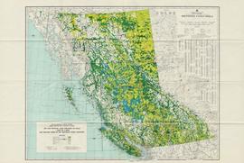
Item consists of a map of British Columbia showing Status of Sustained-Yield Forestry Programme as at December 31, 1969 with colour coded areas indicating Public Sustained Yield Units, Special Scale Areas, Tree Farm Licences, and Major Parks.
Attached description: The graph indicates how Skeena Kraft pulping characteristics compare with the burst-tear properties of other bleached kraft market pulps. In this relationship, Skeena Kraft develops the high bursting strength typical of northern Canadian krafts while retaining a distinct advantage in tearing strength.
Item is a labeled diagram of the power group at a mill.
Item is a diagram of the bleachery and washing portion of the pulp mill.
Item is a diagram of the digesters of the pulp mill.
Item is a diagram of recausticizing plant and lime kiln.
Item is a diagram of the filter plant and lime kiln of the mill.
Item is a diagram of the layout of Skeena Kraft recovery and recausticizing.
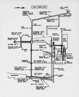
Item is a diagram showing the process through chip preparation and continuous digesting, brown stock washing, brown stock screening and cleaning, bleach plant, and bleach stock screening and cleaning.
Item is a map showing the watersheds of Diana Lake, Rainbow Lake and Prudhomme Lake.
Item is a map that distinguishes the regions covered by Tree Farm Licence No. 1 granted to Columbia Cellulose and Three Farm Licence No. 40 granted to Skeena Kraft. Major locations indicated in this map include: Prince Rupert, Terrace, Hazelton, Smithers, Kitimat, Skeena River, and Nass River. Railway routes are also shown.
Item is a map of British Columbia and is a key map showing: maps published on scale 1 inch to 2 miles and summary zones of the provincial forest inventory. Map includes index of post offices correct to October 22, 1956.
Item is a map of British Columbia's Status of Sustained-Yield Forestry Programme as at 31 December 1962. The map has been annotated to show forest area surveyed by Celgar Ltd. as base for new kraft mill.

