Print preview Close

Showing 4434 results

Archival description
3211 results with digital objects Show results with digital objects
Map Board?
2012.13.1.133.11 · Item · 1985
Part of J. Kent Sedgwick fonds

Image depicts a man holding up a board which appears to have maps of the Cottonwood Park on it.

2009.7.1.254 · Item · ca. 1880-1920
Part of Archdeacon W. H. Collison fonds

Photograph of a marching band performing down a wooden road. Spectators can be seen in the foreground and various businesses are in the background. Annotation on recto reads: "Prince Rupert BC."

2009.5.4.18 · Item · [ca. 1935]
Part of Taylor-Baxter Family Photograph Collection

Margaret (nee Baxter) Lund stands in snowshoes wearing skirt, high socks, sweater, hat and gloves. Log fence crosses midground, power poles and unidentified building stand in background. Margaret is younger sister to Bob Baxter.

2009.7.1.017 · Item · [ca. 1910]
Part of Archdeacon W. H. Collison fonds

Photograph depicts Archdeacon William Henry Collison to left of wife Marion, who stands bent over garden on right. Church steeple visible behind wood fence in background. Hills can be seen in distance.

Handwritten annotation on verso reads: "Grandad & Grannie in garden at Kincolith".

2009.7.1.012 · Item · [1916 or 1917]
Part of Archdeacon W. H. Collison fonds

Marion sits to left of husband Archdeacon William Henry, small boy in between. Young children sit and stand in foreground, Katherine 'Katy' and Muriel 'Mimi' stand in background (daughters of W.E. Collison). The group poses in front of a wood door, ivy on either side.

Handwritten annotation on verso reads: "Grand-dad (Arch. W.H. Collison) & Grannie with grandchildren at Kincolith".

2009.7.1.016 · Item · [ca. 1910]
Part of Archdeacon W. H. Collison fonds

Photograph depicts Marion and William Henry Collison standing on left with shovel, Bertha Collison on right, and young Muriel and Katherine Collison in centre with shovel (eldest daughters of W.E. Collison). Wood buildings cross midground, trees and hills visible in background.

Handwritten annotation on verso reads: "Garden at Kincolith / Grandad, Grannie / Mimi, Katie / Mother".

Mark Gabriel Stadium
2012.13.2.06.13.1 · Item · 2005
Part of J. Kent Sedgwick fonds

The photograph depicts Mark Gabriel Stadium, a baseball stadium in Prince George. The photo was taken in 2005.

Mark Gabriel Stadium
2012.13.2.06.13.2 · Item · 2005
Part of J. Kent Sedgwick fonds

The photograph depicts Mark Gabriel Stadium, a baseball stadium in Prince George. The photo was taken in 2005.

2012.13.1.85.64 · Item · [2004?]
Part of J. Kent Sedgwick fonds

Image depicts an abandoned building on the corner of a street in McBride, B.C. The faded letters on the side read: "McBride Trading Co. Mens Wear, Drugs, Equipment."

McBride - Church
2012.13.1.85.62 · Item · [2004?]
Part of J. Kent Sedgwick fonds

Image depicts a church somewhere in McBride, B.C. The sign in front possibly reads "St. Patrick's Church."

McBride - Yellowhead
2012.13.1.085 · Subseries · [between 1970 and 2004]
Part of J. Kent Sedgwick fonds

File contains slides depicting places in and between McBride and the Yellowhead Pass via the Yellowhead Highway.

McBride, BC in 1914
2009.5.3.57 · Item · 1914
Part of Taylor-Baxter Family Photograph Collection

Photograph depicts street in McBride, wood buildings and tent buildings on either side. Small businesses and restaurants line the left side of the street. Forest slash stands in newly cleared area in foreground. Railway tracks cross right foreground, hills visible in background. Annotation on verso of photograph reads: "MC.Bride, B.C.", handwritten on recto: "1914 [Bourchier?]"

McCulloch CPR depot
2013.6.36.1.026.04 · Item · [22 June 1979]
Part of David Davies Railway Collection

Photograph depicts the McCulloch CPR depot located at mile 76.7 on the Carmi Subdivision, which is about 27 miles northeast of Penticton. The rear building is the passenger depot, which was painted blue inside. The view is looking north.

McCulloch CPR depot
2013.6.36.1.026.03 · Item · [22 June 1979]
Part of David Davies Railway Collection

Photograph depicts the McCulloch CPR depot located at mile 76.7 on the Carmi Subdivision, which is about 27 miles northeast of Penticton. The building on the right is the passenger depot, which was last officially used in January 1964. The view is looking south on the downgrade.

2000.1.1.2.11 · File · 1986 - 1989
Part of Cassiar Asbestos Corporation Ltd. fonds

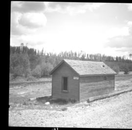
This file includes two major photographic collections concerning the construction and development of the underground mine at Cassiar, title the McDame Project.

The first collection includes fifteen monthly progress reports documenting the development from July 1988 to December 1989. The progress reports are authored by G. Verret, and were distributed to the executives of Cassiar Asbestos in Vancouver as well officials of the B.C. Government and other creditors of the Corporation. Most images are annotated and dated. Many of the loose photographs are accompanied by an inventory sheet.

Subjects depicted include: the staging area prior to mine development, the initial development of the “Vent Portal”, a jumbo drill working on the mine face, the working face marked for drilling and wired with fuses, a Caterpillar dozer clearing snow after an avalanche, scene of a fire in winter time, complete conveyor sump decline, mining vehicle parked on the “Lay-Down Area” presumably near the portal, the working face of the mine at various stages of development, 1563 portal being slashed, the removal of the overburden for the tramline loading station site, the construction of the transfer tower(s), construction of the stockpile area, the construction of a sedimentation pond, a presumed cave in, construction of footings for the conveyor, construction of the tramline loading terminal station, construction of the crusher building, a slash titled “Breakthrough in Access Ramp”, storage of powder and fuses, a washout in conveyor decline, fog at the portal in -30 degrees Celsius, the 1290 junction flooded, a slab of shotcrete which fell on and injured a miner while shotcreting, shotcrete blasted off walls for repairs, images of the “Hilti-test”, shots showing grade of drift, and structural failures in the 1350 adit.

Locations and structure within the underground mine depicted include: yellow ventilation ducting, ground support including steel screen and shotcrete, steel cables bolted unto ground support, puddles in the adits, the access road to the lay-down area, the exhaust drift, “Fans and Heaters in the 1415 adit”, the 1350 sump, the access ramp to the 1320, the exhaust ramp safety bay, the conveyor decline, the ventilation adit, the 1563 portal, the temporary repair shop at the 1415 portal, junctions of various drifts, the ”Fresh Water Pump & Pumphouse on lower Creek”, the “Ventilation Raise/1563 Platform”, a “Diamond Drill Station” at 6066 North in the underground mine, the “Bridge to the Gravel Pit”, the “Crushing and Screening Plant” in the gravel pit, the ventilation bulkhead in the conveyor decline, and the “Powder Magazine”.

People depicted include Rose Gay and R. Tyne on a tour of the underground mine, a geologist with a rockhammer, a miner identified as A. Jacobs working, contract miners Bruno and Marbel from Canadian Mine Development, and unidentified miners rockbolting, shotcreting, and drilling using jackleg drills.

Vehicle and mining equipment depicted include jeeps, pickup trucks, a front end loader, an unidentified a small unmanned tracked machine with a long arm, scoop trams, a land cruiser, an ore truck with a flat tire, the cone crusher, a “scissor lift”, a mobile shotcrete machine, a new grout pump, a new Boart Jumbo Drill, and a detached bucket half of a 413 ore truck.

The second collection depicts the McDame Project construction in 1986 and 1987.
Content of these photographs includes: various machinery used for excavating and drilling, underground progress of tunneling, supports, wire meshing, rock formations in mine, and exposed asbestos. There are no annotations regarding this photographs.

McGregor River - Bridge
2012.13.1.72.34 · Item · July 1981
Part of J. Kent Sedgwick fonds

Image depicts a bridge over the McGregor River. A sign in the image reads: "Danger. The river is not navigable for any type of boat. Down stream falls and rapids impassible!"