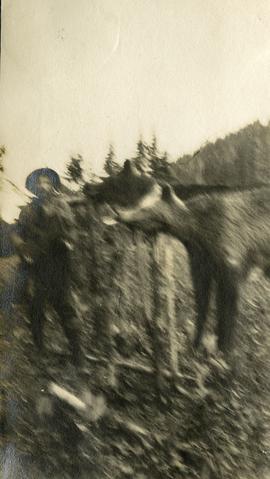
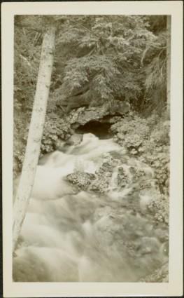
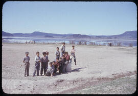
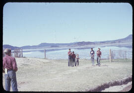
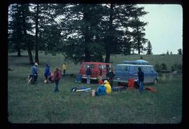
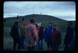
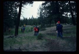
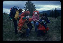
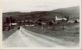
Print preview Close

Showing 4134 results

Archival description
3619 results with digital objects Show results with digital objects
Gravel
2012.13.1.124.18 · Item · Oct. 1975
Part of J. Kent Sedgwick fonds

Image depicts layers of gravel at the BCR site in Prince George, B.C.

Gravel
2012.13.1.124.19 · Item · Oct. 1975
Part of J. Kent Sedgwick fonds

Image depicts layers of gravel at the BCR site in Prince George, B.C.

Gravel Pit
2000.1.1.3.18.013 · Item · June 1987
Part of Cassiar Asbestos Corporation Ltd. fonds

Photograph depicts close up view of gravel pit, ruler displayed for scale. Photograph speculated to have been taken at the plant or near the Cassiar airstrip. Stamped annotation on recto of photograph: "JUN. 1987".

Grooves
2012.13.1.124.14 · Item · June 1975
Part of J. Kent Sedgwick fonds

Image depicts an aerial view of a grooved region of land at an uncertain location.

Grooving
2012.13.1.124.11 · Item · June 1975
Part of J. Kent Sedgwick fonds

Image depicts an aerial view of a grooved region of land at an uncertain location.

Grooving
2012.13.1.124.12 · Item · June 1975
Part of J. Kent Sedgwick fonds

Image depicts an aerial view of a grooved region of land at an uncertain location.

Grooving
2012.13.1.124.13 · Item · June 1975
Part of J. Kent Sedgwick fonds

Image depicts an aerial view of a grooved region of land at an uncertain location.

Grooving
2012.13.1.65.40 · Item · June 1975
Part of J. Kent Sedgwick fonds

Image depicts an aerial view of grooves in the land near the Fraser River, possibly caused by glaciers.

Grooving
2012.13.1.65.42 · Item · June 1975
Part of J. Kent Sedgwick fonds

Image depicts a view of grooves in the land near the Fraser River, possibly caused by glaciers.

Grotto near Atlin, BC
2009.5.2.118 · Item · [ca. 1935]
Part of Taylor-Baxter Family Photograph Collection

Photograph depicts water flowing from ground in forest. Handwritten annotation on recto of photograph: "Atlin, The Grotto, Outlet of a subterranean stream (in limestone) on way to O'Donnell River."

Group and a Bus
2012.13.1.93.34 · Item · 1978
Part of J. Kent Sedgwick fonds

Image depicts a group of individuals and a bus with words that read: "Prince George Limousine & Charter." The river in the background is possibly the Peace River, and the location is possibly somewhere near Fort St. John, B.C.

Group of Hikers
2012.13.1.65.08 · Item · May 1975
Part of J. Kent Sedgwick fonds

Image depicts a group of people and two vans, apparently preparing to set out on a hike somewhere near Riske Creek, B.C.

Group of Hikers
2012.13.1.65.12 · Item · May 1975
Part of J. Kent Sedgwick fonds

Image depicts a group of hikers listening to a man, possibly a guide, speak. The location is possibly near Riske Creek, B.C.

2012.13.1.65.09 · Item · May 1975
Part of J. Kent Sedgwick fonds

Image depicts a group of hikers examining something on the ground, most likely the small pink flower that is barely visible in the grass. The location is possibly near Riske Creek.

Group on Rock Ledge
2012.13.1.91.36 · Item · 1979
Part of J. Kent Sedgwick fonds

Image depicts numerous individuals who appear to be searching among the rocks on a ledge at an uncertain location in the Peace River Region.

Group photo of five men
2008.27.8.3 · Item · [ca. 1920-1930?]
Part of Knox McCusker Collection

Photograph is a group photo of five men standing around a tent in a wintery wooded landscape; Knox McCusker stands first man from the right, with hands in pockets. Caption on verso reads: “Youthful K.F.McC. on the right. Probably Northern Ontario or Manitoba”.

Guest lecture for GEOG 200
2012.13.5.08 · File · 1998-2004
Part of J. Kent Sedgwick fonds

File consists of notes and reproductions relating to Kent Sedgwick's guest lecture for UNBC course "GEOG 200 Geography of British Columbia".

2012.13.5.02 · File · 2008
Part of J. Kent Sedgwick fonds

File consists of notes relating to Kent Sedgwick's guest lecture on historical geography and transportation routes in New Caledonia, including the interior plateau of Central British Columbia. Includes correspondence with James Windsor, the instructor for the course, and Kent Sedgwick's notes for the lecture.

2009.5.1.70 · Item · [ca. 1900]
Part of Taylor-Baxter Family Photograph Collection

Close view of bridge built with wooden planks, poles, and wires, braced from below, with triangles built into its frame. The bridge crosses Hagwilget Canyon on the Bulkley River, five kilometres from its confluence with the Skeena River. This is one of the many bridge structures that have crossed this location since at least 1859. Photograph was taken from one side of canyon, near bridge. Opposite canyon wall in background. Typed annotation glued to verso of photograph: "HAGWILGET - 'the gentle or quiet people'."

2009.5.1.71 · Item · [ca. 1900]
Part of Taylor-Baxter Family Photograph Collection

Photograph depicts two men and a horse on a bridge built with wooden planks, poles, and wires, braced from below, with triangles built into its frame. The bridge crosses Hagwilget Canyon on the Bulkley River, five kilometres from its confluence with the Skeena River. This is one of the many bridge structures that have crossed this location since at least 1859. Photograph was taken from a distance. Rocky riverbank in foreground, opposite shore in background behind bridge. Typed annotation in red ink on verso of photograph: "INDIAN BRIDGE, NEAR HAZELTON, B.C."

2009.5.1.69 · Item · [ca. 1900]
Part of Taylor-Baxter Family Photograph Collection

Photograph depicts bridge built with wooden planks and poles, braced from below, with triangles built into its frame. The bridge crosses Hagwilget Canyon on the Bulkley River, five kilometres from its confluence with the Skeena River. This is one of the many bridge structures that have crossed this location since at least 1859.

Handwritten annotation on recto of photograph: "old bridge at the Bulkley River."

Hagwilget Village
2011.3.1.25 · Item · [ca. 1901-1910]
Part of North Coast & Central BC Postcard Collection

Photograph of the dirt road leading to Hagwilget Village. Residential buildings and a church are visible in the background. Printed annotation on recto reads: "W.W.W. Hagwilget Village."