File consists of training materials related to soil disturbance surveying. These include a "Soil Disturbance Survey Course Workbook" (1994) and excerpts from the "Soil Conservation Surveys Guidebook."
Caption describing photograph: "Soil (sod) development over lacustrine deposits. Depth to carbonated layer (1922 fire) 2.5", depth to parent material 6". Note blocky structure of deposit (clay). Root penetration to 1'. Root penetration of willow and aspen to 1.5'. Blocky structure from fluctuating water table, gentle slope to land form."
Original Land Resource Research Institute soil description detail forms prepared by Scott Smith for 3 locations, annotated on covers as follows:
SS91010 Lost Chicken Regosol Paleosol 26/6/91
SS91011 Lost Chicken Ash in Felty Peat 27/6/91
SS91013 Lost Chicken Mine “Up the Creek” ash site 28/6/91
Each of the three forms contains an attached annotated Polaroid photograph depicting each site.
File of documents consist of a mixture of internal government reports, including reports prepared by consultants, superseded manuals, and training manuals. Most deal with soil conservation in forestry settings, but there is a report on soil conservation in relation to agricultural soils which Paul Sanborn did under contract to Agriculture Canada in 1991.
Includes the following items:
Cuthbert, John. 1991. Why the concern about soil degradation in British Columbia? An address by John Cuthbert, Chief Forester, Ministry of Forests to be delivered by Lois Dellert, Acting Assistant Chief Forester to the 1991 Logging Seminar, October 1991. Prince George, B.C.
J. Hunt & Associates Inc. 1998. Soil compaction and disturbance: status of forestry research and operational trials in British Columbia. Prepared for Lorne Bedford, British Columbia Ministry of Forests, Forest Practices Branch, March 1998.
Ministry of Forests (n.d. – probably ca. 1990). Soil conservation guidelines for timber harvesting: interior British Columbia.
Ministry of Forests. 1994. Interim soil conservation guidelines for mechanical site preparation: interior British Columbia.
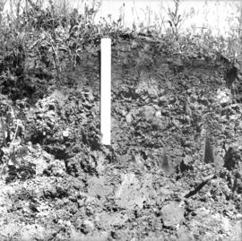
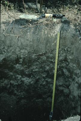
Ministry of Forests (n.d. – probably ca. 1993-95). [excerpt: internal report on soil physical properties in relation to soil disturbance at research site near 70 Mile House, B.C.]
Ministry of Forests. 1996. Audit level soil conservation survey course.
Ministry of Forests. 2002. Forest soil conservation and rehabilitation in British Columbia: opportunities, challenges, and techniques … with examples from recent research. Forest Science Program. March 2002. Available online at https://www.for.gov.bc.ca/hfd/pubs/docs/bro/bro70.pdf (accessed 2023)
Ministry of Forests. 2005. Protocol for soil resource stewardship monitoring: cutblock level. Version 1.0.
Ministry of Forests. 2005. Protocol for soil resource stewardship monitoring: cutblock level. Version 1.0. [Superseded version]
Ministry of Forests. 2009. Protocol for soil resource stewardship monitoring: cutblock level. Version 5.0. [Current version as of March 2023; available from: https://www2.gov.bc.ca/assets/gov/farming-natural-resources-and-industry/forestry/frep/frep-docs/indicators-soils-protocol.pdf]
Rollerson, T.P. (n.d.) Windthrow study, Queen Charlotte Woodlands Division. Prepared for: Queen Charlotte Woodlands Division. Land Use Planning Advisory Team, Woodland Services, Macmillan Bloedel Limited, Nanaimo, BC.
Sanborn, P. 1991. An evaluation of soil conservation under three tillage systems for the Peace River region of British Columbia: soil physical properties. ARDSA Project 23011. Submitted to: Agriculture Canada, Vancouver, B.C. [Unpublished report; cited by: van Vliet, L. J. P., Kline, R. and Hall, J. W. 1993. Effects of three tillage treatments on seasonal runoff and soil loss in the Peace River region. Can. J. Soil Sci. 73: 469-480. https://cdnsciencepub.com/doi/abs/10.4141/cjss93-048 ]
Schwab, J.W. 1993. Interim terrain and slope stability mapping standards, Prince Rupert Forest Region. B.C. Forest Service, Prince Rupert Forest Region.
Thompson, S. 1991. Provincial soil disturbance summary: 1989-1990 results. Prepared for: B.C. Ministry of Forests, Forest Site Degradation and Rehabilitation Committee. Frontline Forest Research, Nelson, B.C.
Thompson, S. 1999. Evaluation of surface erosion on forest roads: a summary of 1st year sampling results. Submitted to Peter Jordan, Ministry of Forests, Nelson Forest Region. January 1999.
Thompson, S.R., P.M. Osberg. 1992. Soil disturbance after logging in British Columbia, 1991 results. Prepared for: Ministry of Forests, Research Branch, May 1992.
Watt, B. (n.d.) Soil disturbance after logging on 11 sites in the Cariboo Forest Region, 1993. Prepared for: Timber Section, Cariboo Forest Region.
Photograph depicts a view of a small village near a river, a narrow dirt road boarders the river.
Group of five miners stand in mining area on left. Woman, man, and young girl sit and stand on far right in more formal attire. Mining tools and equipment throughout.
Printed annotation on recto of photograph: "Société Minière de B.C., Atlin B.C. July 28th, 1901, A.C. Hirschfeld, No. 707".
File consists of the "Social Valuation of Prince George Urban Forests: Assessing Public Opinion of Forest Values and Forest Management" prepared by MVH Associates with McIntyre & Mustel Research Ltd., and E. Lees & Associates Consulting Ltd. for McGregor Model Forest Association.
Photograph depicts a snowy mountain landscape in the Canadian Rockies where Prentiss Gray found his prized mountain goat.
Photograph shows snow melt at Aleza Lake Research Forest in spring season.
Photograph depicts an open air work or woodshop covered with snow, surrounded by lumber and steel drums.
File consists of a photocopy of a Regulated Rivers: Research & Management (vol. 4) article by John Williams entitled "Snake River Spring and Summer Chinook Salmon: Can They Be Saved?".
Item is a photograph of Ray Williston and John Liersch in a small wood area southwest of Prince George.
Item is a photograph of from left, Ralph Robbins and Jack Paine of the BC Forest Service, Ray Williston, Chief Forester for Canadian Forest Products Tom Wright, Deputy Minister of Forests Finley McKinnon, Canadian Forest Products Vice-President in Charge of Development John Liersch, and BC Chief Forester John Stokes investigating small wood in an area near Prince George.
Item is a photograph of Mr. Williston, Chief Forester John Stokes and Tom Wright of Canadian Forest Products examining an area near Prince George in order to determine the timber area required for a Pulp Harvesting License for a proposed pulp mill that would depend completely on waste wood.
Photograph depicts reeds and marsh grasses in the foreground, a beaver house at center of photograph with open water and treed shoreline in the distance.
Photograph depicts the bow of a boat in the foreground, a wide shallow channel extending beyond the boat perhaps opening to a lake beyond. Treed forest on the far shore, a lone mountain peak in the distance.
Photograph depicts a two men on small fishing boat, called a gillnetter, moored at a fish packer dock with six men at work. One man is transferring materials from crates into large bags while several others watch. Handwritten annotation in pen on verso reads: “Fish Packer”
Caption describing photograph: "Small area of transplants on West side of clearing, established Spring 1966. Note thrifty stand of aspend with Spruce understory, typical of stands on this soil type and history of burning."
Photograph depicts sluice trunk in mining area, men on tall structure in background.
File consists of photographic slides from the Arocena & Sanborn 1999 regional soil mineralogy study.
File consists of slides depicting the Aleza Lake Research Forest and area taken by Michael Jull.
File consists of slides depicting the Aleza Lake Research Forest and area taken by John Revel.
Original photographic print included in "Northern Interior Forest Experiment Station: Report of Preliminary Investigations" by Percy Barr.
Photograph depicts a dock and building near the water. A few buildings are being constructed on some newly cleared land nearby.
Item is a copyprint reproduced from the British Columbia Forest Service photographic records held at BC Archives.
Reproduced map on mylar depicts locations of elevations and benchmarks at the Aleza Lake forest.
Item is a diagram of the layout of Skeena Kraft recovery and recausticizing.
Attached description: The Skeena Kraft Group occupies the center of this picture showing the bleaching towers and the continuous Kamyr digesters. In the foreground is the Administration building, the Personnel and Safety building, and the employees' parking lot. The covered conveyor leading to the digesters carries chips. An emergency 1,000,000 water tower stands on the hill in the background.
Attached description: In early stages of construction Skeena Kraft mill was a beehive of activity as carpenters, steel workers, welders and many other trades project to completion.
Attached description: Brilliant lights outline the 750 t/d Skeena Kraft mill at night. Lights on the two Kamyr continuous digesters give the vessels the appearance of missiles in position for takeoff. Lights outline graphically the shape of the spacious and bright structure housing the pulping group, the pulp machine including wet-end equipment and Flakt Drier, and the large warehouse which is nearest the camera.
File consists of a folder containing documents describing Skeena Kraft Limited. Folder consists of:
- Svenska Cellulosa Aktiebolaget--A Forest Products Giant
- Columbia Cellulose Company, Limited--A Corporate History
- Two World-Wide Sales Organizations to Market Skeena Kraft Pulp
- Skeena Kraft Limited Adopts Distinctive Housemark Symbol Adapted from Sun Totem, Kee-War-Kow, Family Crest of Sky People
- The Nass and Skeena Valleys--A New Economic Region Terrace and Prince Rupert are Hubs in Finance and Services
- MISSING: Twinriver Timber Limited: New Company Created to Administer Two Tree Farm Licence Areas
- The Forests Behind the Coast Range Produce Superior Pulp
- Efficient New Woodroom Highlights Skeena Mill
- Integrating Two Power Systems--A Marriage with Convenience One Power Group Serves Two Mills
- Pulping Group Features Flexible Bleaching Sequence and World's Largest Flakt Drier
- New Dams Create Huge Storage Area for Skeena Water Supply
- Advanced Process Control Techniques Employ Computers Extensively
- Skeena Kraft Mill Quality Control and Process Control Tune Mill to Produce Prime Quality Pulps
- Co-ordination and Administration of Construction and Design of Skeena Kraft Shared by H.A. Simons and Central Engineering of Columbia Cellulose
- Purchasing and Traffic Departments Buy and Move More than 25,000 Tons of Materials During Skeena Kraft Construction Co-ordinated Sea and Land Transport System Introduced
- Skeena Kraft--Hundreds of New Jobs Canada-Wide Recruiting Programme Attracts New Workers to Growing Nass-Skeena Region;
- Also includes 19 photographs; 12 technical drawings and diagrams; 2 maps;
- Promotional pamphlet "The Skeena Kraft Story."
Item is an original bibliography entitled "Skeena Fisheries Reports".
Photograph depicts Siwash Rock in Stanley Park British Columbia.
This image appears as Figure 8 in the publication:
Sanborn, P., 2010. Soil reconnaissance of the Fort Selkirk volcanic field, Yukon (115I/13 and 14).
In: Yukon Exploration and Geology 2009, K.E. MacFarlane, L.H. Weston and L.R. Blackburn
(eds.), Yukon Geological Survey, Whitehorse, Yukon. pp. 293-304. https://emrlibrary.gov.yk.ca/ygs/yeg/2009/2009_p293-304.pdf