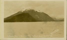
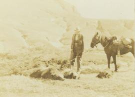
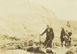
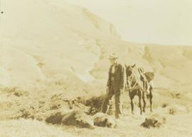
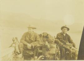
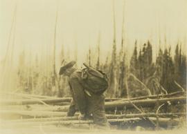
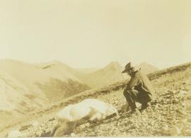
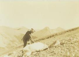
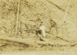
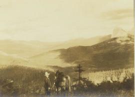
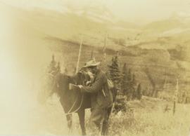
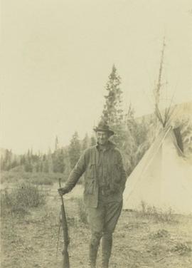
Image depicts the path taken during the portage to McCleary Lake.
Image depicts Portal Lake, located near the Yellowhead Pass on the British Columbia-Alberta border, west of Jasper, A.B.
Image depicts numerous lily pads on the surface of Portal Lake, located near the Yellowhead Pass on the British Columbia-Alberta border, west of Jasper, A.B.
Photograph of a mountain on the waterfront. Annotation on recto reads: "Portland & Stewart. New Twin Cities. Portland Canal. June 17th 1910. Button Photo. Prince Rupert, BC."
Possibly the ‘Iona Campagnolo’ rhododendron.
Annotation on photograph verso: "South of plot 27, N of 18, 20. 15/1/92. Post-logging. Summit Lake Selection Trial"
Annotation on photograph verso: "View south of unit 27 Post-logging. 15/1/92. Summit Lake Selection Trial"
Annotation on photograph verso: "South of plots 27, 21. 15/1/92. (Post-logging). Summit Lake Selection Trial"
Handwritten annotation on recto of photograph: "POURING RIBS JUNE 29/64." Photograph depicts construction workers on large wooden framework structure extending from base of crusher building. Ladders stand parallel to structure against mountainside. The boom of a crane is visible in foreground. Miscellaneous construction equipment and materials throughout.
Image depicts power lines east of the pulp mills in Prince George, B.C.
Annotation on photograph verso: "View from Jtn of A Road and Main Road to NE. Pre-logging. 15/1/92. Summit Lake Selection Trial"
Photograph depicts a man who is probably Prentiss Gray standing over three felled grizzly bears. The man is holding onto the reins of a horse and a rifle while a mountain range rises up in the background.
Photograph depicts a man, probably Prentiss Gray, standing over three felled grizzly bears while holding the reins of his horse and a rifle. In the background a mountain side rises up in the distance.
Photograph depicts a man who is probably Prentiss Gray standing over three felled grizzly bears. The man is holding the reins of a horse while a mountain rises in the distance.
Photograph depicts Prentiss Gray (left) and Mac McGarvey (right) seated in a boat on the Peace River.
Photograph depicts Prentiss Gray climbing over fallen logs in an area of windfall.
Photograph depicts Prentiss Gray standing beside a felled mountain goat on a rocky slope. In the background a mountain range is visible.
Photograph depicts Prentiss Gray reaching out to a felled mountain goat lying on a rocky slope. In the background a mountain range is visible.
Photograph depicts Prentiss Gray sitting on a tree stump skinning his trophy mountain goat while Bruce Otto looks on.
Photograph depicts Prentiss Gray standing with his horse overlooking a backdrop of forest covered mountains.
Photograph depicts Prentiss Gray standing with his rifle and horse in a grassy field. In the background a forested valley and snow-covered mountain range is visible.
Photograph depicts Prentiss Gray standing with a rifle in his hand in front of a teepee with a forested area in the background.
Item is an original BC Parks report entitled "Preservation and Management of the Grizzly Bear in B.C. Provincial Parks: The Urgent Challenge".
Previous site of sawmill in Giscome, B.C. looking northwest. Map coordinates 54°04'19.7"N 122°22'04.7"W
Image depicts a view of Prince George from an uncertain location.
Image depicts a view of Prince George.
Image depicts Prince George with numerous trees obscuring most of the view.
Image depicts Prince George.
Image depicts a view of Prince George.
Image depicts Prince George from University Way, with the P.G.I pulp mill in the distance.
Image depicts Prince George from University Way, with the P.G.I. Pulp Mill in the distance.
Image depicts Prince George, with the picture looking North-Northeast from University Way.
Image depicts an uncertain street in Prince George, B.C.
Image depicts Brunswick Street at 3rd Ave in -35 degree weather. Map coordinates 53°55'03.0"N 122°44'51.7"W
Image depicts 3rd Ave at Brunswick Street in -35 degree weather. Map coordinates 53°55'03.0"N 122°44'51.7"W
Image depicts Prince George at night from the cutbanks.
Image depicts a clearing in Prince George, B.C., possibly in the Pineview area.
Image depicts a clearing in Prince George, B.C.
Image depicts Prince George from the view of Peden Hill.
Image depicts a view of Prince George from the cutbanks.
Image depicts a view of Prince George from the cutbanks on the Nechako river.
Image depicts Prince George near the Airport Road.
Image depicts a view of Prince Rupert, B.C.
Image depicts a view of the downtown core of Prince Rupert, B.C.
Image depicts numerous buildings and a small dock somewhere in Prince Rupert, B.C. One of the buildings is labelled "Fishermen's Supply."