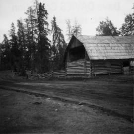
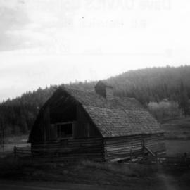
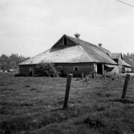
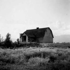
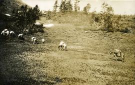
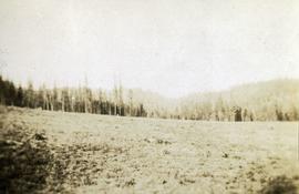
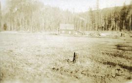
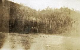
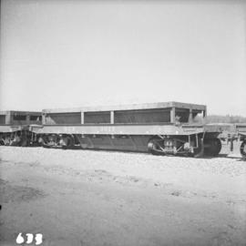
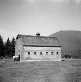
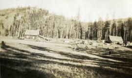
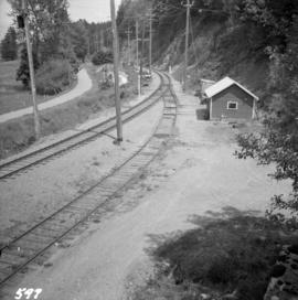
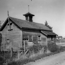
Photograph depicts a barn at Port Guichon, 1 mile west of Ladner, Delta.
Photograph depicts a barn attached to Watch Lake Lodge, a dude ranch.
Photograph depicts a barn located in Aspen Grove.
Photograph depicts a barn advertised for rent on Liverpool Rd. in South Westminster. Barn later half demolished on April 17, 1966.
Photograph depicts a barn in the Upper Fraser Valley, west of the Vedder crossing and southwest of Atchelitz.
Photograph depicts a barn located on the south side of Kokamee Creek, part of Kootenay Lake.
Handwritten photo album caption below this photo reads: "Barracks at Watson Lake". Photograph depicts three long log buildings connected in a U shape. The barracks are in a forest, surrounded with trees. The area around the building is strewn with wood debris and log piles. Dirt road in foreground.
Royal Canadian Air ForceItem is a photograph of a Barrier Lake in the foreground and a forest and mountain range in the background.
Item is a panoramic photograph of Barrier Lake, featuring a rocky shoreline, whitecaps and a mountaineous background.
Item is a photograph of a mountain range.
Item is a photograph of forested landscape in the midground and a barely visible mountain range in the background.
Photograph depicts an unusual style of barrier to a private house.
Image depicts a section of river located somewhere near Barriere, B.C.
Photograph depicts a view of the creek looking up toward the treed mountain. Handwritten annotation below photograph reads, "Barton's creek".
Photograph depicts a creek with lush vegetation on both banks, a snow-capped mountain in the distance. Handwritten annotation below photograph reads, "View on Barton's Creek - Naas River".
Image depicts a basalt landform somewhere in or near Quesnel, B.C.
Paperweight given to Minister Iona Campagnolo during visit to Quidi Vidi Lake, Newfoundland during Canada Summer Games in 1977.
Photograph depicts bascule bridges in the inner harbour of Victoria. Property of EN. In the process of being repaired and painted.
Photograph depicts a human figure at the base of a totem pole supported by ropes at Skidegate museum, Queen Charlotte Islands.
Photograph depicts crowd gathered to watch a baseball game in rustic field. Handwritten annotation on recto reads: “BASE-BALL FORT GEORGE BC” added annotation in ink reads: “1910”.
Photograph depicts packed horses walking in single file across an alpine meadow.
Photograph depicts a newly cleared field, forest and mountains in the background.
Photograph depicts a stump in the foreground, a building in the midground and forested mountains in the background.
Photograph depicts a field in the foreground, forest and mountains in the background.
Photograph depicts a field in the foreground, buildings and stumps in the midground and forest in the background.
Photograph depicts a newly cleared field, forest and mountains in the background.
Photograph depicts three or more people bathing in a stream surrounded by forest.
Image depicts the Battle Hill National Historic Site in Kitwanga, B.C.. The sign located there says: "The small knoll in the valley was a native fortress. Legends maintain that it was man-made: built to repel marauding coastal tribes. The hill was the scene of local tribal battles, and at one time was crowned with the defenders' buildings. Known as Dhawdezp, the unique mound is a prominent feature in the legends and history of the Indian people."
Image depicts a Bavarian style house at College Heights in Prince George, B.C.
Handwritten annotation on recto of photograph: "Edna & Alan Baxter - [guided?] with A. Hanson. Bob & Violet Baxter - Bob delivered mail to & from Quesnel in the 1940s." Young Edna sits on Alan's knee. Bob sits behind Violet as she pets the Cocker Spaniel. Large tree trunk stands behind Bob and Violet. A cabin and gate-like structure are semi-visible in background against forest. It is believed that this photograph was taken at Cluculz Lake, BC. Note on negative envelope: "Edna, Alan, Bob & self. Darkie at the Lake."
Left to right: Margaret (nee Baxter) and husband Gus Lund, Bea Baxter and beau, Violet and Bob Baxter. The group stands on road wearing formal attire. Rear of car can be seen in foreground on right; power poles, log building, and unidentified structure stand in front of forest in background.
Left to right: Margaret (nee Baxter) and husband Gus Lund, Bea Baxter and beau, Violet and Bob Baxter. The group stands on road wearing formal attire. Power poles, log building, and forest in background.
Photograph depicts looking toward a treed shoreline from the water. Klemtu was also known as China Hat due to the shape of Cone Island, which protects it from the open water. Handwritten annotation below photograph reads, "Bay at China Hat, BC Coast".
Photograph is a group portrait of BC Agricultural Land Commission staff members at a Christmas party. Back row, left to right: Patti, Terry Lewis, unknown, Julie Glover, Gordon Gram, Gary Holisko, Kirk Miller, unknown, Shirley Brightman. Middle row, left to right: Eve Lew, Jim Plotnikoff (Santa). Front row, left to right: Verona Hoosen, unknown, Jane Perch, Denise Jankovich, unknown, unknown.
Photograph is a group portrait of the British Columbia Canada Land Inventory team. Back row, left to right: Rob Hawes, unknown, Ivan Cotic, Terje Vold, John Wilcox [?], Keith Valentine, unknown, Alec Green [?], Horst Baender, Dick Marshall, unknown, John Senyk, Bill Watt, Neville Gough, Dan Blower, unknown, Gavin Young, Craig Brownlee. Middle row, left to right: unknown, Peter Murtha, unknown, unknown, John Harris, Al Aldred, Gary Runka, Ed Oswald, Mary Redmond. Front row, left to right: Rick Williams, Gerry Howell-Jones, Chris Stanley-Jones, Larry Lacelle, John Jungen, Tom Pierce, Jim Van Barneveld.
Photograph depicts the Department of Highways ferry named "Nimpkish" that was based in Port McNeill. It maintained a frequent daily triangle run, that travelled from Port McNiell to Sointula, then to Alert Bay. It held a capacity for 16 cars and 150 passengers.
Photograph depicts B.C. Electric ballast car #3013 standing on the new industrial siding on the northeast side of the Langley depot.
Item is a photograph of the B.C. Electric Board taken the day after the company’s take over by the Social Credit government on August 1, 1961. Pictured from the left are: Bill Means, former Lieutenant-Governor Frank Ross, Einar Gunderson, board secretary W. Goth, Gordon Shrum, Mr. Williston, Hydro lawyer Arthur Fouks and John Dunsmuir.
Photograph depicts the B.C. Electric rail bridge crossing the north section of the north arm of the Fraser River from Vancouver to Mitchell Island. The span is always kept open except for rail traffic.
Photograph depicts the B.C Electric rail bridge crossing the south section of the north arm of the Fraser River. The view is looking north from Mitchell Island, which takes steel traffic to and from the Western Canada Steel Ltd.
Photograph depicts a view looking northeast of the B.C. Electric Railway from the abandoned Sumas substation at Vedder Mountain.
Photograph depicts the B.C. Electric Railway, looking east from the depot at Cloverdale.
Photograph depicts the B.C. Electric Railway crossing 3rd Ave. with the first intersection at the immediate left. Note the abandoned double trackage at left. The view is looking north.
Photograph depicts the B.C. Electric Railway crossing at Serpentine Creek, 2 miles west of Cloverdale. The view is looking north.
Photograph depicts the B.C. Electric Railway crossing on Main St. in Langley, looking southwest.