Photograph depicts a man wearing rubber boots, standing on a board walk, a house in the background. Handwritten annotation below photograph reads, "Sweet Wm Smith".
Photograph depicts Jewitt's CF-ABM Fairchild 71 aircraft and a group of men surrounding a Detroit News aircraft NR-32-M, both located at Edmonton Airport.
Photograph depicts Wilkinson Steel Ltd. The spur line was inside the property with an empty bulkhead car awaiting removal.
Photograph depicts a wide ditchline cut into a rocky environment with a line of trees located in the background.
Photograph depicts a wide gravel pathway that has been cleared through a wooded landscape.
Photograph depicts the lower portion of a tall totem pole. Handwritten annotation below photograph reads, "2 views of Totem pole".
Photograph depicts a tall totem pole. Handwritten annotation below photograph reads, "2 views of Totem pole".
Photograph depicts Wickaninnish Beach, north of Ucluelet on Vancouver Island.
Rock pile, unknown building, and hills can be seen in background.
Photograph is one of 11 images taken during a World Health Organization (WHO) trip, Human Rights of Women and Children, Peru, 1990. Possibly affiliated with World Council of Churches, International Ecumenical Delegation to Lima, Peru, 14-25 October 1990. See also items 2009.6.1.505 - 2009.6.1.515.
Vehicles and large cement building in background.
Photograph is one of 11 images taken during a World Health Organization (WHO) trip, Human Rights of Women and Children, Peru, 1990. Possibly affiliated with World Council of Churches, International Ecumenical Delegation to Lima, Peru, 14-25 October 1990. See also items 2009.6.1.505 - 2009.6.1.515.
Young girl stands among unidentified women and men seated around her. Man on far left holds tape recorder towards her.
Photograph is one of 11 images taken during a World Health Organization (WHO) trip, Human Rights of Women and Children, Peru, 1990. Possibly affiliated with World Council of Churches, International Ecumenical Delegation to Lima, Peru, 14-25 October 1990. See also items 2009.6.1.505 - 2009.6.1.515.
Unidentified man and woman sit in background.
Photograph is one of 11 images taken during a World Health Organization (WHO) trip, Human Rights of Women and Children, Peru, 1990. Possibly affiliated with World Council of Churches, International Ecumenical Delegation to Lima, Peru, 14-25 October 1990. See also items 2009.6.1.505 - 2009.6.1.515.
Young boy stands among unidentified women and men seated around him. Tape recorder is held towards him on far left.
Photograph is one of 11 images taken during a World Health Organization (WHO) trip, Human Rights of Women and Children, Peru, 1990. Possibly affiliated with World Council of Churches, International Ecumenical Delegation to Lima, Peru, 14-25 October 1990. See also items 2009.6.1.505 - 2009.6.1.514.
Photograph is one of 11 images taken during a World Health Organization (WHO) trip, Human Rights of Women and Children, Peru, 1990. Possibly affiliated with World Council of Churches, International Ecumenical Delegation to Lima, Peru, 14-25 October 1990. See also items 2009.6.1.506 - 2009.6.1.515.
The group stands in front of a cement building.
Photograph is one of 11 images taken during a World Health Organization (WHO) trip, Human Rights of Women and Children, Peru, 1990. Possibly affiliated with World Council of Churches, International Ecumenical Delegation to Lima, Peru, 14-25 October 1990. See also items 2009.6.1.505 - 2009.6.1.515.
Man wearing suit and tie is partially visible in background.
Photograph is one of 11 images taken during a World Health Organization (WHO) trip, Human Rights of Women and Children, Peru, 1990. Possibly affiliated with World Council of Churches, International Ecumenical Delegation to Lima, Peru, 14-25 October 1990. See also items 2009.6.1.505 - 2009.6.1.515.
The group stands in front of a brick wall.
Photograph is one of 11 images taken during a World Health Organization (WHO) trip, Human Rights of Women and Children, Peru, 1990. Possibly affiliated with World Council of Churches, International Ecumenical Delegation to Lima, Peru, 14-25 October 1990. See also items 2009.6.1.505 - 2009.6.1.515.
Trees in foreground, hills in background. Unidentified man stands on far left.
Photograph is one of 11 images taken during a World Health Organization (WHO) trip, Human Rights of Women and Children, Peru, 1990. Possibly affiliated with World Council of Churches, International Ecumenical Delegation to Lima, Peru, 14-25 October 1990. See also items 2009.6.1.505 - 2009.6.1.515.
Unidentified individuals can be seen walking and sitting behind arches. One man lies on street in foreground.
Photograph is one of 11 images taken during a World Health Organization (WHO) trip, Human Rights of Women and Children, Peru, 1990. Possibly affiliated with World Council of Churches, International Ecumenical Delegation to Lima, Peru, 14-25 October 1990. See also items 2009.6.1.505 - 2009.6.1.515.
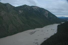
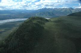
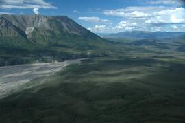
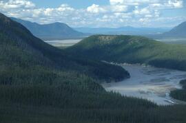
File consists of a speech given by Gary Runka entitled "Who Gets to Use the Land and Water? - the Urban and Agricultural Land Needs of the Okanagan Valley" for the Faculty of Agricultural Sciences, UBC and Okanagan College.
Commentary on this speech by Barry Smith of the Ministry of Agriculture and Lands:
"Although the ALR and ALC Act are not mentioned directly, the paper is focused on agriculture and rural planning.
When speaking of the competition for land and the pressure agricultural land is under, an interesting statement is included referring to the fact that "the fluctuation" in Washington State's apple crop is greater than the entire annual Okanagan production.
The paper reviews pressures on agriculture and urban land uses. Under "Satisfying the Needs (Options and Interrelationships)" seven points are made including "Understanding the land is the most important prerequisite to its wise and proper use," and that Integrated Natural Resource Management and Land Use Planning must be closely tied.
The paper ends with a point of optimism - "I see that potential to increase our understanding of the natural processes and to explore the questions of who gets to use the land and water from a view point somewhere in the orchard or countryside rather than from Main Street. That's a beginning."
Item is a photograph of two survey crewmen seated on the ground surrounded by camp rations and eating.
Handwritten photo album caption below this photo reads: "Whitehorse 'Runway'". Photograph depicts three planes in distance on runway, one of them is parked in front of large building on left (hangar?). Two long unidentified buildings in background on left, trees and range of hills in background on right. See also items 2006.20.12.1 & 2006.20.12.43.
Royal Canadian Air ForceCaption describing photograph: "White Spruce within 20' of pine (see GBW Film 3 Frame 1 - 2007.1.30.2.026). Same age, same site. Height 5' 1966 leader 6". Adelges." Harry Coates stands in the photograph for scale.
This image is part of the outbound sequence of aerial images obtained on the helicopter flight to the Klutlan Glacier study site. The sequence starts from the base camp at the White River crossing on the Alaska Highway and heads south, to a point just upvalley of the debris-covered terminus (approx. 10-15 km from Alaska border), and turning back north to the landing spot on the Generc River floodplain close to the study site (see Fig. 1 in paper).
This image is part of the return trip sequence of aerial images obtained on the helicopter flight leaving the Klutlan Glacier study site. On the return leg at the end of the day, the flight initially went upvalley to pick up another party. This image was taken after the helicopter turned north to return to base camp.
This image is part of the outbound sequence of aerial images obtained on the helicopter flight to the Klutlan Glacier study site. The sequence starts from the base camp at the White River crossing on the Alaska Highway and heads south, to a point just upvalley of the debris-covered terminus (approx. 10-15 km from Alaska border), and turning back north to the landing spot on the Generc River floodplain close to the study site (see Fig. 1 in paper).
Image depicts the White Pass Train crossing over a railway bridge at an uncertain location.
Image depicts the White Pass Train crossing over a railway bridge at an uncertain location in the mountains.
Image depicts the White Pass Train crossing over a railway bridge at an uncertain location.
Image depicts a sign, labelled "The White Pass Snow Fleet," which details the history of the fleet; it is located in Skagway, Alaska.
Image depicts a mountain side somewhere along the White Pass railway. The thin ridge along the mountain side is possibly either a highway or part of the railway.
Image depicts a grave somewhere along the White Pass railway.
Photograph depicts a jut of treed land in the Kettle river.
Photograph depicts a wheelbarrow purchased in 1969, secondhand.
Photograph depicts the Wheatsheaf Inn "pub" on the way to Cedar-by-the-Sea from Nanaimo, B.C.
Warf construction visible in foreground. Background consists of a few built structures and several tents, location unidentified.