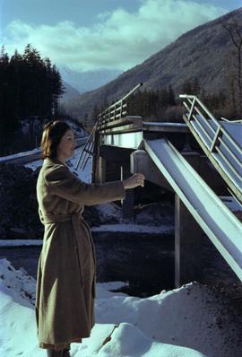
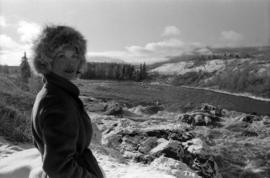
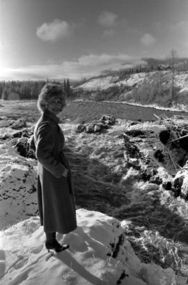
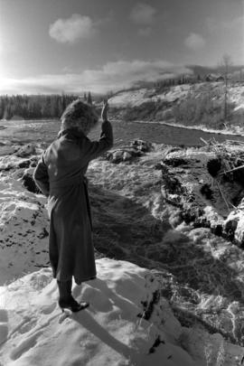
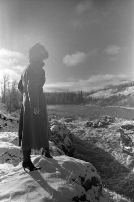
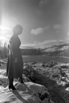
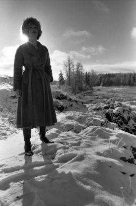
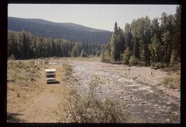
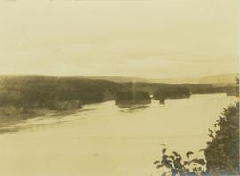
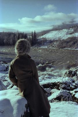
Photograph depicts Iona Campagnolo leaning against a rock by the flooded Bulkley River near Moricetown.
Photograph depicts Iona Campagnolo speaking with a family at the site of a damaged road and bridge from a washout on Highway 16.
Photograph depicts Iona Campagnolo with a family at a damaged road and bridge from a washout on Highway 16.
Photograph depicts Iona Campagnolo with a family looking at a damaged road and bridge from a washout on Highway 16.
Photograph depicts Iona Campagnolo beside a damaged bridge from a washout on Highway 16.
Photograph depicts Iona Campagnolo beside a damaged road and bridge from a washout on Highway 16.
Photograph depicts Iona Campagnolo with a fur hat standing in front of the flooded Bulkley River by Moricetown.
Photograph depicts Iona Campagnolo with the flooded Bulkley River near Moricetown in the background.
Photograph depicts Iona Campagnolo with an upraised hand standing by the flooded Bulkley River near Moricetown.
Photograph depicts Iona Campagnolo watching the flooded Bulkley River near Moricetown.
Photograph depicts Iona Campagnolo standing by the flooded Bulkley River near Moricetown.
Photograph depicts Iona Campagnolo with the flooded Bulkley River near Moricetown in the background.
Photograph was taken during a tour of the Skeena riding in the summer of 1978.
Handwritten annotation on verso reads: “Fisheries Museum Prince Rupert”.
Image depicts Iron Road North, and a creek surrounded by trees. Located north of Woodpecker, B.C.
Image depicts Iron Road South, which is located north of Woodpecker, B.C.
Image depicts the street sign for Iron Road South, which is located north of Woodpecker, B.C.
Image depicts what is possibly an irrigation channel somewhere in Seton Portage, B.C.
Image depicts an irrigation ditch in Lillooet, B.C.
Image depicts the Isaac Falls.
Image depicts a log jamb at the Isaac Falls.
Image depicts Isaac Lake.
Image depicts Isaac Lake from the Betty Wendle campsite.
Image depicts a camp at the Betty Wendle campsite at Isaac Lake.
Image depicts the sunset over Isaac Lake from the Betty Wendle campsite.
Photograph depicts a tall, rocky island rising out of the Peace River above Hudson's Hope.
Photograph depicts a forested island in Bear Hole Lake as seen from the shore. In the foreground of the image is a barren tree line.
Photograph depicts a forested island in Bear Hole Lake as seen from the shore. In the foreground is a barren tree line.
Photograph depicts islands along the Peace River seen from above, located near Hudson's Hope. In the background of the image tree-covered hills are visible.
Image depicts the ferry at Isle Pierre, B.C.
Image depicts an unknown individual in the J. Edwards Camp in South Tweedsmuir Provincial Park.
Image depicts a view of James Creek Valley.
Photograph depicts Jean in foreground, standing in front of wood house, miscellaneous items and furniture crossing midground. Picket fence on left, bushes in background. Handwritten annotation on recto of photograph: "Why didn't you drop off and see us when you were home? Dad came home an told me to guess whom he had seen in Edmonton and right away I said 'Uncle Alan.' Wishing you a very Merry Xmas and Happy New Year. Lots of love to both. Jean. See what lovely cuffs and collar the bear skin you sent for me some years ago made for me this winter. Nobody knows me with it on and everyone admires it." (See item 2009.5.3.100 for photograph depicting bear skin.)
Photograph features one apple tree, field in background. Handwritten annotation on recto of photograph: "This shows size of trees." It is believed that this photograph was given to Lillian & A.K. Bourchier by their niece Jean.
Image depicts a deer somewhere at Joffre Creek.
Image depicts a deer in the bottom left corner, as well as a view of a mountain side, somewhere at Joffre Creek.
Image depicts a road, possibly Joffre Creek Road. The slide is simply labelled "Joffre cr."
File consists of:
- "Devil's Club, Black Flies, and Snowshoes" by John Revel, 2007, 44 p. (3 copies)
File consists of:
- An original final draft of John Revel's problem analysis entitled "Silviculture in Spruce-Alpine Fir Types in the North Central Interior of British Columbia" for E.P. 639 with the Research Division of the BC Forest Service.
Image depicts a junk pile of bottles, cans and bags, as well as the gutted frame of an old car, at Island Cache.
Lofty view of Kaien Island, with other islands in the background. Printed annotation on recto reads: "Kaien Island, Prince Rupert, B.C., showing Water Front of four miles on Prince Rupert Harbor."
Image depicts the townsite of Keithley Creek, B.C.
Image depicts the Keithley Creek, with several unknown individuals walking along the banks.
Image depicts a sign on the dirt road leading to Barkerville from Keithley Creek. The sign reads: "Barkerville 40 (via Yanks Peak) Maximum elevation 6200 FT. Summer road only. Steep grades and switchbacks not recommended for other than 4-wheel drive vehicles. You are entering an isolated mountain area; you will be on your own."
Image depicts a blue truck and a camper in the wooded area surrounding the townsite of Keithley Creek, B.C.
Image depicts a view of Kelly Lake in Downing Provincial Park.
Image depicts a view of Kelly Lake Valley from Pavilion Mountain.
Slide depicts Kelowna and Casa Loma photographed during the day from across the Okanagan Lake in the Lakeview Heights area. Original slide index description: "Kel & Casa Loma from Lakeview Hts."
Image depicts the Kenney Dam near Cheslatta, B.C.