Photograph depicts a trestle near Australian, BC on mile 364. Visible is a northbound freight of 2 locomotives and about 60 cars.
Image depicts the Prince George Multiplex.
Image depicts an aerial view of the Ahbau area somewhere near Prince George, B.C.
Image depicts an aerial view of areas that have been used for logging around Prince George, B.C.
- Agreement of Sale of Prince George Citizen
- Correspondence regarding proposed Prince George Citizen sale – H.G.T. Perry & news clippings
Image depicts two trains in Prince George, B.C.
This souvenir depicts a pewter seagull statuette mounted to a stone. This was possibly a gift to Minister Iona Campagnolo during her visit to St. John's, Newfoundland during the 1977 Canada Summer Games.
This statue of a bird, most likely a Canadian goose, mounted on marble, was a gift to Minister Iona Campagnolo from Iglooik, which is now in present-day Nunavut. She received this gift during ther 1976 summer visit to the eastern arctic, while in discussion for the Mackenzie Pipeline.
Photograph depicts a portrait of Peter Lester that was attached to his resume for Director of Loto Canada.
Photograph depicts Peter Jones sitting at a table with organizers of the Northern BC Winter Games in Smithers.
Jones stands behind microphone in log building. Photo taken during tour with Crowder Communications.
Photograph depicts men standing on shore near what appears to be a long pier extending into the river. Trees on left, opposite shore in background. Handwritten annotation on recto of photograph: "Pete Joy's Bar Finlay River."
Muinok Lake is also known as Belcourt Lake.
Photograph depicts Pete Callao on horseback looking through binoculars in order to determine his course through a forested valley to Pine River. In the background the peak of a mountain is visible.
Photograph depicts Pete Callao using an axe to cut a trail through an area covered with windfall.
Muinok Lake is also known as Belcourt Lake.
Photograph depicts Pete Callao (left) and Frank Dewing (right) napping under a spruce tree lean-to in a forest clearing.
Photograph depicts two men (possibly Pete Callao and Carrol Paul) standing with two saddled horses. In the background a mountain vista is visible.
Caption: "Finlay River below Canyon"
Typed caption glued to album page directly below photograph reads: "38. The land that will produce the large crops when cultivated, along the telegraph road near Fort Fraser." Photograph depicts a dirt road winding through a stand of deciduous trees. Photographer: Dominion Stock & Bond Corporation.
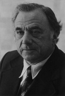
File consists of the written personal reflections of Gary Runka for the "'Ten Years of Agricultural Land Preservation", December 1983.
Commentary on this speech by Barry Smith of the Ministry of Agriculture and Lands:
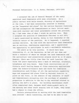
"These personal reflections were prepared by GGR for publication in the ALC's document commemorating its 10th anniversary entitled "Ten Years of Agricultural Land Preservation". These reflections form pages 33 - 35 of this 61 page document.
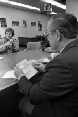
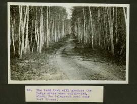
The reflections portray the hectic start of the Land Commission's work but also inform us of GGR's role prior to becoming the Commission's first General Manager. As noted, "I had been extensively involved in drawing up the "suggested ALR plans" for the various regional districts while working with the Soils Branch of the Ministry of Agriculture." He then accompanied the Commission on their initial meetings with regional districts and local governments around the province.
The fact that GGR played a key role in developing the CLI mapping (an important basis of the ALR), then was involved with drawing up the suggested ALR plans, followed by his efforts as ALC General Manager to implement the Reserve plans, and finally sign off on the completed ALR plan map sheets, arguably makes Gary Runka, like no other person, the "Father of the ALR"."
File consists of selected personal records from Dr. Joselito Arocena's digital media. Includes 3 floppies and migrated data from hard drives.
Image depicts an individual walking on a path through a forest somewhere on Haida Gwaii.
Image depicts an individual walking on a a log bridge in a forest somewhere on Haida Gwaii.
Image depicts an individual standing on a trail in the coastal forest on Haida Gwaii, B.C.
Image depicts an individual ducking under a tree branch somewhere in Haida Gwaii, B.C.
Photograph depicts an unknown person eating at a picnic table on a house construction site.