File consists of notes relating to the Salmon Valley Elementary School. Also includes photographs depicting the old weathered wooden Salmon Valley school building [2001?].
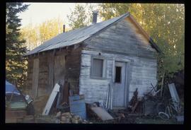
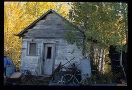
The item is a photograph depicting the old, wooden Salmon Valley elementary school relocated to La Casse farm. The building is weathered with fading paint, a rusted roof and boarded up windows. There is a rusted bicycle, a rusted barrel and other debris in front of the building. Annotation on reverse side of the photograph states, "teacher illegible handwriting La Casse farm." Acompanying note states, "#6 La Casse farm."
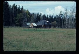
File consists of notes, clippings, and reproductions relating to Salmon Valley and Old Summit Lake Road. Also includes photographs depicting a homestead on Old Summit Lake Road (2005).
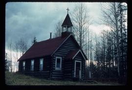
Image depicts an old Catholic church in Salmon Valley.
Image depicts an old log cabin in Salmon Valley.
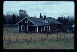
Image depicts an old log house with a collapsing roof in Salmon Valley.
Image depicts the teacherage for the Salmon School, located in the Prince George vicinity.
Image depicts the teacherage for the Salmon School, located in the Prince George vicinity.
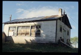
Image depicts the Salmon School in the Prince George vicinity.
File consists of photographs depicting the Salmon River Portage. Includes depictions of potential past mill sites, overgrown fields, and derelict buildings.
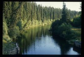
Image depicts the Salmon River by Fraser Lake.
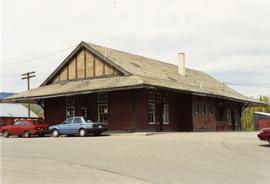
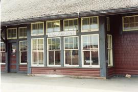
Photograph depicts the CPR depot in Salmon Arm.
Photograph depicts the CPR depot in Salmon Arm.
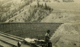
Photograph depicts Mr. Crysdale sitting on a velocipede on the Sallus Creek ("14 Mile") Pacific Great Eastern Railway trestle with an estimated date of very late July 1915 or later. "Canadian Railway and Marine World" reported that track had been laid to 14 miles North of Lillooet by July 30, 1915 (CR&MW , Sept 1915, p341, c2). 14 miles North of Lillooet is approximately 20 rail lengths beyond the North end of this trestle, leading to a "best estimate" of very late July 1915 as the earliest date for this photograph. The velocipede depicted is a 3-wheel, manually propelled vehicle operated by a push-pull (back & forth) action on the actuating handle.
The ca. 1921-1927 “PGE Bridge List” from the notebook of William H. Hewlett (1914-1968) references a Mile 13.7, 14 Mile Creek, frame trestle, 905 ft. long, 182 ft. high, 61 spans of 14.8 feet in the Lillooet Subdivision. A “PGE Track Profile” drawing shows this trestle was on a 1.55% grade and a 12 degree left hand curve. While the drawing had been revised at least twice (with an unknown date for the most recent revision), the pre-“Lillooet Diversion of 1931" mileage figures confirm that the 1915 “Mile 13.7" was in agreement with a more recent hand written note “Sallus Creek”. The trestle appears to have gone by the names "14 Mile" trestle, "13.7 Mile Trestle", and "Sallus Creek" trestle.
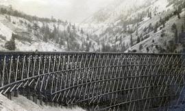
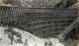
Photograph depicts a partially constructed Pacific Great Eastern Railway trestle located near Sallus Creek in the area around Lillooet, Fountain, and Pavilion. "Canadian Railway and Marine World" reported that track had been laid to 14 miles North of Lillooet by July 30, 1915 (CR&MW , Sept 1915, p341, c2). 14 miles North of Lillooet is approximately 20 rail lengths beyond the North end of this trestle, leading to a "best estimate" of early-mid July 1915 as the latest date for this photograph.
The ca. 1921-1927 “PGE Bridge List” from the notebook of William H. Hewlett (1914-1968) references a Mile 13.7, 14 Mile Creek, frame trestle, 905 ft. long, 182 ft. high, 61 spans of 14.8 feet in the Lillooet Subdivision. A “PGE Track Profile” drawing shows this trestle was on a 1.55% grade and a 12 degree left hand curve. While the drawing had been revised at least twice (with an unknown date for the most recent revision), the pre-“Lillooet Diversion of 1931" mileage figures confirm that the 1915 “Mile 13.7" was in agreement with a more recent hand written note “Sallus Creek”. The trestle appears to have gone by the names "14 Mile" trestle, "13.7 Mile Trestle", and "Sallus Creek" trestle.
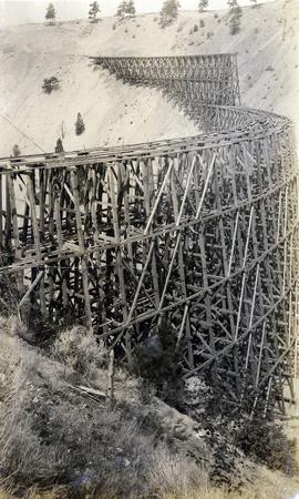
Photograph depicts the Pacific Great Eastern Railway trestle located near Sallus Creek in the area around Lillooet, Fountain, and Pavilion. "Canadian Railway and Marine World" reported that track had been laid to 14 miles North of Lillooet by July 30, 1915 (CR&MW , Sept 1915, p341, c2). 14 miles North of Lillooet is approximately 20 rail lengths beyond the North end of this trestle, leading to a "best estimate" of very late July 1915 or later as the earliest dates for this photograph.
The ca. 1921-1927 “PGE Bridge List” from the notebook of William H. Hewlett (1914-1968) references a Mile 13.7, 14 Mile Creek, frame trestle, 905 ft. long, 182 ft. high, 61 spans of 14.8 feet in the Lillooet Subdivision. A “PGE Track Profile” drawing shows this trestle was on a 1.55% grade and a 12 degree left hand curve. While the drawing had been revised at least twice (with an unknown date for the most recent revision), the pre-“Lillooet Diversion of 1931" mileage figures confirm that the 1915 “Mile 13.7" was in agreement with a more recent hand written note “Sallus Creek”. The trestle appears to have gone by the names "14 Mile" trestle, "13.7 Mile Trestle", and "Sallus Creek" trestle.
Photograph depicts the Pacific Great Eastern Railway trestle located near Sallus Creek in the area around Lillooet, Fountain, and Pavilion. A number of men are working along the trestle, possibly completing final construction work or performing repairs. "Canadian Railway and Marine World" reported that track had been laid to 14 miles North of Lillooet by July 30, 1915 (CR&MW , Sept 1915, p341, c2). 14 miles North of Lillooet is approximately 20 rail lengths beyond the North end of this trestle, leading to a "best estimate" of very late July 1915 or later as the earliest dates for this photograph.
The ca. 1921-1927 “PGE Bridge List” from the notebook of William H. Hewlett (1914-1968) references a Mile 13.7, 14 Mile Creek, frame trestle, 905 ft. long, 182 ft. high, 61 spans of 14.8 feet in the Lillooet Subdivision. A “PGE Track Profile” drawing shows this trestle was on a 1.55% grade and a 12 degree left hand curve. While the drawing had been revised at least twice (with an unknown date for the most recent revision), the pre-“Lillooet Diversion of 1931" mileage figures confirm that the 1915 “Mile 13.7" was in agreement with a more recent hand written note “Sallus Creek”. The trestle appears to have gone by the names "14 Mile" trestle, "13.7 Mile Trestle", and "Sallus Creek" trestle.
The item is a photograph depicting a stained-glass window from the church at Indian Reserve No. 2 in Shelley. The window is titled "Saint Peter" and depicts a saint holding keys and a scroll.
The item is a photograph depicting a stained-glass window from the church at Indian Reserve No. 2 in Shelley. The window is titled "Saint Peter" and depicts a saint holding keys and a scroll.
The item is a photograph depicting a stained-glass window from the church at Indian Reserve No. 2 in Shelley. The window is titled "Saint Peter" and depicts a saint holding keys and a scroll.
The item is a photograph depicting a stained-glass window from the church at Indian Reserve No. 2 in Shelley. The window is titled "Saint Paul" and depicts a saint holding a sword.
The item is a photograph depicting a stained-glass window from the church at Indian Reserve No. 2 in Shelley. The window is titled "Saint Paul" and depicts a saint holding a sword.
The item is a photograph depicting a stained-glass window from the church at Indian Reserve No. 2 in Shelley. The window is titled "Saint Nicholas" and depicts a saint holding a staff and three golden balls.
The item is a photograph depicting a stained-glass window from the church at Indian Reserve No. 2 in Shelley. The window is titled "Saint Nicholas" and depicts a saint holding a staff and three golden balls.
The item is a photograph depicting a stained-glass window from the church at Indian Reserve No. 2 in Shelley. The window is titled "Saint Joseph" and depicts a saint holding an olive branch.
The item is a photograph depicting a stained-glass window from the church at Indian Reserve No. 2 in Shelley. The window is titled "Saint Joseph" and depicts a saint holding an olive branch.
The item is a photograph depicting a stained-glass window from the church at Indian Reserve No. 2 in Shelley. The window is titled "Saint John" and depicts a saint holding a chalice and a book.
The item is a photograph depicting a stained-glass window from the church at Indian Reserve No. 2 in Shelley. The window is titled "Saint John" and depicts a saint holding a chalice and a book.
The item is a photograph depicting a stained-glass window from the church at Indian Reserve No. 2 in Shelley. The window is titled "Saint Agnes" and depicts a saint holding an olive branch and a lamb.
The item is a photograph depicting a stained-glass window from the church at Indian Reserve No. 2 in Shelley. The window is titled "Saint Agnes" and depicts a saint holding a lamb and an olive branch.
Postcard depicts Sailor Bar Tunnel on the Fraser Canyon Section of the Trans-Canada Highway.
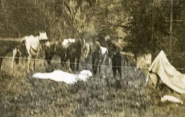
Photograph depicts two men saddling several horses.
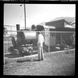
Photograph depicts a saddle tank built by Porter Company, Pittsburgh, USA in 1901. It was used for charging coke ovens and was acquired from the Crows Nest Pass Coal Company in 1970.
The item is a photograph of the front and side of Sacred Heart Catholic Cathedral at 887 Patricia Boulevard, Prince George.
Fonds consists of ledgers recording accounts and maintenance notes of the S. B. Trick Lumber Co. and one photograph of the Ambrose Trick Sawmill.
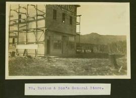
S. B. Trick Lumber Co.Typed caption glued to album page directly below photograph reads: "70. Ruttan & Son's General Store." Photographer: Dominion Stock & Bond Corporation.
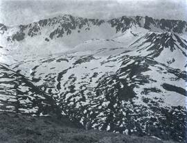
Photograph depicts a view of a snow covered valley (Rusty Basin) with a mountain range visible in the background.
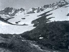
Photograph depicts a view of Duncan Creek in front of a snow covered valley (Rusty Basin) with a mountain range visible in the background.
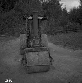
Photograph depicts a Ruston steam roller owned by Gary Wellburn in Duncan, BCIt was previously owned by the Oak Bay municipality.
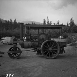
Photograph depicts a Ruston steam roller owned by Gary Wellburn in Duncan, BC
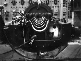
Photograph depicts the large bearing cups of one of the Ruston Hornsby diesel engines that turned the generators in the power house on the Cassiar plant. Engine believed to be under repair. Electric panels in background.
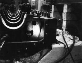
Photograph depicts the large bearing cups of one of the Ruston Hornsby diesel engines that turned the generators in the power house on the Cassiar plant. Engine believed to be under repair. Electric panels in background.
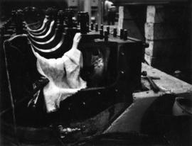
Photograph depicts the large bearing cups of one of the Ruston Hornsby diesel engines that turned the generators in the power house on the Cassiar plant. Engine believed to be under repair. Electric panels and unidentified individual in background.
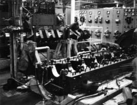
Photograph depicts the large bearing cups of one of the Ruston Hornsby diesel engines that turned the generators in the power house on the Cassiar plant. Engine believed to be under repair. Saw horse, machinery, and electric panels in background.
An aerial view of Rustad Bros. Sawmill with the beehive burner, mill complex and log yard in the background and the lumber yard in the foreground. Photographer of this oversize photograph believed to be Bill Theessen.
Photographic negatives depict men on tour in unknown locations in Russia. Images depict urban areas, mining areas, construction of buildings, railway, mineral samples, and equipment including dump truck and electric shovel. Also includes images of area speculated to be a mine pit. Men on tour are dressed in formal attire.
Handwritten annotation in pencil on envelope containing negatives: "Russian 'Asbest' Mine Slides" "7 copies of each - 23 negatives - 161 prints".
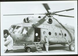
Item is a photograph of the Russian helicopter which Ray used to survey timber on the border between Bangladesh and Burma.
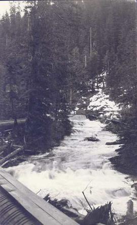
Photograph depicts a landscape shot of rushing water with a forested area in the background.
The item is a photograph depicting a workshop in the rural Prince George area.
The item is a 35 mm photograph depicting a workshop in the rural Prince George area.
