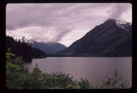
Print preview Close

Showing 3808 results

Archival description
3546 results with digital objects Show results with digital objects
Dunlevy Creek?
2012.13.1.50.138 · Item · 2006
Part of J. Kent Sedgwick fonds

Image depicts the Dunlevy Creek area somewhere near Dawson Creek, B.C. The slide is simply labelled "Dunlevy irrigation" for uncertain reasons.

Dunlevy Creek?
2012.13.1.50.137 · Item · 2006
Part of J. Kent Sedgwick fonds

Image depicts the Dunlevy Creek area somewhere near Dawson Creek, B.C. The slide is simply labelled "Dunlevy irrigation" for uncertain reasons.

Dump Truck at Tailings Pile
2000.1.1.3.18.001 · Item · 1953
Part of Cassiar Asbestos Corporation Ltd. fonds

Photograph depicts red truck dumping waste at what is believed to be the tailings pile at the Cassiar plant. Small building and unidentified individual in bottom left foreground, valley and mountains in background. Photo caption next to printed copy of image in 1953 Annual Report: "Stockpile of 80,000 tons of Ore at Mill."

Ducks
2012.13.1.50.055 · Item · 1978
Part of J. Kent Sedgwick fonds

Image depicts a large flock of ducks in a field full of water at an unknown location.

Drying sugar
2014.10.1.104 · Item · 1910
Part of Arthur Holland Land Surveying Collection

Photograph depicts a tarp spread out on the grass, two men sit nearby the tarp. There is a canvas tent in the background with a man standing beside it. Behind the tent is a low hill with a fence bordering the top of the hill. There are blankets drying on the fence.

2000.1.1.3.18.004 · Item · September 1954
Part of Cassiar Asbestos Corporation Ltd. fonds

Photograph depicts large dry rock storage building in foreground on right, mill on left behind tailings pile, and dryer building in centre behind conveyor belt connecting mill to dry rock storage. A cloud can be seen rising from plantsite. Trees and Troutline Creek cross foreground, mine valley and mountains visible in background. Stamped annotation on recto of photograph: "ANSCO PRINTON Munshaw Colour Service Ltd. MAR 10 1955".

2000.1.1.3.18.003 · Item · September 1954
Part of Cassiar Asbestos Corporation Ltd. fonds

Photograph depicts large dry rock storage building in foreground on left, mill in background, dryer building in right midground. Miscellaneous supplies in far right foreground, mountains visible in background. Handwritten annotation on verso of photograph: "Sept 1954". This photograph was originally stored inside duotang labeled "CASSIAR ASBESTOS CORPORATION LIMITED PHOTOGRAPHS 1954"; photo caption beneath this image: "40,000 Ton Dry Storage Building / Mill / Dryer Building".

2009.7.1.053 · Item · [ca. 1915?]
Part of Archdeacon W. H. Collison fonds

Photograph depicts buildings visible through clearing in trees. Water crosses foreground, hills visible in background.

Handwritten annotation on verso reads: "Dry dock / Prince Rupert B.C."

Driveway in Newlands, BC
2012.13.1.87.102 · Item · [between 1975 and 1995]
Part of J. Kent Sedgwick fonds

Image depicts a driveway cordoned off by a red mesh material in Newlands, B.C. The address of the house is labelled 31951, and the name listed is "Fauchers." Map coordinates 54°06'47.8"N 122°08'22.4"W

Driftwood Station
2012.13.1.62.02 · Item · June 1978
Part of J. Kent Sedgwick fonds

Image depicts the Driftwood BCR station, possibly located near Driftwood Creek in the Driftwood Canyon Provincial Park east of Smithers, B.C.

Driftwood Creek
2012.13.1.62.03 · Item · June 1978
Part of J. Kent Sedgwick fonds

Image depicts a number of identical buildings and vehicles at "Driftwood Creek" in the Driftwood Canyon Provincial Park.

Dozer on Cliff, Close View
2000.1.1.3.15.14 · Item · [ca. 1958]
Part of Cassiar Asbestos Corporation Ltd. fonds

Photograph depicts unknown man driving bulldozer near edge of mine area at high elevation. Dozer is an International model TD24 (manufactured between 1947 and 1955). Valley and mountain range in background.

2000.1.1.3.15.17 · Item · 1961
Part of Cassiar Asbestos Corporation Ltd. fonds

Photograph depicts unknown man driving bulldozer on edge of mine area at high elevation. Mine road can be seen below leading to Cassiar plant in background on left, townsite visible on right. South mountain range in distance. Handwritten annotation on verso of photograph: "1961".

Dozer on Cliff
2000.1.1.3.15.11 · Item · [ca. 1958]
Part of Cassiar Asbestos Corporation Ltd. fonds

Photograph depicts unknown man driving bulldozer on edge of mine area at high elevation. The dozer is an International model TD24 (manufactured between 1947 and 1955). A second man stands on edge of cliff, directing driver. Mountain range in background.

Dozer on Cliff
2000.1.1.3.15.10 · Item · [ca. 1958]
Part of Cassiar Asbestos Corporation Ltd. fonds

Photograph depicts unknown man driving bulldozer on edge of mine area at high elevation. The dozer is an International model TD24 (manufactured between 1947 and 1955). A second man stands on edge of cliff, directing driver. Expansive mountain range in background.

Dozer Near Mine Garage
2000.1.1.3.15.18 · Item · [1962?]
Part of Cassiar Asbestos Corporation Ltd. fonds

Photograph depicts unknown man driving bulldozer in foreground. Shop area in background, numerous haul trucks and dozers throughout. Old mine garage can be seen in center behind dozer, and the mine's West Peak rises on right behind shop buildings. Mountain range in background. Handwritten annotations on recto of photograph: "Cassiar Asbestos Corporation Limited. Cassiar B.C. Mining asbestos ore elevation approx 6000 ft. above sea level. McDame mountain, Northern British Columbia"; "Toronto Set"; "D - 336"; "-4 1/2 -". What appears to be framing measurements are annotated on verso.

2011.13.24 · Item · ca.1910-ca.1930
Part of Parker photograph collection

Street view of various buildings in Stewart, BC, covered with a heavy layer of snow. Visible businesses include "The R. Boyd Young Co." and "Stewart Land Co." Printed annotation on recto reads: "Stewart B.C. Hughes 78."

2009.7.1.296 · Item · 20 October 1907
Part of Archdeacon W. H. Collison fonds

Photograph of several buildings down the street in Prince Rupert, including the church. Lumber pallets are littered around the buildings. Annotation on recto reads: "Prince Rupert, BC. 20.10.07."