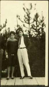
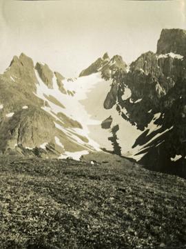
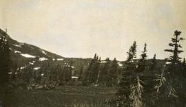
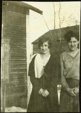
Violet (nee Taylor) Baxter stands in snow beside Bob's sister Bea. Two buildings are semi-visible behind trees in background. See item 2009.5.4.29 for image of Bob and Bea.
Lucy stands next to Violet on far right in group with six other unidentified young girls. Each girl wears a white dress and holds a holly branch. They stand on material laid out in snow in front of unidentified building. Handwritten annotation on recto of photograph: "Violet. Lucy. This is their Holly and Mistletoe Drill".
Handwritten annotation on recto of photograph: "Here they are in Sleeping beauty asleep. Virginia is not all in. She is behind Violet who is King. Father of the beauty. That is the queen in front and the nurse at the head of the bed and the Beauty on the bed." The girls are in costume on material laid out in snow in front of unidentified building. Unknown wood object in left foreground.
Virginia stands in dress pants, jacket, tie and army hat, with arm around older sister Violet. The girls stand on a boardwalk with trees in background. A man standing next to Violet is semi-visible on left.
Photograph depicts a 4 wheeler vintage 'Scale test Car," built in June 1919. Found in the CPR Kamloops yard.
Postcard overview of the Bulkley River running closely past the village of Telkwa. Handwritten annotation in pen on verso reads: "Don Choracy [?] Prince Rupert, B.C. c/o Wrathall's Photo Shop. Aug. 9 Lake Kaetlyn. We had to drive all the way to Telkwa the other nite for postcards, imagine. We were sure glad and surprised to see Jack & Dick drive in at 7 to-nite. Just like being home. We are having so much fun. The boys are out on Lake to-nite, went to visit Dr. Macdonald's me thinks. I have bad head cold so have to stay home first nite at home I've since we came, Dieks is taking me on Lake tomorrow I hope, Love Bea-P."
Photograph depicts a cluster of small buildings situated on the river's shore. There is a background of treed hills. Handwritten annotation below photograph reads, "Indian village of Fishery Bay Naas River".
Photograph depicts two rows of small homes near the shoreline. Handwritten annotation below photograph reads, "Indian Village May 1923".
Photograph depicts a cluster of small homes built near a dock. There is a church spire in the back of the photograph, treed mountains in the background. Handwritten annotation below photograph reads, "Kincoolith Village".
Photograph depicts several buildings bordering the shoreline. Handwritten annotation below photograph reads, "Village - Alert Bay".
Photograph depicts water in foreground, bayside village in background.
Photograph depicts a city view of Yokohama, Japan. Handwritten annotation below photograph reads, "Views in Yokohama Japan December, 1923".
Photograph depicts a garden with large shrubs and tall trees. Handwritten annotation below photograph reads, "Views of Stanley Park"
Photograph depicts a park area with fences, pedestrians, pathways and tall trees. Handwritten annotation reads "View o-Stanley Park".
Photograph depicts a view of a lake and river from a high hill. Treed hills in the background.
Photograph depicts a view of immense rolling, treed hills.
Photograph depicts treed hills in the foreground. Buildings on a field near the river in the midground. Treed hills and a body of water in the background.
Photograph depicts a lake in the foreground, treed hills in the background.
Photograph depicts a view of a lake and river from a high hill. Treed hills in the background.
Photograph depicts view of an alpine meadow, alpine trees and mountains in the background.
Photograph depicts scrub alpine trees with a layer of snow in the foreground and several mountain ranges in the distance.
Photograph depicts a view from a high mountain ridge looking down on forest, river and snowy mountain peaks in the distance.
Photograph depicts an alpine meadow in the foreground, forest, river and mountains in the distance.
Photograph depicts view of an alpine ridge with an alpine meadow in the foreground.
Photograph depicts alpine meadow in the foreground, forest, river and mountains in the distance.
Photograph depicts summit between John Brown and Kitseucla creeks.
Photograph depicts a view from the summit between John Brown and Kitseucla creeks.
Photograph depicts views from the summit between John Brown and Kitseucla creeks.
Photograph depicts a view looking down on the river with Hudson Bay mountain in the background.
Photograph depicts a view from the summit between John Brown and Kitseucla creeks.
Photograph depicts views from the summit between John Brown and Kitseucla creeks, Hudson Bay mountain.
Photograph depicts a view from the summit between John Brown and Kitseucla creeks.
Photograph depicts a few of forest in the foreground, a snowy mountain range in the distance.
Photograph depicts looking down on a snowy mountain ridge.
Photograph depicts looking up a snowy slope to a rocky peak.
Photograph depicts a view from a mountain summit looking across the valley to forested mountain slopes with snowy mountain tops.
Photograph depicts an alpine meadow with a mountain ridge in the background.
Photograph depicts looking across the water of Babine Lake toward low forested hills. [55th parallel]
Photograph depicts two men near their CF-AAM float plane on Thutade Lake in Sand Bay in front of their Consolidated Mining and Smelting Company of Canada Ltd. (CMS) camp site.
Photograph depicts three men sitting in a circle in a clear area near a sparsely forested area in front of a snowy mountain range. The location of the photograph is noted to be at Duck Creek at Copper Mountain; however, those names may no longer be in current use. Location is assumed to be approximately 55.979291, -125.208415 near what is currently named Wasi Peak.
Photograph depicts a wide view of the Omineca River with a man standing on a boat in the right corner of the image. In the background the river a forested shoreline and mountain range are visible.