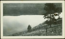
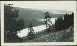
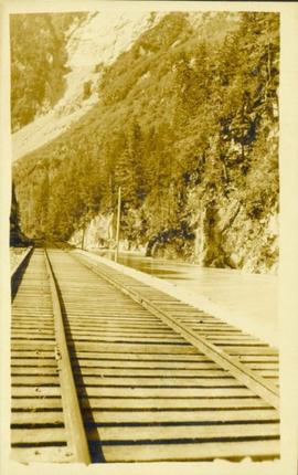
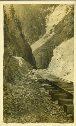
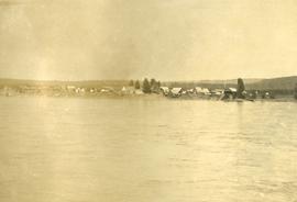
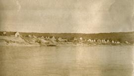
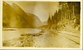
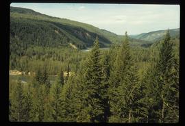
Photograph of a stretch of railroad passing by a small body of water. Mountains are visible in the background.
Photograph depicts railroad tracks along unidentified river or lake. Trees and grass in foreground, opposite shore in background.
Photograph depicts railroad tracks along unidentified river or lake. Trees, grass, and fence in foreground, hills on opposite shore in background.
Photograph is a printed postcard depicting a section of railroad track going through a mountain pass. Possibly near Stewart B.C.
Image depicts a man and woman standing in the mouth of a tunnel from the old Kettle Valley Rail Road.
Image depicts the mouth of a tunnel from the Kettle Valley Rail Road.
Image depicts an unknown figure standing inside a tunnel from the old Kettle Valley Rail Road.
Image depicts a tunnel from the old Kettle Valley Rail Road.
Image depicts a woman standing inside a tunnel from the old Kettle Valley Rail Road.
Image depicts the mouth of a tunnel from the Kettle Valley Rail Road.
Image depicts rail road tracks west of Takla Landing.
Image depicts rail road tracks at an uncertain location.
Image depicts a rail road construct from Highway 97 at Mile 126; the slide is also labelled "McAlister."
Image depicts the forest surrounding Quesnelle Forks.
Image depicts a dirt road and power-lines running through the woods, possibly near Quesnelle Forks.
Image depicts a collapsed wooden structure, possibly a bridge, which is likely located somewhere near Quesnelle Forks.
Image depicts an old building which has collapsed into a pile of wood, possibly in Quesnelle Forks.
Image depicts numerous abandoned and ruined cabins at Quesnelle Forks.
File contains slides depicting Quesnelle Forks, B.C.
Image depicts numerous old and ruined cabins in Quesnelle Forks.
Photograph depicts several buildings lining the river bank at Quesnel BC.
Photograph depicts a view of buildings lining the river bank, a steamship is anchored near shore.
Photograph depicts a long row of buildings bordering a river.
Photograph depicts a long row of buildings bordering a river. A scow is anchored near the river bank.
Image depicts numerous wood piles near the sawmill somewhere in Quesnel, B.C.
Image depicts a sawmill somewhere in Quesnel, B.C.
Image possibly depicts the Fraser River from Highway 97 near Quesnel, B.C.
Image depicts the Fraser River from Highway 97 near Quesnel, B.C.
Image depicts an old, pyramid shaped wooden frame somewhere near Miworth, B.C.
Image depicts the flows from a pulp mill in Prince George, B.C.
Photograph depicts a ptarmigan in the foreground, two men on foot, leading a packhorse across a meadow.
Image depicts the Provincial Government Building located in Stewart, B.C.
Photograph depicts the proposed site for a hydro power project on Klemtu Lake with rock sill outlet to creek.
Series consists of print photographs created or collected by Gary Runka over the course of his personal and professional life. Includes school portraits, sporting event photographs, and work-related group portraits. Also includes aerial photographs of the West Coast Trail.
Photograph of a small vessel on the ocean with a dock and harbour buildings in the foreground. Tents and piles of lumber can be seen among the buildings. Annotation on recto reads: "The Wharf, Prince Rupert, BC. 1657." Printed annotation on verso reads "The Wharf, Prince Rupert, BC J. Howard A. Chapman, Victoria. BC. 1657."
Photograph of the Prince Rupert wharf. A small vessel is docked, and a large tree is in the foreground. Annotation on recto reads: "Prince Rupert Wharf & Harbor[sic]. Allen Photo."
Lofty view of the buildings along the Prince Rupert wharf with workers unloading a vessel. Water and mountains can be seen in the background. Printed annotation on recto reads: "Prince Rupert Wharf."
Street view of Prince Rupert storefronts. A high cliff can be seen in the background with several large houses perched atop it. Printed annotation on recto reads: "Prince Rupert Residences on the Cliff which runs thru the Heart of the City." Handwritten annotation on verso reads: "8-18-24 I am still on the go but heading for home when [illegible] to be by Soft cot. Here seen some great scenery in Canada. Trains by boat to-night for Vancouver. Nan felt better. Love for all Chas[??]." Handwritten address on verso reads: "Mrs. Friderich Eley R [illegible] 3 Santa Ana Calif. U.S.A." Postmark stamped on verso reads: "Prince Rupert BC. 10 PM Aug 18 1924."
Image depicts a view of the port in Prince Rupert, B.C. The slide is labelled "superport."
Wide angle photograph of Prince Rupert sometime during the winter. There is snow on the ground and a marge mountain range is visible in the background. Annotation on recto reads: "Prince Rupert looking East from Waterworks J.D.A Pho 5/2."
Side view of the Prince Rupert in on Prince Rupert Road. Printed annotation on recto reads: "Prince Rupert Road, showing Prince Rupert Inn."
Photograph depicts a view from the water looking into Prince Rupert harbor.