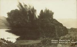
Photograph of a large explosion on a rocky shoreline. A bridge is visible in the foreground and a body of water is partially visible in the background. Printed annotation on recto reads: "McRae Bros Moving Mountains at Prince Rupert BC Apr 24th" Handwritten annotation on verso reads: "Rupert. July 17 1913. Dear [illegible]. Just a card for that album if you've got any room left by now. This is one of the blasts for the clearing of the drydock up here. [Illegible] W.M." Postcard is addressed to: "Miss C.M. Ranip[??] 931 Northlane Av.[sic] Seattle Wash." Two Canadian one cent stamps are affixed on verso. Postmark reads: "Prince Rupert BC. PM Jul 17 13."
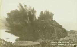
Photograph of a large explosion on a rocky shoreline. A bridge is visible in the foreground and a body of water is partially visible in the background. Annotation on recto reads: "McRae Bros Moving Mountains at Prince Rupert BC Apr 24th"
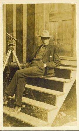
Photograph of a happy man reclining on a short exterior staircase. A surveyor's transit can be seen in the background.
Photograph depicts Mount Begbie, noted by Wyness to be the highest point on the Cariboo Highway at mile 85. Mount Begbie is located at approximately 51°28'33''N, 121°22'00''W, on the east side of Cariboo Hwy, between 70 Mile House and 100 Mile House, in the Lillooet Land District. Also visible in this photograph is the Cariboo Highway road.
Photograph depicts Mount Begbie, noted by Wyness to be the highest point on the Cariboo Highway at mile 85. Mount Begbie is located at approximately 51°28'33''N, 121°22'00''W, on the east side of Cariboo Hwy, between 70 Mile House and 100 Mile House, in the Lillooet Land District. Also visible in this photograph is the Cariboo Highway road.
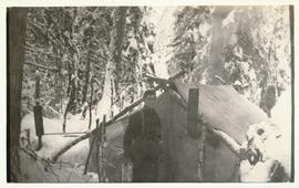
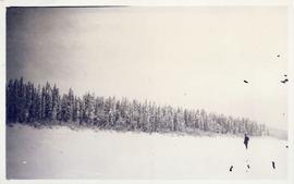
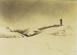
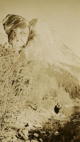
Photograph depicts one unidentified man surveying a landscape from a snowy mountain peak with other mountain ranges in the background.
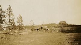
Photograph depicts a view of Lone Butte, BC. The butte formation of the same name (Lone Butte) is visible in the background; a ranch or residence is visible in the foreground. Wyness notes that Lone Butte was the "last one [they] tied in". "Tying in" is a land surveying technique. Since the photograph is dated October 1936 and Wyness described the survey trip as lasting June 5 - October 8, 1936, that implies that Lone Butte was the last location they surveyed on this trip.
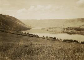
Photograph depicts Lake Chelan in Washington state.
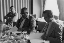
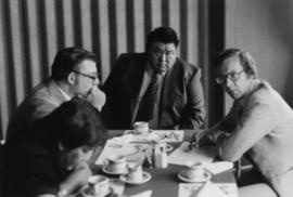
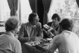
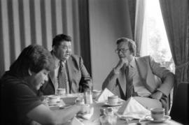
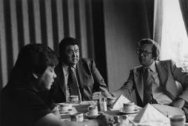
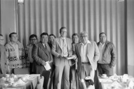
Two Kitamaat Band Council members sitting at a table during the Kitamaat Band North Coast District Council meeting and land claim presentation. A third man is sitting in the background with crossed arms.
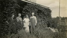
Photograph depicts (from left to right) Jack Lee, Philip Monckton, Jessie McInnes, and Archie McInnes at Pioneer Ranch.
In 1903, brothers Neil and Archie McInnes pre-empted a section of land two miles east of Cote Flat, each taking half. Archie McInnes' land later became known as Pioneer Ranch (later known as the Barnett Ranch); Neil McInnes' land became Meadowbrook Ranch. Archie McInnes married Jessie Aitken in October 1905. Pioneer Ranch became known as a stop-over for travellers en route from Hazelton to the Ootsa Lake area via the Telegraph Trail. Archie and Jessie McInnes had three daughters: Vera (m. Ivan Frank), Ivy (m. Eric Strimbold), and Neva (m. John Ivan Nickolichuk).
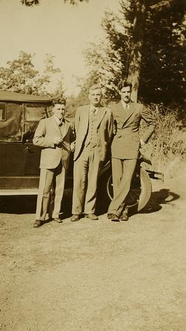
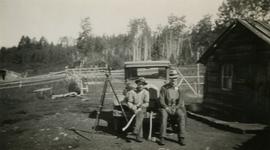
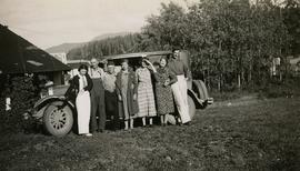
Photograph depicts (from left to right) Jack Lee, Philip Monckton, and Gordon Wyness by car at Monckton's residence.
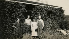
Photograph depicts (from left to right) Jack Lee, Gordon Wyness, Jessie McInnes, and Archie McInnes at Pioneer Ranch.
In 1903, brothers Neil and Archie McInnes pre-empted a section of land two miles east of Cote Flat, each taking half. Archie McInnes' land later became known as Pioneer Ranch (later known as the Barnett Ranch); Neil McInnes' land became Meadowbrook Ranch. Archie McInnes married Jessie Aitken in October 1905. Pioneer Ranch became known as a stop-over for travellers en route from Hazelton to the Ootsa Lake area via the Telegraph Trail. Archie and Jessie McInnes had three daughters: Vera (m. Ivan Frank), Ivy (m. Eric Strimbold), and Neva (m. John Ivan Nickolichuk).
Photograph depicts (from left to right) Jack Lee, Gordon Wyness, and Lavender Monckton sitting on their 1930 Buick Series 40 car in front of their temporary cabin lodgings in Prince George. This photograph was taken before the group left Prince George to head to 6 Mile Lake or Tabor Lake.
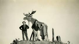
Photograph depicts (from left to right) Jack Lee, Gordon Wyness, and Lavender Monckton standing in front of a wooden moose. The wooden moose was located on top of a hill to the east of Prince George. The wooden moose was an advertisement for John A. Lestin's taxidermy business on Third Avenue in Prince George.
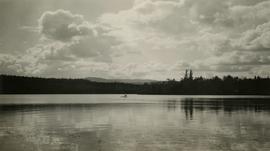
Photograph depicts Jack Lee rafting with a sail on Bobtail Lake, as he was going over to other side of the lake to locate traverse posts (without success, according to the annotation on the photograph verso).
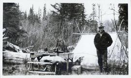
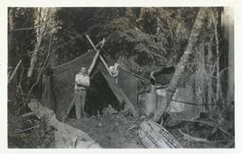
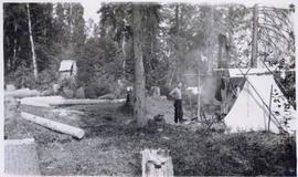
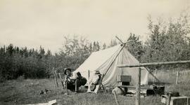
Photograph depicts Jack Lee with gear in front of a tent at Bobtail [Lake?] campsite after returning from Bobtail Mountain where the crew had camped overnight without a tent.
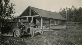
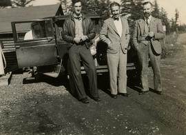
Photograph depicts (from left) Jack Lee and Philip Monckton leaning up against their 1930 Buick Series 40 car before leaving for Southbank Francois Lake. Behind them is the cabin they stayed in at Burns Lake, which was owned by Ben[?] Smith.
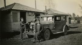
Photograph depicts (from left) Jack Lee and Gordon Wyness sitting on a car next to their equipment while surveying at an Indian Reserve. A cabin on the reserve is also depicted. According to the transcription on the photograph verso, they were surveying road through an "Indian Reserve South of South bank François Lake".
Photograph depicts Jack Lee (front) and Gordon Wyness drinking lakeside in Marble Canyon. The survey crew had been travelling along Marble Canyon Road, which is now Highway 99. The lakes in Marble Canyon are now named Turquoise Lake, Crown Lake, and Pavilion Lake. Wyness notes the blueness of these lakes and the white mountains of this area.
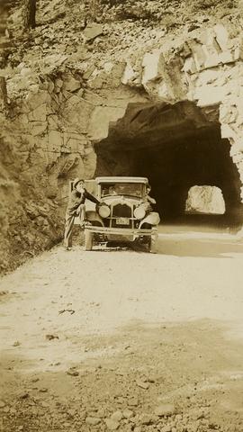
Photograph depicts Jack Lee and the survey crew's 1930 Buick Series 40 car below the Boston Bar tunnel on their return trip.
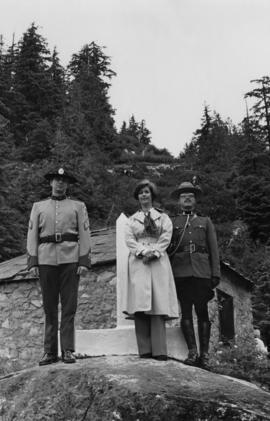
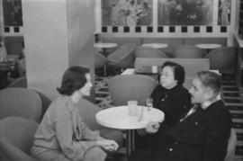
Photograph depicts MP Iona Campagnolo, a RCMP officer, and a customs officer standing in front of a boundary marker at the Canadian-American border between Hyder and Stewart.
Iona Campagnolo sitting and speaking with Mr. and Mrs. Solomon Doolan in Kincolith during the North Coast Council meeting and land claim presentation with the Kitimaat Band Council.
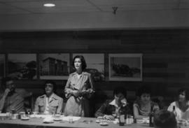
Minister Iona Campagnolo speaking at the North Coast District Council, three unidentified men and two unidentified women seated around her. Handwritten annotation on verso reads: “North Coast District Council”.
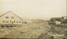
Several large buildings on a rocky shore. Wood piles and a crane are visible in the background. Annotation on recto reads: "Prince Rupert BC"
Hugh Faulkner, Kitamaat Band Council members, and an unknown man sitting at a table talking during the Kitamaat Band North Coast District Council meeting and land claim presentation.
Hugh Faulkner is sitting at a table and speaking into a recording device that is held by two men. A third man is sitting with his back to the camera.
Hugh Faulkner and Kitamaat Band Council members sitting at a table talking during the Kitamaat Band North Coast District Council meeting and land claim presentation.
Hugh Faulkner and Kitamaat Band Council members sitting at a table talking during the Kitamaat Band North Coast District Council meeting and land claim presentation.
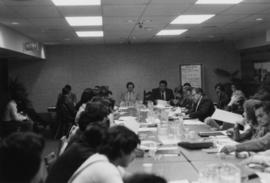
Many people are seated around a meeting table. Hugh Faulkner is at the head of the table, seated beside a flip chart with the word "Agenda" written at the top.
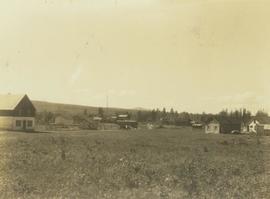
Photograph depicts the townsite of Hudson's Hope featuring a number of small wooden buildings clustered in a field. The Hudson's Bay post is building visible on far left.
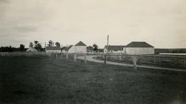
Photograph depicts the Hudson Bay buildings at Fort St. James.
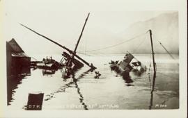
Photograph of a partially sunken sailboat near a harbour. Individuals on debris and in a rowboat are surveying the damage. Annotation on recto reads: "GTP. SS Prince Rupert Sept 28th 1920 McRae." Handwritten annotation on verso reads "CTP "Prince Rupert" Sunk at Prince Rupert BC 1920."
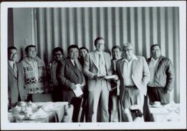
The group stands against wall, banquet tables in foreground.
Handwritten annotation on verso reads: “Minister DINA Hugh Faulkner + Kitamaat Band Council for Land Claim presentation”.
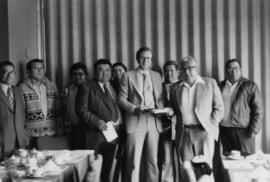
Group shot of Hugh Faulkner and the Kitimaat Band Council at a land claims presentation during the North Coast District Council meeting. Eight council members are pictured.
The group stands against wall, banquet tables in foreground.
Handwritten annotation on verso reads: "Minister DINA Hugh Faulkner + Kitamaat Band Council for Land Claim presentation".
Photograph depicts a group of people leaning up against the survey crew's Buick car in Francois Lake. Based on the transcription on the photograph verso, from left to right the individuals are: "Mrs. Hunter", "Bobby", Jack Lee, "Edna", "Verna", "Banker's wife", and Gordon Wyness.
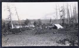
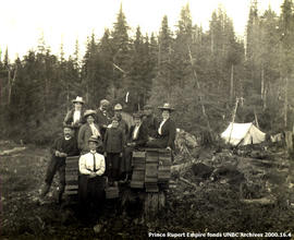
Item is a copy print of a photograph of a group of people in a cleared area with a small tent in the background in Prince Rupert on June 1, 1906. The people in the photograph are identified as: Mrs. J.L. Williams, Jack or Jock Williams, Mrs. Porter, Miss Mai Johnston, Mrs. R.L. McIntosh, J.H. Pillsbury, Mr. Pinder ? (Engineer), Captain Jenner ?, Mrs. S.G. Harris, and Cannon Rushbrook.
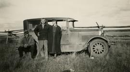
Photograph depicts (from left to right) Gordon Wyness, Philip Monckton, and Lavender Monckton by their 1930 Buick Series 40 car in the Williams Lake area. In this image, the car may be broken down; Wyness noted that they "were forced to spend the nite in a school house due to condenser burning out in the car". Wyness also noted that they had "just finished tying in Fraser Mtn", suggesting that they had just completed survey work in the Fraser Mountain area.
Photograph depicts (from left to right) Gordon Wyness, Louis LeBourdais, and Earl Malcolm (owner of Quesnel Hotel) standing in front of a 1930 Buick Series 40 car at Twilight Lodge in Lac La Hache, BC. The group was preparing to leave for Prince George.
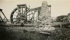
Photograph depicts Gordon Wyness sitting on a historic boat, which he described as built ca. 1860 and could carry "7 Indians" and 5000 lbs of freight up the river. Located nearby is a telegraph cairn erected to commemorate the Collins Overland Telegraph lines that began in Quesnel in 1865. Until 1907, Quesnel was the terminus for the telegraph line. Behind Wyness is a replica of a Cornish water wheel that was originally located at Williams Creek in Barkerville. This location is now called Ceal Tingley Memorial Park-Heritage Corner and is located along Front Street in Quesnel, near the Fraser River Bridge. The cairn and water wheel still stand in this location, however the boat was removed around 1941.
According to additional information from Quesnel & District Museum & Archives, Wyness may have been provided with inaccurate information about the canoe depicted. The canoe believed to have been located at that spot was actually created in 1905 to pack out the Grand Trunk Preliminary Survey Team, which was led by J.M. Rolston.
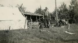
Photograph depicts Gordon Wyness at the Bobtail campsite after having just returned from a night of camping without a tent on Bobtail Mountain. Wyness noted (on photograph verso) that there were pack rats in the telegraph cabin in the background of this photograph.
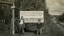
Photograph depicts (from left to right) Gordon Wyness and Jack Lee in front of the Fort St. James sign, which reads "First white settlement in British Columbia. Established by the North West Company in 1806 by Simon Fraser and John Stuart and taken over by the Hudson's Bay Company in 1821. - General Merchandise Visitors Welcome".
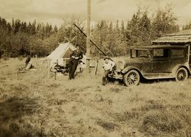
Photograph depicts (from left to right) Gordon Wyness and Jack Lee at a camp scene "at Bobtail" (possibly Bobtail Lake) near Vanderhoof. As noted in the album caption, the crew had "just returned from Vanderhoof". The telegraph cabin roof and their 1930 Buick Series 40 car is visible at right.
