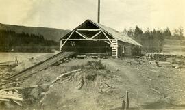
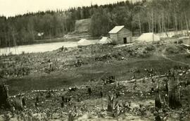
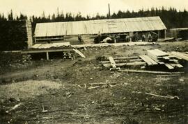
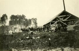
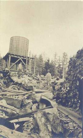
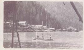
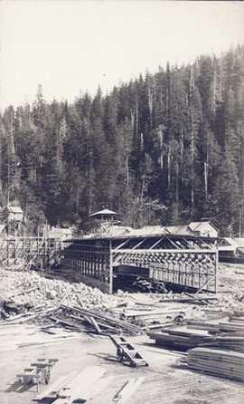
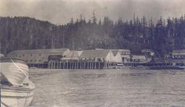
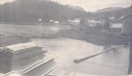
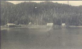
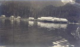
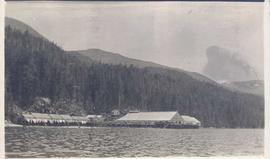
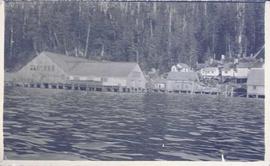
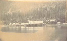
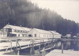
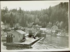
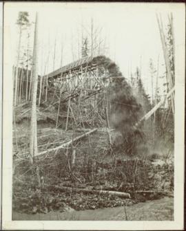
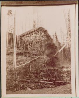
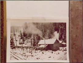
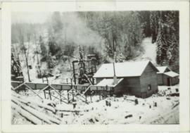
Typed caption glued to album page directly below photograph reads: "79. Lumber yard at Fort Fraser." Photograph depicts lumber yard and sawmill. Photographer: Dominion Stock & Bond Corporation.
Typed caption glued to album page directly below photograph reads: "71. Sawmill." Photograph depicts a rustic sawmill, lumber stacked outside, and a ramp leading from the sawmill to the water's edge where floating logs await. Photographer: Dominion Stock & Bond Corporation.
Typed caption glued to album page directly below photograph reads: "41. Looking South from Block 171 Nechac[k]o River at a distance & logging operations south of Fort Fraser." Photograph depicts a cleared section of land in foreground and a wooden building and three tents situated beside the Nechako River in midground. Photographer: Dominion Stock & Bond Corporation.
Typed caption glued to album page directly below photograph reads: "27. Fort Fraser Sawmill." Photograph depicts men standing outside the Fort Fraser Sawmill. Photographer: Dominion Stock & Bond Corporation.
Typed caption glued to album page directly below photograph reads: "50. Sawmill at Fort Fraser." Photograph depicts a group photo of men and work horses standing outside the Fort Fraser Sawmill. Photographer: Dominion Stock & Bond Corporation.
This West Fraser Timber Company Ltd. 50th anniversary video covers the history of the company through interviews, narration, and historical images.
The map depicts where minerals can be found and also includes railways, highways, and roadways for easy access to desired minerals.
The map depicts the distribution locations and transportation routes for the processing of mineral and petroleum in British Columbia.
The map depicts mineral deposits in Northern British Columbia.
The item is a CD-R containing Kent Sedgewick's files regarding the Upper Fraser Valley history. Files include literature summaries, oral history transcripts and various other documents referring to the Upper Fraser Valley. Annotations on CD-R state, "Jun 7 '04 Kent - UF files to start."
Image depicts numerous wood piles near the sawmill somewhere in Quesnel, B.C.
Image depicts a sawmill somewhere in Quesnel, B.C.
Plan depicts Granville Island industrial sites in False Creek, Vancouver. Shows revised trackage from 1955 annotated in colour by Davies.
Photograph depicts a man in a fishing boat in front of a line of fishing boats being towed by a tug boat on the water with the base of a mountain in the background.
Photograph depicts a cannery in front of a forested mountains with water in the foreground.
Photograph depicts a line of cannery fishing boats being towed across the water with the base of a mountain in the background.
Photograph depicts a tug boat hauling a line of small fishing boats across the water with a mountain in the background. Annotation on verso of photograph states: "Tow of Cannery Fishing boats"
Photograph depicts several fishing boats on the water with a wooden dock in the foreground to the left of the image.
Photograph depicts two men seated in front of a row of hanging fish.
Photograph depicts three men standing behind salmon hung to dry on a wooden deck. Annotation on recto of photograph states: ""Spring Salmon" Rivers Inlet, B.C"
Photograph depicts a two men standing on piles of whale bones at a whaling station. Annotation on verso of photograph states: "Pile of whale bones, Whaling station, Vancouver Is."
Photograph depicts three men at a whaling station with debris on the ground and a large elevated tank in the background.
Photograph depicts three men fishing in a boat with a cannery and wooden buildings along the forested shoreline in the background.
Photograph depicts a building under construction with wood planks on the dock in the foreground and a forested area in the background.
Photograph depicts a cannery on wood pilings with several other buildings along a forested shoreline with a body of water and boat in the foreground.
Photograph depicts wood planks piled on a dock with wood buildings built along the shoreline of the background.
Photograph depicts cannery buildings on wooden pilings with a body of water in the foreground and a forested area in the background.
Photograph depicts a view of cannery buildings from the shoreline with mountains in the background.
Photograph depicts cannery buildings on pilings with a body of water in the foreground and a deforested area behind the shoreline.
Photograph depicts a distance perspective of several cannery buildings with a body of water in the foreground and a mountain range in the background.
Photograph depicts several cannery buildings on pilings with water in the foreground and a forested area in the background.
Photograph depicts cannery buildings on pilings with a body of water in the foreground and tree covered mountains in the background.
Photograph depicts a cannery on pilings with a body of water in the foreground and houses and trees in the background.
Photograph depicts a cannery on pilings with a body of water in the foreground with a forested area in the background.
Photograph depicts a cannery on pilings over the water with other cannery buildings in the background.
Photograph depicts a man standing on the deck of a sailboat with a view of a cannery along the shoreline of Ocean Falls with mountains in the background.
Photograph depicts piles of wood planks and log booms in the foreground with a waterfall in the background.
Photograph depicts several log booms on the water with a forested area in the foreground.
Photograph depicts a two men on small fishing boat, called a gillnetter, moored at a fish packer dock with six men at work. One man is transferring materials from crates into large bags while several others watch. Handwritten annotation in pen on verso reads: “Fish Packer”
Photograph depicts a wharf and buildings along the shore of an unidentified fishing community with a forested environment visible in the background.
Photograph depicts families at Dedrickson’s Camp at Drury Inlet standing on a wharf on baptism day.
Photograph depicts an unidentified man holding the lever of a piece of wharf machinery on a dock.
Photograph depicts two unidentified men fishing in a boat in front of Namu Cannery with a forested mountain visible in the background.
Photograph depicts a wooden flume funneling water in a forested area. Photo is adhered to paper backing. Original annotations on verso of photo are covered by paper mounting. Typed annotation on recto of paper reads: “First wash for gold by Hixon Creek Cariboo Gold Co. Across Hixon from Quesnel Quartz up the hill. North side of creek 1930’s”
Photograph depicts a wooden flume funneling water in a forested area. Photo is adhered to paper backing, upon which handwritten annotation on recto reads: “First wash for gold by Hixon Creek Cariboo Gold Co. Across Hixon from Quesnel Quartz up the hill. North side of creek 1930’s”
Photograph depicts a dam and spillway obstructing a creek. Photo is adhered to paper backing, upon which handwritten annotation on recto reads: “This is the dam and spillway about nine miles up Hixon Creek belonging to the Hixon Creek Cariboo Gold Co., whose main camp on Hixon Creek was at the falls. A fellow Sterling or Bill Tordiffe & I took a contract to cut the logs for this dam in January 1934. The first few winters Quart [sic] Quesnel Quartz had to shut down for snow”
Photograph depicts two wooden buildings in a snow covered forest environment. Photo is adhered to paper backing, upon which handwritten annotation on recto reads: “Quesnelle Quartz mining Company Hixon, B.C. Taken in mid nineteen thirties. Powerhouse from rear. Present day (1973) logging road would run through powerhouse at immediate rear of it at which you are looking. Tom Marsh Box 156 Squamish BC V0N 3G0 December 1978”
Photograph depicts two wooden buildings in a snow covered forest environment. Photo is adhered to paper backing, upon which handwritten annotation on recto reads: “Quesnelle Quartz Mining Co. Hixon BCTaken in mid 1930ies. Power house from rear. Present day (1973) Logging road would run through powerhouse at immediate rear of it at which you are looking. Tom Marsh Box 150 Squamish BC 1978.12”