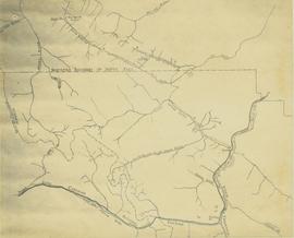
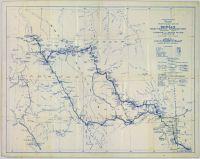
Flight index for 68 aerial photographs accompanying item. Map depicts Clinton Creek area, identifying airfield and mine. Cartographic legend: "CASSIAR ASBESTOS CORP LTD" "FLIGHT INDEX" "DATE OF PHOTOGRAPHY MAY 1965" "SCALE OF PHOTOGRAPHY 1" = 900 APPROX." "McELHANNEY ASSOCIATES VANCOVER B.C." "JOB No C189/6524".
The topographic map shows mine and campsite holdings within the proposed mine site. Asbestos deposits, the tramline and water bodies, such as Troutline Creek, are also included.
Annotations include certain lot titles being crossed out as well as as indication of missing survey information.
This map depicts a drawn bench plan for the estimated excavated waste for bench 6440 during the first quarter of 1972. Annotated details include the approximate excavated ore tonnages, broken and planned values for the first quarter and revised calculations from previous years values. Planned excavated areas are drawn with different colors.
This map depicts the pit layout and estimated waste extraction areas for 6380 bench. Extraction dates accompanied by its total tonnages are located within each planned area. Certain extraction dates are labeled with bench numbers. Annotated details include extraction dates, approximate total tonnages per area as well as extraction dates, total planned and broken tonnages, total tonnages from December 31, 1970 from a survey done in September 1, numerical bench markers as well as a rough colored legend depicting extraction month by color. The hand drawn plan consists of solid lines drawn with green, yellow, red and lead pencils.
This map depicts the pit layout and estimated waste extraction areas for 6410 bench. Extraction dates accompanied by its total tonnages are located within each planned area. Certain extraction dates are labeled with bench numbers. Annotated details include extraction dates, approximate total tonnages per area as well as extraction dates, total planned and broken tonnages, total tonnages from December 31, 1970 and numerical bench markers. The hand drawn plan consists of solid lines drawn with green, yellow, orange and lead pencils.
This map depicts the pit layout and estimated waste extraction areas for 6320 bench. Extraction dates accompanied by its total tonnages are located within each planned area. Certain extraction dates are labeled with bench numbers. Annotated details include extraction dates, approximate total tonnages per area accompanied by extraction dates, total planned tonnages, total tonnages from December 31, 1971 as well as a rough colored legend depicting extraction month by color. The hand drawn plan consists of solid lines drawn with green, red, orange and lead pencils.
This map depicts the ore type and geology that can be found among each of the bench layers. Classifications and grades of ore are included within it. Different bench layers are included in the map. Annotations include a title in the back of the map written out as "1972 BENCH PLANS".
This map depicts the generalized pit layout and estimated waste extraction areas for benches 5840 and 5870. Annotated details include numerical bench markers as well as extraction dates. The hand drawn plan consists of solid and dotted lines drawn with green and red pencil.
This map depicts the generalized pit layout and estimated waste extraction areas for 5810 bench. Annotated details include numerical bench markers, extraction dates and approximate ore extraction amounts. The hand drawn plan consists of solid and dotted lines drawn with green, orange and lead pencil.
This map depicts the generalized pit layout and estimated waste extraction areas for 6290 bench for the month of November. Annotated details include numerical bench markers and waste extraction dates. The hand drawn plan consists of solid and dotted lines drawn with green, orange, red, blue and lead pencil.
This map depicts the generalized pit layout and estimated waste extraction areas for 6290 bench for the month of October and November. Extraction dates as well as total unbroken tonnages are included within certain portions of the plan. Annotated details include numerical bench markers, extraction dates, total tonnages to be extracted and approximate waste tonnage calculations for October. The hand drawn plan consists of solid and broken lines drawn with red, green, orange and lead pencils as well as black ink.
This map depicts the pit layout and estimated waste extraction areas for 6320 bench for the end of September to October. Extraction dates are included within certain portions of the plan. Annotated details include numerical bench markers, extraction dates, and approximate waste tonnage calculation for October. The hand drawn plan consists of solid and broken lines drawn with red, orange and lead pencils as well as black ink.
This map depicts the pit layout and estimated waste extraction areas for 5840 bench for the end of September to November. Extraction dates, approximate extraction tonnages and ore, waste and talus locations are included throughout the plan. Annotated details include numerical bench markers, extraction dates, approximate total tonnages as well as waste and ore tonnage calculations for October. The hand drawn plan consists of solid and broken lines drawn with red, blue, orange and lead pencils as well as black ink.
This map depicts the pit layout and estimated waste extraction areas for 5870 bench for the end of August to November. Extraction dates, approximate extraction tonnages and ore, waste and talus locations are included throughout the plan. Annotated details include numerical bench markers, extraction dates, approximate extraction tonnages, ore, waste and talus locations as well as waste, ore, talus and total tonnage calculations for October. The hand drawn plan consists of solid and broken lines drawn with red, blue, orange and lead pencils as well as black ink.
This map depicts the pit layout and estimated waste extraction areas for 6350 bench. Extraction dates accompanied by its total tonnages are located within each planned area. Annotated details include extraction dates, approximate total tonnages per area as well as extraction dates, total planned and broken tonnages and total tonnages from December 31, 1970 from a survey done in September 30. The hand drawn plan consists of solid lines drawn with red, green and orange colored pencils.
Map depicts the rivers, railways, and select lakes and towns located at Jasper Park between the northern boundary of the park and the townsite of Jasper. Part of the border between Alberta and British Columbia is visible on the west of the map.
This Slocan Group forestry development plan highlights contributing obstacles to the development like the Pine Beetle infestation.
Map depicts central British Columbia including Prince George, Queen Charlotte Island, Prince of Wales Island, Prince Rupert, and describes what these areas are known for.
Map depicts the climactic regions of British Columbia which includes the coast, interior, and the northwest.
The map depicts multiple real-estate listings by Multiple Listing Service (MLS) Prince George members.
The map depicts the town of Kitimat and on the other side of the map there is an advertisement for Northland Shipping.
This photocopy of a 1911 pre-emptor's map depicts land parcels in the vicinity of the Fraser River, Salmon River, and Willow River in the Fort George and Peace River areas.
The map depicts the biotic regions and forests in British Columbia.
The map depicts the highest mountains in British Columbia; includes the Rocky Mountains, the Northern and Southern Plateaus, and the Mackenzie Mountain area.
The map is split into four time periods of colonial exploration. The map depicts pre-colonial, post-colonial, traditional, and colonial expansion.
The map of Canada is part of a greater booklet on Canadian history. This booklet was intended to help those preparing for their Canadian citizenship interview.
The map is part of an advertising pamphlet that depicts the Yellowhead Highway 16. The map highlights towns and tourist attractions along Highway 16 like Hazelton, Kitimat, Vanderhoof, Fraser Lake, Burns Lake, Fort St. James, Prince George, Terrace, and Smithers.
This 1967 centennial map depicts Canadian achievements from 1867 to 1967. The map includes over 73 moments, events, and people that have shaped Canada in the last one hundred years.
This map depicts where to find ghost towns, forts, First Nation villages, and sites with supposed hidden treasures in British Columbia.
The map is taken from the supplement of the Omineca Express/Bugle Caledonia Courier newspaper. The area map depicts highways, secondary roads, lakes, and gravel roads near Fort St. James, Stuart Lake, Fraser Lake, Fort Fraser, and Vanderhoof.
The map depicts where minerals can be found and also includes railways, highways, and roadways for easy access to desired minerals.
The map depicts the distribution locations and transportation routes for the processing of mineral and petroleum in British Columbia.
The map depicts mineral deposits in Northern British Columbia.
Pennock, W.B. RIVER CROSSING EXERCISE. Prince George, B.C. 2 SEP 43. Presented to Major-General H.N. Ganong G.O.C. 8 CDN. DIV. by Lt-Col. W.B. Pennock C.R.C.E. 8 CDN. DIV. 1943. Oblong 4to. 24pp of text, color maps, one showing the proposed crossing of Nechako River. 20 b/w snapshot photos, mounted with corners, each with captions + Appendix A, B and C of facts and figures. A large folding contemporary map of Vernon is laid in, with one of the training zones (?) highlighted on the map in a red square box. Fabricoid spine and corners.
The original typescript for a (presumably confidential and secret) document listing the preparations for defensive manoeuvres in the event of war with Japan taking place in Northern British Columbia. This document describes a simulation of what events and defences could take place, including how to conduct river crossings; when in the war game, the author imagines what would happen should the Japanese invade Prince Rupert as a starting point for the invasion of Canada.
An important document providing insight into the thinking of the Canadian military while preparing for the possibility of Japan extending its war into the North Pacific Theatre during World War II.
Item consists of the Kohklux map originally created by Chief Chilkaht Kohklux of Tlingit in 1852. This is one of the earliest known maps of the southern Yukon. Map originally inserted into a book about the map.
Map issued as part of the Canadian Pulp and Paper Industry magazine. Depicts locations of all pulp and paper mills in Canada in 1975 and provides a listing of company names.
Zimmerman, AdamHand annotated map depicts the proposed location of the Northwood Pulp Ltd. Beaver Bridge over the Fraser River near Prince George.
Map is a "Recreation and Logging Road Guide to the Forest Lands of Vancouver Island Alberni Valley and the Surrounding Area" created for the public.
Map is a "Recreation and Logging Road Guide to the Forest Lands of Vancouver Island Alberni Valley and the Surrounding Area" created for the public. Backside states "Welcome to TFL 44", along with promotional imagery and information for backcountry travelers.
Item is a preliminary plan showing traveled route of the Bedaux Sub-Arctic Expedition in 1934.
Reproduced map on mylar depicts the Aleza Lake timber reserve near Aleza Lake, BC.
Reproduced map on mylar depicts locations of elevations and benchmarks at the Aleza Lake forest.
Reproduced map on mylar depicts a proposed railway spur for the Aleza Lake Forest Experiment Station.
Original forest cover map shows timber history in the area of Giscome, BC.
Map is a photocopy reproduction of the "Aleza Lake Experiment Forest" map that was included in the appendix to the 1957 Aleza working plan.
Map is a photocopy reproduction of the Aleza Lake Experiment Forest development map that was included in the appendix to the 1957 Aleza working plan.
Map is a photocopy reproduction of the Aleza Lake Experiment Forest permanent plot map that was included in the appendix to the 1957 Aleza working plan.
Map is a photocopy reproduction of the Aleza Lake Experiment Forest working circle timber sale map that was included in the appendix to the 1957 Aleza working plan.
Map is a photocopy reproduction of the Aleza Lake Experiment Forest map that was included in the appendix to the 1957 Aleza working plan.


