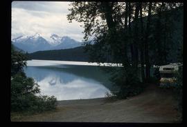
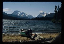
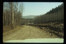
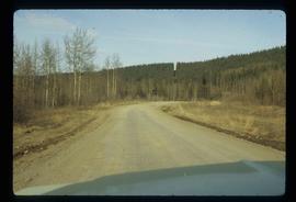
Image depicts a road somewhere in Tumbler Ridge, B.C. There are three bush planes in the image.
Image depicts a road somewhere in Tumbler Ridge, B.C.
Image depicts what appears to be a type of log bridge crossing a river somewhere on Haida Gwaii.
Image depicts a river in South Tweedsmuir Provincial Park. There is an unknown individual present in a canoe with the camera-man.
Photograph depicts a rainbow over a large body of water.
Image depicts a mountain peak, possibly Mt. Robson.
Image depicts a mountain, possibly Mt. Robson.
Photograph depicts a man standing in front of a wood shed beside a tent in a snow covered landscape.
Photograph depicts an unidentified man putting a weather balloon into flight aboard a weather ship.
Image depicts a man on the hiking trail near Mt. Robson, with a river in the background; it is possibly the Robson River.
Photograph depicts a large white dome structure aboard a weather ship.
Image depicts an elevated view of a lake and a road located somewhere near Bralorne, B.C.
Image depicts what is possibly Melita Lake. The mountain in the background is possibly Tseax Cone, the volcano responsible for the existence of the Tseax lava flow.
Image depicts a lake somewhere near Mt. Robson; it is possibly Kinney Lake.
Image depicts a lake in South Tweedsmuir Provincial Park.
Image depicts a lake in South Tweedsmuir Provincial Park. There is an unknown individual present in a canoe with the camera-man.
Image depicts a lake in South Tweedsmuir Provincial Park.
Image depicts a lake in South Tweedsmuir Provincial Park. There is an unknown individual present in a canoe with the camera-man.
Image depicts an aerial view of a lake in South Tweedsmuir Provincial Park.
Image depicts a lake in South Tweedsmuir Provincial Park. There is a canoe present on the shore.
Image depicts a lake in South Tweedsmuir Provincial Park.
Image depicts a lake in South Tweedsmuir Provincial Park. An unknown individual is walking along the shore.
Image depicts a lake at an uncertain location.
Image depicts three people standing at the front door of a house at an uncertain location.
Image depicts a hotel in what appears to be a small community, possibly an outlying area of Bralorne, B.C.
Image depicts a horse near a camper somewhere in Quesnelle Forks, B.C.
Image depicts a horse on Cottonwood Island.
Image depicts a stretch of highway, possibly Highway 29 or 97.
Image depicts what appears to be a ferry crossing a river at an uncertain location.
Photograph depicts a distant river running through a forested valley. Location is perhaps in the Moberly area.
Image depicts a creek somewhere near Bralorne, B.C.
Image depicts a cow at an uncertain location.
Photograph depicts a man standing on the deck of a sailboat with a view of a cannery along the shoreline of Ocean Falls with mountains in the background.
Photograph depicts a cannery in front of a forested mountains with water in the foreground.
Photograph depicts a cannery on pilings with a body of water in the foreground and houses and trees in the background.
Image depicts a camper and a man and woman at an uncertain location, possibly somewhere near Meldrum Creek, B.C. The woman in the image is Sue Sedgwick.
Photograph depicts a building on a rocky shore with water in the foreground.
Photograph depicts a wooden building on a rocky shoreline with a forested area in the background.
Photograph depicts a wooden bridge and pathway leading through a forest.
Image depicts a bear, possibly a grizzly. The location is uncertain.
Photograph shows two men and a cart full of lumber at a street intersection. Various residential buildings are visible in the background and atop a large clear cut hill. Annotation on recto reads: "3rd, 4th Aves and Fullton St. Prince Rupert. BC. Allen Photo 8/Aug/09."
Item is a BC Ministry of Environment and Parks report entitled "1987 Coastal Skeena Moose Survey".
Photograph depicts flowing water believed to be Troutline Creek which ran south of Cassiar, B.C. Tailings pile and plant buildings visible behind forest in midground, northern mountain range in background. Handwritten annotation on verso of photograph: "Cassiar June 15 71".