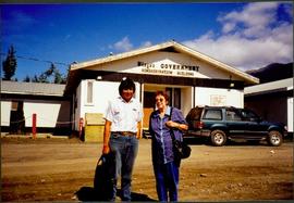
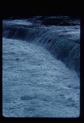
Photograph depicts Moran seated to right of woman on bench in foreground. Waterfall area at Moricetown Canyon can be seen below, behind booth labeled "MONITER BOOTH". Highway and houses visible on opposite shore in background.
Photograph depicts Bridget Moran standing beside unidentified man in front of white building with the sign "Nisga'a Government Administration building". Suburban parked in front of building, trees and mountains visible in background.
Photograph of a group of male trappers posing in front of a log cabin. Printed annotation on recto reads: "Moonlight Cabin Enroute to Naas #90."
Photograph depicts colour-coded model of mine in display case. Legend partially legible in image: "TALUS / VOLCANICS / WASTE SERPENTINE / AAA ORE / AA ORE". Handwritten annotation on recto of photograph: "Cassiar B.C. June 1970 by Tom Kiefer".
Photograph depicts large square model of the new mill building that was built at the Cassiar plant site in 1970. Model is displayed on green material set on a platform in snowy area. Machinery modeled inside the structure is colour-coded. Mountain in background.
Photograph depicts large square model of the new mill building that was built at the Cassiar plant site in 1970. Model is displayed outdoors on a platform that stands on four saw horses. Machinery modeled inside the structure is colour-coded. Plant buildings and mountains in background.
Photograph depicts large square model of the new mill building that was built at the Cassiar plant site in 1970. Model is displayed on green material set on a platform in snowy area. Machinery modeled inside the structure is colour-coded. Mountain in background.
Image depicts a delta at Moberly Lake north of Chetwynd and south of Hudson's Hope, B.C.
Image depicts an obstructed view of Moberly Lake, located north of Chetwynd and south of Hudson's Hope, B.C.
Image depicts the remains of the old Miworth Ferry, somewhere near Miworth, B.C.
Image depicts two unknown individuals and the remains of the old Miworth Ferry, somewhere near Miworth, B.C.
Image depicts four unknown individuals and the remains of the old Miworth Ferry, somewhere near Miworth, B.C.
Image depicts the remains of the old Miworth Ferry, somewhere near Miworth, B.C.
Image depicts four unknown individuals and the remains of the old Miworth Ferry, somewhere near Miworth, B.C.
Image depicts the Mist Glacier on the slope of Mt. Robson.
Handwritten annotation on verso reads: “with Peter Jones".
Handwritten annotation on verso reads: “Iona in Queen Charlotte City, August 1977”.
White rapids visible below.
Handwritten annotation on verso reads: “summer tour 77, Morricetown Canyon in Skeena”.
The pair stands beside trees in foreground, opposite shore visible in background.
Handwritten annotation on verso reads: “with Peter Jones, 1977”.
The pair stands beside trees in foreground, opposite shore visible in background.
Handwritten annotation on verso reads: “on Highway 37”.
Photograph depicts lumber piles and what appears to be a very long sluicing trough along Otter Creek. Forest and hills in background. Handwritten annotation on verso of photograph: "Otter Creek 6/6/37". See also item 2009.5.2.70.
Photocopied map depicts mineral and coal mining properties in north western British Columbia.
Switchback road, power lines and tramline towers are believed to be visible in the background valley. Construction of a long structure near the edge of the excavation area can be seen in midground; this is speculated to be the section of the crusher building which housed conveyor "B".
Image depicts what appears to be a junkyard for old mining equipment at an uncertain location, though possibly near Gibraltar.
Image depicts a group of people at a mine somewhere near Hazelton, B.C.
Photograph depicts buildings near West Peak of Cassiar mine. Haul trucks parked near old mine garage in background, new mine garage and unknown buildings in foreground. Mine valley crosses midground, expansive western mountain range in background.
Image depicts a view of the Millar Addition suburb in Prince George, B.C.
Image depicts numerous trees on the bank of a river, possibly in Miles Canyon near Whitehorse, Y.T. The slide is labelled "canyon city."
Image depicts numerous unidentified individuals getting off a boat which bears the name "Schwatka." It is located somewhere in Miles Canyon.
Image depicts the Robert Lowe Bridge, built in 1922, in the Miles Canyon near Whitehorse Y.T.
Image depicts several unidentified individuals on a boat in the Miles Canyon near Whitehorse Y.T.
Image depicts a river in the Miles Canyon near Whitehorse Y.T.
Image depicts a river in the Miles Canyon near Whitehorse Y.T. The Robert Lowe Bridge, built in 1922, can be seen over the canyon.
Image depicts the river which runs through Miles Canyon, located near Whitehorse Y.T.
Image depicts a river at an uncertain location, but possibly in Miles Canyon near Whitehorse, Y.T.
Image depicts a stretch of land from Highway 97 at Mile 231, possibly near Clinton, B.C.
Image depicts the property of an old ranch at Mile 108 of Highway 97.
Image depicts Middle River by Trembleur Lake.
Image depicts the Meziadin Lake and the Bear Pass in the distance.
Image depicts the Meziadin Lake.
Image depicts the fish ladder of the Meziadin Falls, designed to help fish swim upstream.
Image depicts the Meziadin Falls in Meziadin Lake Provincial Park.