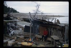
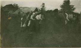
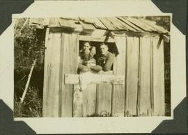
Showing 39008 results

Archival description
21297 results with digital objects Show results with digital objects
2004.1.2.1.134 · Item · ca. 1930
Part of Phipps-Mackenzie Collection

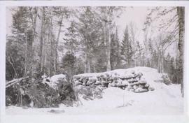
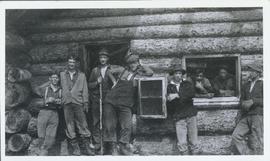
Caption: Shack over Hot Spring, Nascall Bay: Willie Hill, Andy Whitsen, Jack Stenstrum, Cupruin's [sic] Skipper and Engineer. Item is a photograph featuring three men looking out a small window of a wooden shack.

Shack - Seed Plant?
2012.13.1.20.12 · Item · 1980
Part of J. Kent Sedgwick fonds

Image depicts a shack in Woodpecker, B.C. The previous slide of the same building is labelled "seed plant" for unknown reasons.

Shack
2012.13.1.6.092 · Item · Aug. 1979
Part of J. Kent Sedgwick fonds

Image depicts a wood shack, likely near McLeod Lake.

Seymour Narrows, BC Coast
2009.10.2.083 · Item · Sept. 1924
Part of Fred Jeffery Photograph Collection

Photograph depicts the Seymour Narrows section of the Discovery Passage in British Columbia. Handwritten annotation below photograph reads, "Seymour Narrows, BC Coast, September, 1924".

Seymour District
1996.8.1.230 · Item · 1972
Part of Chander Suri fonds

A blueprint plan re Highway Right-of-Way through Lot A. Plan 19885, Block 162, Seymour District. Illustrates section, lot and block divisions of Seymour district. Land surveyor Michael H. Hanson. This plan includes traverse table and legend.

Seymour District
1996.8.1.439 · Item · 1967
Part of Chander Suri fonds

A blueprint plan of subdivision of part of block 162, Seymour District. Esquimalt and Nanaimo Railway are identified on the plan.

Seymour District
1996.8.1.440 · Item · 1972
Part of Chander Suri fonds

A blueprint plan of highway right-of-way through lot A, plan 19885, block 162, Seymour District. Cowichan Valley Road is identified on the plan.