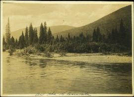
Photograph depicts opposite shore in midground behind river, tree-covered hills in background. Handwritten photo caption on verso and recto of this photograph reads: "On the Clearwater".
Kalamalka Lake Provincial Park, Okanagan region of British Columbia
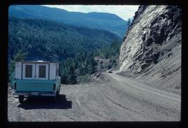
Image depicts a camper parked on the side of a narrow road along a cliff as another car approaches; located somewhere near Bralorne, B.C.
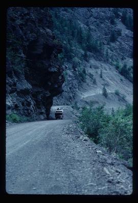
Image depicts a camper passing under an overhang as it drives along a narrow road near a cliff; located somewhere near Bralorne, B.C.
Item is an original Canada Department of Agriculture Publication 1190 entitled "Climate and Agriculture in Central British Columbia".
This unpublished document from the BC Ministry of Environment, Lands and Parks Communications Branch collates information about the issue of climate change circa the year 2000. Includes polling highlights from a poll of BC residents about climate change in 1998; a summary of points about media interest in climate change circa 1998-2000; and a short listing of supportive business comments on climate change circa 1999-2000.
Videotape contains footage of: 13-Jan-03 - Climate change panel with Environment Minister David Anderson
Item is an original Canada Department of Agriculture Publication 1434 entitled "Climate of the Lower Peace River Region".
Item is an original Canada Department of Agriculture Publication 1224 entitled "Climate of the Upper Peace River Region".
Wales, Great Britain
Butterfly on a blade of grass
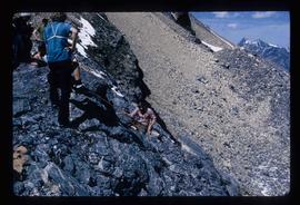
Image depicts a climbing either up or down a rock face.
Climbing trail visible in snow beneath peak
Postcard depicts Field station in the Rockies. Man standing on the left with a bowler hat was Chris McGregor, a professional (mining?) engineer. Earliest frank seen for the postcard was in July 1906.
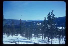
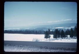
Image depicts a view of the scenery near Clinton, B.C.
Image depicts a view of the scenery near Clinton, B.C.
Flight index for 68 aerial photographs accompanying item. Map depicts Clinton Creek area, identifying airfield and mine. Cartographic legend: "CASSIAR ASBESTOS CORP LTD" "FLIGHT INDEX" "DATE OF PHOTOGRAPHY MAY 1965" "SCALE OF PHOTOGRAPHY 1" = 900 APPROX." "McELHANNEY ASSOCIATES VANCOVER B.C." "JOB No C189/6524".
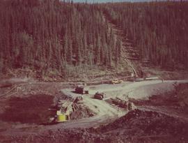
Aerial photograph of Clinton Creek, north west of plant site.
Aerial photograph of Clinton Creek, north west of plant site.
Aerial photograph of Clinton Creek, north west of plant site.
Aerial photograph of Clinton Creek, north west of plant site.
Aerial photograph of Clinton Creek, north west of plant site.
Aerial photograph of Clinton Creek, west of plant site.
Aerial photograph of Clinton Creek, west of plant site.
Aerial photograph of Clinton Creek, south west of plant site.
Aerial photograph of Clinton Creek, south west of plant site.
Aerial photograph of Clinton Creek, south west of plant site.
Aerial photograph of Clinton Creek, south west of plant site.
Aerial photograph of Clinton Creek, south west of plant site.
Aerial photograph of Clinton Creek, south west of plant site.
Aerial photograph of Clinton Creek, south west of plant site.
Aerial photograph of Clinton Creek, south west of plant site.
Aerial photograph of Clinton Creek, south west of plant site.
Aerial photograph of Clinton Creek, west of plant site.
Aerial photograph of Clinton Creek, west of plant site.
Aerial photograph of Clinton Creek, north west of plant site.
Aerial photograph of Clinton Creek, north west of plant site.
Aerial photograph of Clinton Creek, north west of plant site.
Aerial photograph of Clinton Creek, north west of plant site.
