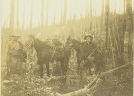
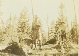
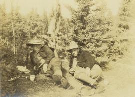
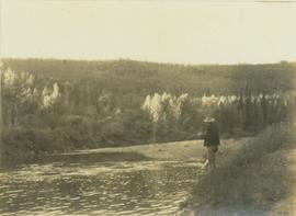
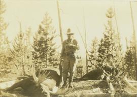
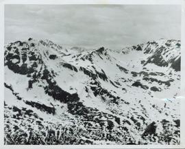
Footage of a herd of caribou running on mountain plateau, probably the Rainbow Mountains. Also various clips of hunting camp and the men loading their pack horses.
Footage of caribou herd on an open landscape.
Location is speculated to be the Ulkatcho Mountains, Rainbow Mountains or Tweedsmuir Provincial Park.
Image depicts a small slope on Carney Hill in Prince George, B.C.
Image depicts miocene gravels on Carney Hill in Prince George, B.C.
Image depicts Carp Lake.
Image depicts two boats on the shore of Carp Lake.
Image depicts a campsite on the shore of Carp Lake.
Image depicts Carp Lake at dusk.
Image depicts a green canoe sitting in the water on the shore of Carp Lake.
Image depicts a man holding a chain of fish on the shore of Carp Lake.
Image depicts a low rain cloud over Carp Lake.
Image depicts a low rain cloud over Carp Lake, and a man on a boat on the lake.
Photograph depicts Carrol Paul (left) and George Bates (right) standing with pack horses loaded with bull moose meat. In the background a burnt forest is visible.
Photograph depicts Carrol Paul (left) and George Bates (right) holding rifles and standing beside two felled bull moose. In the background a sparse forest is visible.
Photograph depicts Carrol Paul (right) and Harry Snyder (left) sitting on the ground during a tea break. In the background is a forested area filled with coniferous trees.
Photograph depicts Carrol Paul fishing along the banks of a river. In the background is a forested shoreline.
Photograph depicts Carrol Paul standing to the left beside a felled bull moose while George Bates sits on top of a felled bull moose.
Photograph depicts Carrol Paul standing with rifle on top of felled bull moose. In the background a sparse forest is visible.
Photograph depicts Carrol Paul (left), unidentified man (middle), and Harry Snyder (right) sitting on the ground next to a small camp fire during a tea break. To the far left an unidentified fourth man is sitting amidst the bushes around the camp fire.
Photograph depicts Carrol Paul (left), unidentified man (middle), and Harry Snyder (right) sitting on the ground next to a small camp fire during a tea break. Surrounding the camp set up are several small coniferous trees.
Image depicts a truck parked on the side of the Cassiar Highway.
Overview of a snow covered mountain tops of the Cassiar Mountains. Handwritten annotation on verso in pen reads: “Cassiar mtns.”
Photograph depicts the Cassiar townsite behind shadow in foreground. Plantsite can be seen including the mill, dry rock storage building, tailings pile, and many other buildings. Mountains in background. Handwritten annotation on recto: "<- 13 1/2" ->". (This photograph was made into a promotional poster.)
Image depicts the Catholic Church in Penny, B.C.
Image depicts Cayoosh Creek.
Image depicts Cayoosh Creek from a bridge in Cayoosh Valley.
Image depicts a bridge over Cayoosh Creek.
Image depicts a view of the scenery surrounding Cayoosh Creek.
Image depicts a view of Cayoosh Valley.
Image depicts a view of Cayoosh Valley. Cayoosh Creek is visible in the bottom left corner of the image.
Image depicts Cayoosh Valley.
Image depicts a mountain side in Cayoosh Valley.
Image depicts a road in Cayoosh Valley.
Image depicts an individual crouching in an old cemetery located somewhere in the coastal forest on Haida Gwaii, B.C.
Image depicts the Barkerville Cemetery.
Image depicts a cemetery at an uncertain location, possibly in Fort St. James, B.C.
Photograph depicts landscape with cleared land in foreground, river in middle, building and trees in background.
Handwritten annotation on verso: "Central Fort George 1911".
Photograph of residents in motion on Centre Street in Prince Rupert. Buildings are visible on either side of the street and a railway track runs down the length of the road. Annotation on recto reads: "Centre Street, Prince Rupert, BC. 1664."
Image depicts a chasm full of trees at an unknown location.