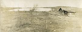
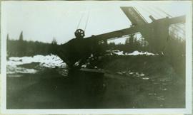
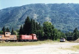
Gravel road running parallel to the Nechako River
Dirt trail running parallel with a river
Photograph depicts a C.P.R. fire car (extender) on the Esquimalt and Nanaimo Railway at Parksville, B.C. on Vancouver Island.
Item is a reel to reel recording produced by the Canadian Association of Broadcasters Tape #1
21 blueprint plans attached together re Cabaret-Banquet Centre for Mr. J. Lalikeas Spartan Catering LTD. Architect: Tom West. Consultants: McKenzie Snowball and Skalbania Associates LTD. "Set#4"
One white and one purple winter cabbage
Stick, boom, and bucket of a "NORTHWEST" cable shovel excavator can be seen left of a steep wall of earth in lower level of construction area. Construction worker is partially visible in foreground on far right. Building materials in background.
Image depicts a cabin at an unknown location.
Image depicts a cabin somewhere in Mud River, B.C.
Image depicts a cabin at an uncertain location.
Image depicts a cabin somewhere in Mud River, B.C.
Photograph depicts a log cabin with sod roof in forest clearing. Handwritten annotation on recto of photograph: "Sayer Creek."
Photograph depicts a small wood frame cabin with a lean to porch. Smoke is rising from the lean to chimney. There is a large snow pile in the foreground and snowy forest in the background. Possible location is Nass Harbour. Handwritten annotation below the photograph reads, "Cabin Home - H. H. Welda's 3/28"
Photograph depicts a cabin near Williams Lake. Its interior contained two old treadle sewing machines and a chesterfield. Davies had the impression it had not been inhabited for at least a decade.
Photograph depicts a rustic log cabin, shed and garden fence near the edge of a lake. The surrounding landscape is low rolling hills.
Item is a photograph of Ray Williston and other cabinet ministers paddling a birch bark canoe in the grass during BC Centennial celebrations in Prince George.
Originally mounted on poster with photographs 115.1, 115.2, 115.3.
Caption: "Indian cabins, MacLeod Lake. First Hudson Bay Port west of the Rockies"
Photograph depicts a man standing beside a small dwelling. Handwritten annotation below photograph reads, "Cabins, Naas Harbour".
Photograph depicts the boom, stick, and bucket of a "Northwest" cable shovel loading a dump truck in excavation area, snow and forest in background.
Photograph depicts the end view of a cable/hose car.
Photograph depicts a cable/hose car (work car) that was not part of the Kamloops Auxiliary.
Photograph depicts a caboose that was formerly part of KVR and was on its way to Grand Forks. It now only went 3 miles to the Canadian Cellulose pulp mill in Kraft.
Photograph depicts a wooden-sided caboose, CPR #43708, arch bar trucks. It was built in September 1943 and may have been part of a wreck train.
Photograph depicts CPR caboose #400572 at Cranbrook. It is an older style caboose with older style lettering.
Photograph depicts the last car on a train. One man is standing on a step, there is an outdoor viewing deck at the end of this railroad car.
Photograph depicts a caboose used as a mobile "Maintenance of Way" office. It was a transfer yard caboose built in Montreal in 1977-8. Made into a series of which all except two had been put to other uses since 1991-2.
Photograph depicts a line of CPR cabooses and work cars at Nelson. The foremost is #437374 and was built in September, 1948.
Woodland landscape in autumnal colours, Prince George, British Columbia
<i>Populus deltoides</i> in snowy landscape, Prince George, British Columbia
Prince George <i>Populus</i>
Northern British Columbia
Horse and cabin in the woodland, Prince George, British Columbia
Caption: Cache Meadows on the summit Kubicek Pass, 13th July. The razor edge in the centre is Mt. Kubicek, in honour of Frank's pilot. The dumps are seperate being provisions for different months. Item is a photograph of two men standing in a patch of snow within a valley; Mt. Kubicek is visible in the background. Bob and self (Jim McKenzie?) identified.
Photograph depicts two men standing near two horses in front of a tall log cache in a forested environment.
River perspective from Cache to Nechako Cutbanks, Prince George, British Columbia
Landscape, Prince George, B.C.
Image depicts a nature trail along the Nechako River at Island Cache looking west with the cutbanks in the background. Map coordinates 53°55'36.2"N 122°45'11.8"W
Prince George, British Columbia
Landscape, Prince George, B.C.
Prince George, British Columbia
Image depicts some cacti somewhere near Soda Creek, B.C.
Photograph depicts a home made field cattle fodder trough found at Dot Ranch, some 200 yards from a CPR Dot spur.
Photograph depicts Cadero St. in the west end of Vancouver, looking north from Barclay St. intersection in the 800 block.
Photograph speculated to have been taken during a Cadets award ceremony in Stewart, B.C. (see also item 2009.6.1.748). Power lines, trees, and mountains in background.