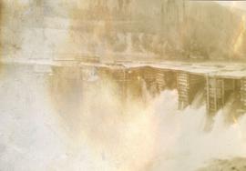
Photograph depicts a portion of the pit in foreground at the Cassiar mine. Crushing plant visible in centre below base of West peak. Footwall road in midground, mine valley in background. Building near trucks at top of pit was called the "shifter shack," where crews were relieved or dropped off for work.
Photograph depicts a portion of the Cassiar pit in right foreground. Crushing plant visible to left of pit, West peak visible in right background. Mountain range can be seen in distance.
Photograph depicts an unidentified man mining in rocky area, trees and hills in background. Handwritten annotations on verso of photograph: "PLACER MINER WSHING FOR GOLD FINDLAY RIVER BC", "PHOTO WWW".
Photograph depicts two miners standing on either side of wooden sluicing trough in rocky area. Man on left pans for gold. Hills in background. Handwritten annotations on verso of photograph: "PLACER MINERS AT WORK INGINECA RIVER BC", "PHOTO WWW".
Five unidentified miners pose for a photo. Logs and wood scraps in foreground, forest in background.
Printed annotation on recto of photograph: "PLACER MINING, ATLINTOD RIVER, ATLIN, B.C. A.C. HIRSHFELD NO. 753."
Photograph depicts plateau below summit between John Brown and Kitseucla creeks. Survey of 55th parallel.
Annotation on slide: "Plot 3 uncut control plot, Summit Lake".
Annotation on slide: "Plot 3, Summit".
Photograph depicts a few scattered buildings and railway siding in the foreground, sparsely forested mountain in the background.
Photograph depicts two persons holding long poles, standing on a canoe on the Nechako river. The water vessel appears to be very near a falls. Image is out of focus.
Photograph depicts four men standing on a canoe, loaded with supplies. Calm river water in the background, bluffs in the background.
No caption provided with photograph negative. Appears similar to 2007.1.30.2.011, which has the following caption: "Poor quality Spruce left after diameter cutting. Note insect killed trees and leaning tree. Sparse stocking. Very poor increment. Devils Club site. Silty clay. No post logging regeneration. Continous understory of alder and willow. West Branch, F.E.S. Aleza Lake."
Caption describing photograph: "Poor quality Spruce left after diameter cutting. Note insect killed trees and leaning tree. Sparse stocking. Very poor increment. Devils Club site. Silty clay. No post logging regeneration. Continous understory of alder and willow. West Branch, F.E.S. Aleza Lake."
Annotation on photograph verso: "South of plot 27, N of 18, 20. 15/1/92. Post-logging. Summit Lake Selection Trial"
Annotation on photograph verso: "View south of unit 27 Post-logging. 15/1/92. Summit Lake Selection Trial"
Annotation on photograph verso: "South of plots 27, 21. 15/1/92. (Post-logging). Summit Lake Selection Trial"
Caption describing photograph: "Potentially commercial Black Spruce stand. Fully developed peat (3-8') over impervious clay. Ledum B. Glandulosa. Mile 3 Hart Highway. Ht 55', 5-10" DBH. Age 85 years. Frames 1-5"
Photograph depicts a power dam near Cascade, BC.
Item is a labeled diagram of the power group at a mill.
Item is an original wildlife section report by R.W. Ritcey entitled "Predators in Wells Gray Park 1950-1956".
Annotation on photograph verso: "View from Jtn of A Road and Main Road to NE. Pre-logging. 15/1/92. Summit Lake Selection Trial"
Photograph depicts Prentiss Gray sitting on a log skinning his trophy mountain goat.
Item is an original BC Parks report entitled "Preservation and Management of the Grizzly Bear in B.C. Provincial Parks: The Urgent Challenge".
Image depicts Prince George, possibly with the Northwood Pulpmill in the background.
Image depicts the Prince George Sawmill from the Northwood Bridge.
Image depicts Prince George Sawmill taken from across the Nechako River looking southwest. Map coordinates 53°56'00.0"N 122°44'29.7"W
Photograph depicts silhouette of Prince Rupert BC buildings and the view looking beyond to the water.
Photograph depicts view of Prince Rupert harbor from a deck.
Photograph depicts a view from the water looking into Prince Rupert harbor.
Photograph depicts a view from the shore looking out into Prince Rupert harbor.
Item is an aerial photograph of log rafts, log booms, and a mill.
Item is a photograph of Princess Margaret on July 17, 1958 at an event staged in the Prince George railway yards. Alex Moffat dressed as a prospector demonstrates panning for previously salted gold nuggets, which were later given to the Princess.
Item is a diagram showing the process through chip preparation and continuous digesting, brown stock washing, brown stock screening and cleaning, bleach plant, and bleach stock screening and cleaning.
Item is a photograph of a copy print that has been reproduced as a slide, resulting in low photographic quality. Location of original photograph unknown.
This born-digital "Profile Descriptions" document provides descriptions of Williams Lake (Skulow Lake), Aleza 1 & 2, Log Lake, and Lucille Mountain pedons.
During a year away from studies in 1987-88, Dr. Paul Sanborn developed a successful grant proposal to the Science Council of BC (SCBC) to pursue a postdoctoral project with Dr. Tim Ballard in relation to sulphur-deficient soils in BC and prescribed fire. This project built on an existing broadcast burning study conducted by Macmillan Bloedel Ltd. near Port Alberni on Vancouver Island, led by Bill Beese (later at Vancouver Island University). Dr. Sanborn's work addressed sulphur forms and amounts in the soils at these sites, and the chemical processes influencing sulphur availability in relation to prescribed fire.
Only one part of this work was eventually published:
Sanborn, P.T. and T.M. Ballard. 1991. Combustion losses of sulphur from conifer foliage: Implications of chemical form and soil nitrogen status. Biogeochemistry 12: 129–134.
https://doi.org/10.1007/BF00001810
The remainder of the work was documented in this Project Completion Report to SCBC, dated February 28, 1990, and entitled "Effects of Prescribed Fire on Sulphur in Forest Soils".
Reproduced map on mylar depicts a proposed railway spur for the Aleza Lake Forest Experiment Station.
Photograph depicts the proposed site for a hydro power project on Klemtu Lake with rock sill outlet to creek.
Item is a photocopy of "Provincial Parks and Stone Sheep: 'Affinity Through Default'" report by W.G. Hazelwood, Parks Biologist.
Photograph depicts a ptarmigan in the foreground, two men on foot, leading a packhorse across a meadow.
Caption describing photograph: "Pulpwood Logging Operations on P.T.S. X91960, Swamp Lake, Prince George Pulp and Paper Ltd."
Caption describing photograph: "Pulpwood Logging Operations on P.T.S. X91960, Swamp Lake, Prince George Pulp and Paper Ltd. Close-up of Pre-loading Trailer and Typical Load of pulp wood."
Caption describing photograph: "Pulpwood Logging Operations on P.T.S. X91960, Swamp Lake, Prince George Pulp and Paper Ltd. Close-up of rubber-tired skidder at landing." Harry Coates holds a measuring tape against a felled tree to show trunk diameter.