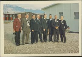
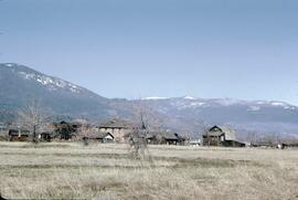
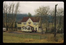
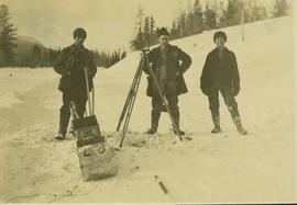
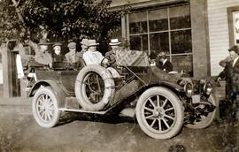
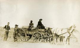
Image depicts the Onward Ranch near Williams Lake, B.C.
In a special article written by Barry Sale for The Williams Lake Tribune, he provides a detailed history of this ranch (see https://www.wltribune.com/community/haphazard-history-onward-ranch-steeped-in-history-5549882):
"One of the most famous ranches in the Cariboo region is the venerable and storied Onward Ranch. Located in the picturesque San Jose River valley, some eight miles southwest of Williams Lake, the land was first pre-empted in 1867 by Charles Boromeo Eagle. He had been born in Pennsylvania in 1837, coming from German (often called Pennsylvania Dutch) extraction. Eagle made his way to the Cariboo just as the placer gold rush was beginning to decline, and he decided to homestead in the fertile river alley. He built a small rough cabin on the north bank of the San Jose and began clearing land.
To finance his dreams, Eagle did day work for Pascal Bates, the owner of the 150 Mile Roadhouse and ranch. After work, Eagle would walk the five miles back to his little log dwelling and labour until dark to develop his own place. He invested the money he earned in livestock, seed plants, tools, and a small sawmill powered by water from the river. Slowly, he accumulated sufficient lumber to build a few outbuildings, including a small store. He gradually gained the trust of the local Indigenous people and built up a respectable fur trade. Eagle named his ranch the Onward after the region in Pennsylvania where his family had settled.
In the late 1860s, Charles met Annie Tatkwa, a Shuswap woman from the Bonaparte Band near Cache Creek. Prior to his arrival in the area, she had been a “country wife” to Thomas “Jack” Paxton, who had come out from England to seek his fortune. They had one son, Thomas Jr. (Tom). Paxton did not find the riches he sought and returned home with no plans to return to Canada, so, after a brief courtship, Annie and Charles were legally married at St. Joseph’s Mission, and Tom was adopted.
Over a span of almost 20 years, Annie gave birth to 10 children at the Onward. Four of them, all girls, died early in childhood. The six surviving children were Josh, Basil, William, Louise, Christine, and Rose. Annie, only 40 years old, died in September of 1887. She never recovered from the difficult childbirth of her youngest daughter, Ida May, who lived only for another five months following Annie’s passing. Charles never remarried.
The Onward was well situated on the route to the goldfields from Dog Creek, Alkali Lake, and Springhouse. It became a stopping place for packers, freighters, and travelers and it was an ideal place for a general store. At one time, in the mid 1890s, there were plans to build a town, to be named San Jose, right next to the Onward Ranch. Lots of 66 by 125 feet were advertised in the B.C. Mining Journal, published at Ashcroft for this “promising town in the South Cariboo, the centre of an extensive farming district and the natural distributing point for Alkali Lake, Chilcotin, Williams Lake Valley, Quesnelle Forks and Horsefly.” These lots were described as “beautifully located at the junction of the Williams Lake Road with the Cariboo Trunk Road, commanding an extensive view of the most picturesque part of Williams Lake Valley,” and “abundantly supplied with pure water from the San Jose River.” Apparently the “terms reasonable” weren’t, and there was very little interest.
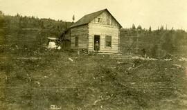
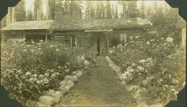
In 1886, Charles began building a large new house from lumber he had milled on site. All the boards were planed by hand, sturdy timbers cut, and shakes split. The house was 2 and a half storeys in height and had verandas on two levels. Inside, it was meticulously furnished with oiled and polished pine. It cost approximately $10,000 to build, quite a sum in those days. The original log cabin was repurposed as a chicken house.
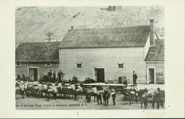
The ranch prospered. It was irrigated by a seven-mile long ditch with plentiful water year round. Over 110 tons of grain, 125 tons of vegetables, and 200 tons of hay were produced annually. A larger store was built, and contracts were signed to supply the mines and communities of the goldfields to the northeast with provisions, general merchandise, farm produce, beef and pork.
Charles Eagle died in 1890 at the age of 53. The ranch was taken over by his son John and adopted son Tom. Together, they formed the firm of “Eagle and Paxton, Store Merchants.” Unfortunately, they were not very well versed nor interested in the business of ranching, and they focused their efforts on the general store. For a while, they did very well, but as the mines in the goldfields began closing down, their business fell off. By 1900, both the store and the ranch were on the verge of bankruptcy, and in 1903, the entire operation was sold for $9,500 to John Edgar Moore, a pioneer rancher and businessman from Alkali Lake.
Over the next 17 years, Moore refurbished the ranch house, restocked the store and made it profitable again, added a huge livestock and storage barn (in 1911), and built up the farming and ranching operation. In 1920, nearing the age of 70, Moore sold the Onward to Charles Cowan for the price of $20,000. Cowan owned two ranches in the Kamloops area and was an agent for the Cariboo Trading Co., which owned the 134 Mile and the 150 Mile ranches. He and his wife Vivien moved into the big house, and Charles immediately concentrated on rejuvenating the land. He planted legume crops and plowed them under, fertilized, and brought water to arid areas. He also built miles of fences along with his new ditches, and within a few years, the place was producing excellent quantities of crops and livestock once again.
Charles and Vivien had two daughters, Sonia, born in 1919, and Drusilla (Dru), born in 1928. In 1929, the Cowans purchased the neighbouring 150 Mile Ranch. However, Charles’ health had begun to deteriorate, and the family spent more and more time in Victoria, where he received specialized medical care. During the family’s absence, John Zirnhelt took over the management of both ranches. In 1939, Charles died in Victoria as a result of a massive stroke.
Vivien and her daughters returned to the Onward to continue running the ranch. She was shocked to learn that her husband had left unsettled debts which amounted to about $9,500. The only way to pay them off was to make both ranching operations profitable.
That she did, with the help of her daughters, but she also found time to pursue her talent for painting. Her home became a gathering place for many artists, musicians, and writers. A.Y. Jackson, one of the famous Canadian “Group of Seven” was a regular visitor. In 1945, Vivien founded the Cariboo Art Society, which met frequently in the living room of the big ranch house. Both daughters were also artistically inclined, with Sonia becoming known throughout Canada for her paintings of the Cariboo, and Dru becoming a celebrated playwright and author. In the 1950s. Sonia and her husband Hugh Cornwall took over the management of the ranch, which now had a solid reputation as a centre for the arts.
The 150 Mile Ranch was sold in 1950, and in 1966, the Onward was sold off, this time to the Order of Mary Immaculate, the Catholic Oblate order which also owned the nearby St. Joseph’s Mission Ranch. The Oblates kept the ranch operating on a reduced scale, and they used the ranch house as a retreat for the priests and brothers. In 1979, St. Joseph’s Mission was officially closed down by the Roman Catholic church, and in 1980, the Onward was sold again. Since then, it has seen a number of owners, subdivisions, and changes. It is now owned by Tyrone Johnston, who is working diligently to bring back production and sustainability. After more than a century and a half of continuous operation, the Onward is indeed a special place with a unique and colourful history."