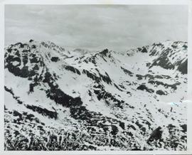
Showing 20407 results

Archival description
20407 results with digital objects Show results with digital objects
Cassiar - Stewart Highway
2006.20.9.25 · Item · [ca. 1897 - 1960]
Part of Northern BC Archives Historical Photograph Collection

View of snow capped mountains in the distance, vast rolling treed hills in mid ground and a gravel road in the foreground. Road sign indicating severe curve in road situated at the right of the gravel road. Handwritten annotation on verso in pen reads: “Cassiar – Stewart highway”

Cassiar Aerial
2000.1.1.1.07.09 · Item · [ca. 1965]
Part of Cassiar Asbestos Corporation Ltd. fonds

Photograph depicts the Cassiar town in foreground, mine valley and north mountain range in background. Photograph speculated to have been taken during the plane ride of an outside exploration trip.

Cassiar Aerial - Mine Valley
2000.1.1.1.07.08 · Item · [ca. 1965]
Part of Cassiar Asbestos Corporation Ltd. fonds

Photograph depicts the Cassiar mine valley in north mountain range. Plant and tailings pile can be seen in right foreground, and the east end of the town is visible in left foreground. Photograph speculated to have been taken during the plane ride of an outside exploration trip.

Cassiar Aerial, East View
2000.1.1.1.07.10 · Item · [ca. 1965]
Part of Cassiar Asbestos Corporation Ltd. fonds

Photograph depicts the Cassiar valley, showing the east end of town in foreground. Plant and tailings pile can be seen in right midground. Photograph speculated to have been taken during the plane ride of an outside exploration trip.

2000.1.1.3.13.04 · Item · [before 1970]
Part of Cassiar Asbestos Corporation Ltd. fonds

Photograph depicts the Cassiar townsite behind shadow in foreground. Plantsite can be seen including the mill, dry rock storage building, tailings pile, and many other buildings. Mountains in background. Handwritten annotation on recto: "<- 13 1/2" ->". (This photograph was made into a promotional poster.)

2009.5.2.58 · Item · [ca. 1913]
Part of Taylor-Baxter Family Photograph Collection

Photograph depicts Catholic church, with rectory on its left, and First United Church behind. A wood boardwalk crosses midground, and a man can be seen riding a bicycle near church. Power lines and rough cleared land in foreground, hills and mountains in background. Handwritten annotation on recto of photograph: "Church in Rupert."

2013.6.36.1.016.26 · Item · 14 Oct. 1974
Part of David Davies Railway Collection
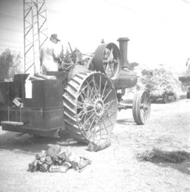
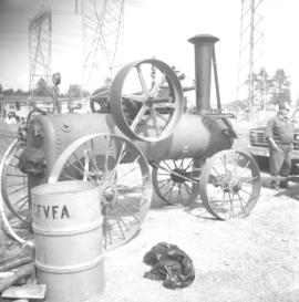
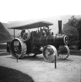
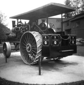
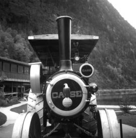
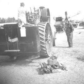
Photograph depicts a cattle dock about 1/4 mile west of the former site of the Haney CPR depot. To the left and west of the dock is a meat processing plant which used to use the dock but does not anymore. The view is looking northeast.

Cayoosh Valley
2012.13.1.54.10 · Item · July 1977
Part of J. Kent Sedgwick fonds

Image depicts a view of Cayoosh Valley. Cayoosh Creek is visible in the bottom left corner of the image.