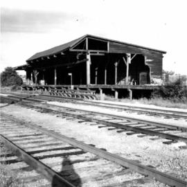
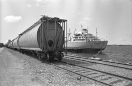
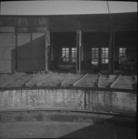
Print preview Close

Showing 39008 results

Archival description
21297 results with digital objects Show results with digital objects
2013.6.36.1.115.05 · Item · Aug. 1998
Part of David Davies Railway Collection

Photograph depicts a disused depot at Ellis and Clement. Taken from Ellis, looking east. Tracks across Ellis had just been removed. Side walk was inserted and black top had been laid. The removal of the road crossing signals had yet to be done.

2013.6.36.1.115.07 · Item · 8 Aug. 1998
Part of David Davies Railway Collection

Photograph depicts a disused depot at Ellis and Clement. Taken from Ellis, looking east. Track was an isolated piece between St. Paul Street and Ellis and had been subsequently removed. Davies notes the vague talk at the time of converting the building into a railway centre

2000.13.1.63 · Item · [between 1962 and 1967].
Part of Ray Williston fonds

Item is a photograph of the diversion tunnel as engineers plan to blast the plug to allow the Peace River to be diverted for construction of the W.A.C. Bennett Dam.

Diving
2012.13.1.84.40 · Item · 1994
Part of J. Kent Sedgwick fonds

Image depicts an unidentified individual diving into a pool of water at an uncertain location.

D.L. 2611 SOUTH HALF
1996.8.1.453 · Item · 7 January 1974
Part of Chander Suri fonds

Topographical plan depicting Prince George south from the convergence of Massey Ave. and Ospika Blvd. Prominent streets are Massey, Ospika, and Foothills Blvd.

Dock
2012.13.1.60.18 · Item · July 1973
Part of J. Kent Sedgwick fonds

Image depicts a dock on a lake in Carp Lake Provincial Park, possibly War Lake.