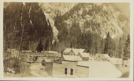
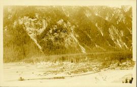
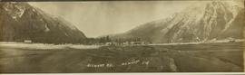
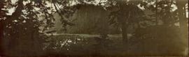
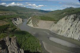
Salmon migrating up the Stellako River, Northern British Columbia
Topographic map depicting regions, communities, government posts. bodies of water, transport routes, surveyed areas, and reserves.
Colour-coded geological topographic map. Geological Survey produced for the Bureau of Economic Geology, Department of Mines, Bureau of Economic Geology, Canada. Scale 1:126,720. Includes overview of "General Geology" and "Economic Geology."
Item is a detailed management plan for the following Stikine Country Protected Areas: Mount Edziza Provincial Park, Mount Edziza Protected Area (Proposed), Stikine River Provincial Park, Spatsizi Plateau Wilderness Provincial Park, Gladys Lake Ecological Reserve, Pitman River Protected Area, Chukachida Protected Area, Tatlatui Provincial Park.
Detail of <i>Ribes</i> in upright flower
Elevated, wide angle photograph of Stewart, BC with mountains visible in the background.
Slightly elevated photograph of commercial and residential buildings in Stewart, BC. Printed annotation on recto reads: "Hughes #11 Stewart Looking N.W."
Wide angle photograph of a forested mountain. The town of Stewart, BC is visible at the mountain's foot.
Image depicts the Robert Stewart house, built in 1910 and inhabited by the Stewart family until 1945. It is located in Stewart, B.C.
Image depicts Stewart Harbour in Stewart, B.C.
Wide angle view of mountains and small residential buildings. A large dock is visible in the foreground. Annotation on recto reads: "Stewart, BC., from Government Wharf."
Map depicts existing harbour development in Stewart, with an enlargement of the west side of the harbour.
Photograph depicts view a panoramic view of Stewart B.C taken from the valley bottom.
Photograph depicts view a panoramic view of Stewart B.C. taken from an elevated view.