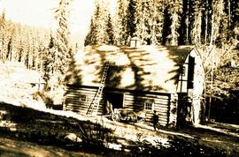
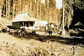
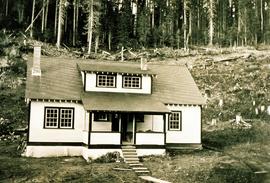
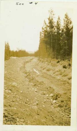
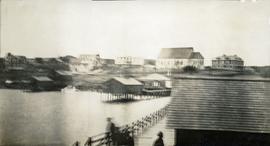
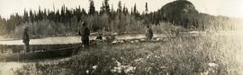
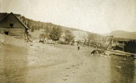
Photograph depicts eighteen or more canvas tents scattered on the river shore next to rough cabins and an outhouse.
Item is a photograph of a copy print that has been reproduced as a slide, resulting in low photographic quality. Location of original photograph unknown.
Photograph depicts a ditch cut through a forested landscape. Handwritten annotation on recto of photograph reads: "Sec. #4"
Photograph depicts a close up view of the range grass.
Photograph depicts an open field with a fence. There is a house in the midground and low sparsely treed hills in the background.
Photograph depicts a view of a barn, house, fences and cattle on Norman Lee's ranch.
Photograph depicts a view of open range land in the foreground and rocky bluffs in the background.
Photograph depicts scientists Alejandra Duk-Rodkin (GSC) and Rene Barendregt (U Lethbridge) working at the Norman Range site.
Photograph depicts scientists Paul Sanborn and Rene Barendregt (U Lethbridge) working at the Norman Range site.
Photograph depicts looking north and south in North Fork from above Boulder creek.
Photograph depicts the North peak of McDame mountain after extensive strip mining, South peak unmined in background. Old mine garage visible on right of West peak in foreground. Crusher plant partially visible on far right. Photograph believed to have been taken just prior to the development of the pit mine between the North and West peak.
Photograph depicts tramline in a strip cleared of trees on McDame Mountain, bucket in foreground. Handwritten annotation on recto of photograph: "#2 SECTION LOOKING NORTH". Photograph was glued to cardboard backing with the annotation: "1962".
Photograph depicts tramline in a strip cleared of trees on McDame Mountain, bucket in foreground. Handwritten annotation on recto of photograph: "1961 - 62".
Item is a poorly photocopied version of Percy Barr's "Northern Interior Forest Experiment Station Progress Report". Location of original is unknown.
Item is an original "Northern Interior Forest Experiment Station: Report of Preliminary Investigations" by Percy Barr. Includes original photographic prints.
Photograph depicts a small coastal village in northern British Columbia.
Large-format map depicts Northwood Pulp & Timber operating areas in 1975.
Image depicts the Northwood pulpmill in Prince George B.C.
Image depicts the Northwood Pulpmill in Prince George, B.C. taken from above the Nechako River looking east. Map coordinates 53°56'00.0"N 122°44'29.7"W
Image depicts the Northwood pulpmill in Prince George B.C.
Item is a photocopied report by Don Miller entitled "Observations of Caribou and Caribou Environment in Northern and Southern Tweedsmuir Park and Wells Gray Park in Summer of 1977 with Comments on Related Observations in Spatsizi Park during Spring".
Photograph depicts a collapsed bridge on North Fork creek.
Photograph depicts a creek with banks on either side.
Photograph depicts a cluster of buildings including a church, a river in the foreground, rolling hills in the background.
Caption describing photograph: "Old growth Douglas fir 300 yrs, 28" DBH 90' Ht. Wind shook, coarse limbed sweeping bole, heart rot, survivor of old fire. Weakly drained lacustrine deposit. Note typical of isolated distribution (single or groups occuring in Sub-Alpine zone). Very infrequent cone crops - low viability, suspect high level inbreeding. No regeneration though receptive bed. West branch, F.E.S. Aleza Lake." Harry Coates stands in the photograph for scale.
Photograph depicts two men (O'Brine on left) standing in front of a log building. Handwritten note on verso reads: "Consulting engineer for Crocker 1st National Bank, San Franscisco. Examining (?) Fleuving & Downey Leases with object of taking in dredge."
Item is a photograph of a copy print that has been reproduced as a slide, resulting in low photographic quality. Location of original photograph unknown.
"I originally prepared this slide in 1992 to make the point that many of those researchers who worked at Aleza lived to a ripe old age. Two of these men died in 1993, Eric Garman and Dr. Joe Falconer. Joe never quite made his 100th birthday." -- quote from the notes of Ralph Schmidt in accompanying file
Photograph depicts three boats on the edge of a small river. Two men attend each boat. Wild grasses with a skiff of snow in the foreground, river, forest and a low forested bluff in the background.
Photograph depicts several men standing on the river bank. Possibly A.H. Holland in center of photo.