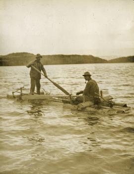
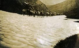
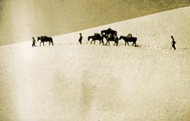
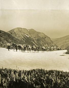
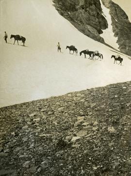
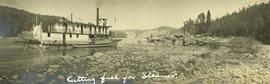
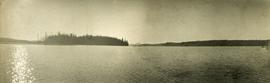
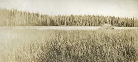
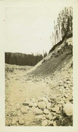
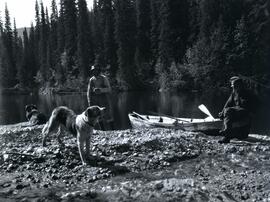
Photograph depicts two men and two dogs resting near a wooden rowboat stopped along the shoreline of upper Osilinka River near Swiggums mining claims.
Photograph depicts a full length image of (presumably) one of Holland's survey crewmen.
Photograph depicts a lofty view of a winding river, forest in the foreground, rolling forested hills in the background.
Photograph depicts a looking through trees to a view of a river, forested low hills in the background.
Item is an original report by Grant Hazelwood and Steve Head regarding "Crooked River Fisheries and Wildlife". Includes one original photographic print pasted into the report. This project was aimed at improving the recreational use of the Crooked River and it's adjoining corridor.
Photograph depicts five men standing in a field of cut hay. Some men are holding scythes, buildings, forest and rolling hills in background.
Photograph depicts 5 men in a field using scythes to cut grain.
Photograph depicts two men navigating a small raft across the waters of Babine Lake, BC. Low mountains in the distance. [55th parallel]
Photograph depicts a snowy mountain slope with a rocky ridge in the background. Two men and five horses are traversing across the snowy slope.
Photograph depicts a long line of horses with packs traveling toward the photographer on a snowy mountain pass.
Photograph depicts three men and five horses traversing through the snow. The men are on foot leading the horses.
Photograph depicts four men pulling a long canoe across a clearing on a wheeled trailer.
Photograph depicts crossing summit between John Brown and Kitseucla creeks. Survey of 55th parallel.
Caption describing photograph: "Crown form."
Photograph depicts a cut section of a hillside with a forested area visible in the background.
Photograph depicts a steamship anchored near the shore of the river. Three or more people are working in a large pile of driftwood on the shore.
Annotation on photograph verso: "D-4 tracked skidder. 15/1/92. Summit Lake Selection Trial"
Annotation on photograph verso: "D-4 tracked skidder at Start of B Road. 15/1/92. Summit Lake Selection Trial"
Annotation on photograph verso: D-4 tracked skidder at "Start of B Road. 15/1/92. Summit Lake Selection Trial"
Annotation on slide: "Summit Lake D4H highdrive"
Annotation on slide: "Summit Lake D4H highdrive skidder"
Annotation on slide: "Summit Lake D4H highdrive"
Annotation on slide: "Summit Lake D4H on skid road"
Annotation on slide: "Summit Lake, D4H on narrow skid road".
Annotation on slide: "Summit Lake, D4H skidding logs".
Annotation on photograph verso: "D6 grapple skidder used for road development only. 27/12/91. Summit Lake Selection Trial"
Attached description: An extensive program of development was undertaken for the new Skeena Kraft mill water supply. Dams were constructed to improve storage in the several lakes supplying the water; these are primarily, Diana, Prudhomme and Rainbow. This picture shows the large dam constructed on Diana Lake. A 78-inch wood stave pipeline was built, and now supplements the 48-inch pipeline that served the existing sulphite mill. Enough water is transported to supply a city of more than 100,000 population.
Data set "Yukon-AK 2004 soils data (Lost Chicken).xls" consists of Pliocene Rego Humic Gleysol (peaty) data from the Lost Chicken Mine site.
Photograph depicts a lake in the foreground with a possible island in the center of the photograph, low treed hills in the background.
Photograph depicts lake water in the foreground, low treed hills in the background.
Photograph depicts the bow of a boat in the foreground, lake water and low treed hills in the background.
This image is part of the outbound sequence of aerial images obtained on the helicopter flight to the Klutlan Glacier study site. The sequence starts from the base camp at the White River crossing on the Alaska Highway and heads south, to a point just upvalley of the debris-covered terminus (approx. 10-15 km from Alaska border), and turning back north to the landing spot on the Generc River floodplain close to the study site (see Fig. 1 in paper).
This image is part of the return trip sequence of aerial images obtained on the helicopter flight leaving the Klutlan Glacier study site. On the return leg at the end of the day, the flight initially went upvalley to pick up another party.
This image is part of the return trip sequence of aerial images obtained on the helicopter flight leaving the Klutlan Glacier study site. On the return leg at the end of the day, the flight initially went upvalley to pick up another party. This image was taken after the helicopter turned north to return to base camp.
This image is part of the outbound sequence of aerial images obtained on the helicopter flight to the Klutlan Glacier study site. The sequence starts from the base camp at the White River crossing on the Alaska Highway and heads south, to a point just upvalley of the debris-covered terminus (approx. 10-15 km from Alaska border), and turning back north to the landing spot on the Generc River floodplain close to the study site (see Fig. 1 in paper).