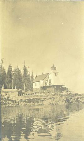
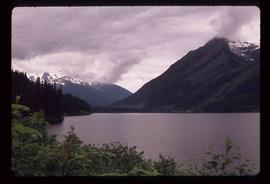
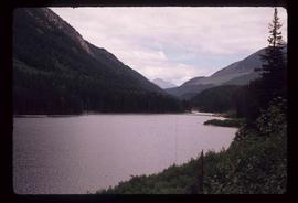
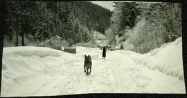
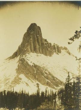
Photograph depicts Eagle's Nest Pass mountain with trees in the foreground.
Slide depicts two eagles in an enclosure. The photograph was taken in Kaleden, BC. Original slide index description: "Eagles, Kaleden."
Shoreline perspective of Eagle Lake. Handwritten annotation in pen on verso reads: “This is Eagle Lake. It is about 2 blks [sic] away.”
Shoreline perspective of Eagle Lake. Handwritten annotation in pen on verso reads: “Eagle Lake from the C.N.R. railway tracks.”
Overview of sawmill situated in valley. Finished lumber visible in distance.
Image depicts the Dunlevy Creek area somewhere near Dawson Creek, B.C. The slide is simply labelled "Dunlevy irrigation" for uncertain reasons.
Photograph depicts red truck dumping waste at what is believed to be the tailings pile at the Cassiar plant. Small building and unidentified individual in bottom left foreground, valley and mountains in background. Photo caption next to printed copy of image in 1953 Annual Report: "Stockpile of 80,000 tons of Ore at Mill."
Image depicts a view of Duffey Lake Provincial Park, looking west over Duffey Lake.
Image depicts a view of Duffey Lake Provincial Park, looking east over Duffey Lake.
Image depicts a large flock of ducks in a field full of water at an unknown location.
Photograph depicts large dry rock storage building in foreground on right, mill on left behind tailings pile, and dryer building in centre behind conveyor belt connecting mill to dry rock storage. A cloud can be seen rising from plantsite. Trees and Troutline Creek cross foreground, mine valley and mountains visible in background. Stamped annotation on recto of photograph: "ANSCO PRINTON Munshaw Colour Service Ltd. MAR 10 1955".
Photograph depicts large dry rock storage building in foreground on left, mill in background, dryer building in right midground. Miscellaneous supplies in far right foreground, mountains visible in background. Handwritten annotation on verso of photograph: "Sept 1954". This photograph was originally stored inside duotang labeled "CASSIAR ASBESTOS CORPORATION LIMITED PHOTOGRAPHS 1954"; photo caption beneath this image: "40,000 Ton Dry Storage Building / Mill / Dryer Building".
Photograph depicts large dry rock storage building on left, mill in background, dryer building on far right. Road and power poles cross foreground, mountains stand in background. Photo caption next to printed copy of image in 1953 Annual Report: "Completed dry rock storage and dryer buildings."
Image depicts a driveway cordoned off by a red mesh material in Newlands, B.C. The address of the house is labelled 31951, and the name listed is "Fauchers." Map coordinates 54°06'47.8"N 122°08'22.4"W
Photograph depicts driftwood on a beach at Skidegate, Queen Charlotte Islands.
Image depicts a number of identical buildings and vehicles at "Driftwood Creek" in the Driftwood Canyon Provincial Park.
Photograph depicts a lighthouse on a rocky shoreline with a forested area in the background. Annotation on verso of photograph states: "Driad Pt. light near Bella Bella kept by B.B. indian"
Photograph of several buildings down the street in Prince Rupert, including the church. Lumber pallets are littered around the buildings. Annotation on recto reads: "Prince Rupert, BC. 20.10.07."
Image depicts Downton Lake, the Lajoie Dam reservoir.
Image depicts an old, unused log cabin somewhere in Dome Creek, B.C.
Image depicts a log cabin somewhere in Dome Creek, B.C.
Image depicts what is possibly the CN Station in Dome Creek, B.C.
Image depicts the CN Station in Dome Creek, B.C.
Photograph depicts a dogwood tree in front of the garden at 1057 Beach Ave. in Vancouver. The photo is taken looking northeast.
Photograph depicts the dogwood tree in winter at the former site of 1057 Beach Ave. in Vancouver. The view is looking east.
Image depicts a pair of dogs in a forest, possibly somewhere near Woodpecker, B.C.
Image depicts two dogs and numerous chickens in a yard at Island Cache.
A woman stands in distance on a road with high snowbanks and trees on either side. A dog can be seen in foreground, facing woman. A fence and other structures stand in midground. Tree-covered slope in background.
Image depicts an unknown individual and a dog on a bridge over what is possibly the Robson River.
Image depicts a dog standing on a path through the woods somewhere in Carp Lake Provincial Park.
Image depicts a dog in a forest, possibly somewhere near Woodpecker, B.C.
Photograph depicts dog seated on grass in foreground. Unidentified individuals visible below with fishing nets in waterfall area at Moricetown Canyon.
Photograph depicts a dog sitting in shoveled walkway in steep snow, snowshoes inserted in the snow banks over dog's head. Unidentified building in background.
Image depicts a ferry docked at Haida Gwaii, B.C.
Image depicts numerous docked boats in Prince Rupert, B.C.
Image depicts numerous docked boats somewhere in Prince Rupert, B.C.
Photograph of a large dock littered evidence of lumber transportation. Small buildings and stumps are on the shoreline. Annotation on recto reads: "Prince Rupert BC, '07."
Image depicts a dock on a lake in Carp Lake Provincial Park, possibly War Lake.
Image depicts a dock in Prince Rupert, B.C.
Image depicts the "Divides Lake Waterfall" as well as a man in front of a helicopter in the foreground.
Image depicts the "Divides Lake Waterfall."
Image depicts Divide Lake.
Image depicts a ditch of water at an uncertain location.
Image depicts a section of disturbed ground at an unknown location.
Image depicts an area of disturbed ground, most likely due to a landslide, at an unknown location.
Image depicts a large section of disturbed ground at an unknown location.
Image depicts an area of disturbed ground, most likely due to a landslide, at an unknown location.