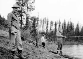
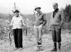
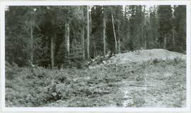
Image depicts a mountain side in Cayoosh Valley.
Image depicts a road in Cayoosh Valley.
Image depicts an individual crouching in an old cemetery located somewhere in the coastal forest on Haida Gwaii, B.C.
Image depicts the Barkerville Cemetery.
Image depicts a cemetery at an uncertain location, possibly in Fort St. James, B.C.
Photograph depicts landscape with cleared land in foreground, river in middle, building and trees in background.
Handwritten annotation on verso: "Central Fort George 1911".
Photograph of residents in motion on Centre Street in Prince Rupert. Buildings are visible on either side of the street and a railway track runs down the length of the road. Annotation on recto reads: "Centre Street, Prince Rupert, BC. 1664."
Image depicts a chasm full of trees at an unknown location.
Image depicts the wall of a chasm full of trees at an unknown location.
Image depicts the Cheslatta Falls.
Image depicts what appears to be a tour group at Cheslatta.
Image depicts the Cheslatta River.
Image depicts a view of Chetwynd, possibly from Highway 97.
Image depicts a view of some farm land in Chetwynd, B.C.
Image depicts a view of a saw mill in Chetwynd, B.C.
Image depicts a view of a train passing through an area of Chetwynd, B.C.
Image depicts what is possibly the Chilcotin River.
Image depicts a group of hikers hiking towards what is possibly the Chilcotin River.
Image depicts a sign titled "Chilcotin Wildlife Management Area" somewhere near Riske Creek, B.C. It reads: "This trail has been provided by the Fish and Wildlife Branch in co-operation with Riske Creek Ranching Ltd., as access to the Chilcotin Wildlife Management Area. Please do not leave the the trail as the surrounding land is private property."
Image depicts Chimney lake with a number of houses near the shore, and a child in the foreground.
Image depicts the Chimney Lake Lodge.
Photograph of a person chopping down firewood in a forest. Printed annotation on recto reads: "Chopping Fire-Wood, near Fort Simpson, 1118." Handwritten annotation on verso reads: "55 Avenell Road, N. 29-2-'08 I wanted to write you a letter, but have had suck a lot to do, I find there isn't time before Prayer meeting; and as I haven't been able to go to P.M. for the last three weeks, I am sure you won't mind just for this once. Here is a p.c. of Canada which I promised you; don't you think it is pretty? Things are going on pretty well now; mother is better & Daisy- well, I never saw SO much improvement in anyone in one short week. As much love as if this were the longest letter I have ever written you, from Effie." Postcard is addressed to: "Mis J.G. Grafton "Belmont" Tividale Road, Tipton, Staffs." Verso is affixed with a British halfpenny green stamp and canceled with a postmark that reads: "Highbury S.O. 915 PM Fe 29 08."
Photograph depicts three men fishing from shore. Water and trees in background. Left to right: Jack Christian, Plato Malezemoff, Tam Zimmermann.
Photograph depicts three men with fishing gear. Trees and mountains in background. Left to right: Plato Malezemoff (holding fish), Jack Christian, Tam Zimmermann.
Image depicts a church on a hill somewhere in Seton Portage, B.C.
Image depicts the Clayhurst Ferry on the Peace River.
Image depicts a highway, and a section of mountain in the background which is bare due to clear-cut logging. It is possibly somewhere near Prince George, B.C.
Image depicts a logging area, and a section of mountain in the background which is bare due to clear-cut logging. The slide is also labelled "logging show." It is possibly somewhere near Prince George, B.C.
Slide depicts a cleared area at the Aleza Lake Experiment Station with plant regeneration.
Photograph depicts cleared area of forest, vehicle tracks visible in the mud, and a large dirt area in midground.
Image depicts a clearing at Island Cache.