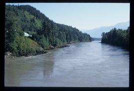
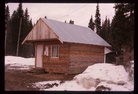
Image depicts a narrow footbridge suspended over a river at an uncertain location.
Image depicts what is possibly the Nass River.
Image depicts what is possibly Hospital Beach in Kitimat, B.C. The facility in the background is possibly the Alcan smelter.
Image depicts the Rearguard Falls in Rearguard Falls Provincial Park near Tête Jaune Cache along the Yellowhead Highway.
Image depicts a view of what is possibly the Yellowhead Pass on the British Columbia-Alberta border, west of Jasper A.B.
Image depicts the Rocky Mountain Trench from McBride, B.C.
Image depicts a view of what is either the Rocky Mountains or possibly the Columbia Mountains near McBride, B.C.
Image depicts a view of what is either the Rocky Mountains or possibly the Columbia Mountains in the background of a small section of McBride, B.C.
Image depicts several houses in McBride, B.C. A mountain is visible in the background.
Image depicts a view of what is either the Rocky Mountains or possibly the Columbia Mountains near McBride, B.C.
Image depicts Mt. Robson.
Image depicts a view of Valemount with numerous mountains in the background.
Image depicts a view of Valemount, with numerous mountains in the background.
Image depicts a view of the Rocky Mountain Trench somewhere near McBride, B.C.
Image depicts the ranch house of the Ranch of the Vikings, originally owned and operated by Bjorger Pettersen, a member of the Canadian Ski Hall of Fame, from 1970 until 1985. It is located somewhere west of McBride, B.C.
Image depicts a view of the Rocky Mountain Trench.
Image depicts the boundary line between British Columbia and Alberta at the Yellowhead Pass.
Image depicts numerous lily pads on the surface of Portal Lake, located near the Yellowhead Pass on the British Columbia-Alberta border, west of Jasper, A.B.
Image depicts a forest service cabin somewhere near Tête Jaune Cache, B.C.
Image depicts the Valemount CN Station.
Image depicts an old road through the trees near Yellowhead Pass. The slide labels it as the origin of the Yellowhead highway.
Image depicts Mt. Fitzwilliam.
Image depicts a house somewhere in McBride, B.C.
Image depicts McBride, B.C.
Image depicts the McBride District Centennial Library.
Image depicts the railway running near Crescent Spur in the Rocky Mountain Trench.
Image depicts several buildings in the community of Loos, B.C.
Image depicts what appears to be a small mill in the community of Crescent Spur, B.C.
Image depicts the old school building in Lamming Mills, B.C.
Image depicts several boarded-up houses in Lamming Mills, B.C.
Image depicts a boarded-up house in Lamming Mills, B.C.
Image depicts the old, boarded-up community hall in Lamming Mills, B.C.
Image depicts the CN Railway and Station at Goat River, B.C.
Image depicts a set of rail road tracks and an old, collapsing log building somewhere in Goat River, B.C.
Image depicts what is possibly the CN Station in Dome Creek, B.C.
Image depicts the CN Station in Dome Creek, B.C.
Image depicts a Catholic Church in Dome Creek, B.C.
Image depicts the community hall in Dome Creek, B.C.
Image depicts a small shack that became the later post office in Dome Creek, B.C.
Image depicts a horse and a barn in Dome Creek, B.C.
Image depicts a strangely shaped orange vehicle somewhere in Dome Creek, B.C.
Image depicts the Fraser River, likely near the Hansard railroad bridge.
Image depicts a flooded area with an old sawdust pile in the background. Likely near McGregor, B.C.
Image depicts several eighteen wheelers at the Pass Lake Road and Upper Fraser Road intersection with numerous houses and buildings in the background in McGregor, B.C. Map coordinates 54°04'38.1"N 121°50'00.1"W
Image depicts bunkhouse, restaurant and store in Sinclair Mills, B.C. Map coordinates 54°01'17.4"N 121°40'53.0"W
Image depicts a pile of old logs on the bank of the Fraser River with mountains in the background. In the foreground, a set of railway tracks run through an uncertain location, likely Upper Fraser, B.C.
Image depicts two dilapidated houses in Sinclair Mills, B.C.
Image depicts several houses, and three goats standing on a narrow dirt road. The location is uncertain, likely Sinclair Mills, B.C.
Image depicts two old shacks and a mountain in the background. Possibly located in or near Longworth, B.C.