Print preview Close
Showing 179 results
Archival description
"Gold Regions of British Columbia"
"Gold Regions of British Columbia"
"Map of Northern British Columbia and the Peace River Country"
"Map of Northern British Columbia and the Peace River Country"
"Map of the Central Section of British Columbia Shewing the Country Served by the Grand Trunk Pacific Railway"
"Map of the Central Section of British Columbia Shewing the Country Served by the Grand Trunk Pacific Railway"
"Pre-Emptor's Map Fort George Sheet" 1915
"Pre-Emptor's Map Fort George Sheet" 1915
"Fort Fraser Division"
"Fort Fraser Division"
"Plan No. 1268 Subdivision of part of Indian Reserve No. 1 Lot 343 Cariboo District British Columbia"
"Plan No. 1268 Subdivision of part of Indian Reserve No. 1 Lot 343 Cariboo District British Columbia"
"Plan No. 1268 Subdivision of part of Indian Reserve No. 1 Lot 343 Cariboo District British Columbia"
"Plan No. 1268 Subdivision of part of Indian Reserve No. 1 Lot 343 Cariboo District British Columbia"
"Pre-Emptor's Map Tete Jaune Sheet" 1919
"Pre-Emptor's Map Tete Jaune Sheet" 1919
"Cariboo District of British Columbia"
"Cariboo District of British Columbia"
"Pre-Emptor's Map Fort George Sheet" 1923
"Pre-Emptor's Map Fort George Sheet" 1923
"Eagle Lake Spruce Mills Ltd. Giscome, British Columbia"
"Eagle Lake Spruce Mills Ltd. Giscome, British Columbia"
"Pre-Emptor's Map Fort George Sheet" 1930
"Pre-Emptor's Map Fort George Sheet" 1930
"Pre-Emptor's Map Fort George Sheet" 1930
"Pre-Emptor's Map Fort George Sheet" 1930
"Pre-Emptor's Map Quesnel Sheet" 1935
"Pre-Emptor's Map Quesnel Sheet" 1935
"Pre-Emptor's Map Fort George Sheet" 1943
"Pre-Emptor's Map Fort George Sheet" 1943
"Fort George" 1944 map
"Fort George" 1944 map
"Fort George" 1944 map
"Fort George" 1944 map
"Pre-Emptor's Map Fort George Sheet" 1949
"Pre-Emptor's Map Fort George Sheet" 1949
"Chilcotin" 1950 map
"Chilcotin" 1950 map
"Eagle Lake Sawmills Ltd. Giscome BC Plan of Sawmill and Adjacent Buildings"
"Eagle Lake Sawmills Ltd. Giscome BC Plan of Sawmill and Adjacent Buildings"
"Isle Pierre, British Columbia" 1952 map
"Isle Pierre, British Columbia" 1952 map
"Isle Pierre, British Columbia" 1952 map
"Isle Pierre, British Columbia" 1952 map
"Salmon Valley, British Columbia" 1954 map
"Salmon Valley, British Columbia" 1954 map
"Surficial Geology, Anahim Lake, British Columbia"
"Surficial Geology, Anahim Lake, British Columbia"

PP 160 - Conditions after Logging of a Spruce-Balsam Forest in Relation to Spruce Reproduction and to the Rate of Growth of the Second Story
"Giscome, British Columbia" 1961 map
"Giscome, British Columbia" 1961 map
"Prince George" map
"Prince George" map
"Sinclair Mills, British Columbia" 1961 map
"Sinclair Mills, British Columbia" 1961 map
"Giscome" 1961 map
"Giscome" 1961 map
Development Study - Northern Resources
Development Study - Northern Resources
"Quesnel, British Columbia" 1966 map
"Quesnel, British Columbia" 1966 map
Skeena Kraft Limited Press kit
Skeena Kraft Limited Press kit
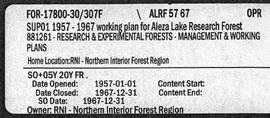
Aleza Lake Research Forest - Management and Working Plan - 1957-1967 - Supplement
"Prince George" 1967 map
"Prince George" 1967 map

Aleza Lake Various Historical Records
"British Columbia Relief Map"
"British Columbia Relief Map"
3 July 1968 Flight - Photos 27900-27999
3 July 1968 Flight - Photos 27900-27999
"Taseko Lakes, British Columbia" 1969 map
"Taseko Lakes, British Columbia" 1969 map
"Bonaparte Lake, British Columbia" 1969 map
"Bonaparte Lake, British Columbia" 1969 map
"Prince George, British Columbia" 1969 map
"Prince George, British Columbia" 1969 map
8 Sept. 1969 Flight - Photos 41243-41329
8 Sept. 1969 Flight - Photos 41243-41329
10 Sept. 1969 Flight - Photos 41644-41655
10 Sept. 1969 Flight - Photos 41644-41655
"Mount Waddington, British Columbia" 1969 map
"Mount Waddington, British Columbia" 1969 map
"McLeod Lake, British Columbia" 1969 map
"McLeod Lake, British Columbia" 1969 map
8 Sept. 1969 Flight - Photos 41334-41361
8 Sept. 1969 Flight - Photos 41334-41361
8 Sept. 1969 Flight - Photos 41404-41407
8 Sept. 1969 Flight - Photos 41404-41407
9 Sept. 1969 Flight - Photos 41540-41643
9 Sept. 1969 Flight - Photos 41540-41643
"Quesnel, British Columbia" 1969 map
"Quesnel, British Columbia" 1969 map
9 Sept. 1969 Flight - Photos 41439-41539
9 Sept. 1969 Flight - Photos 41439-41539
"British Columbia" 1970 map
"British Columbia" 1970 map