Print preview Close

Showing 841 results

Archival description
761 results with digital objects Show results with digital objects
2023.2.2.6 · Subseries · 1983-2010
Part of Dr. Paul Sanborn fonds

During the 1980s, Agriculture Canada pedologists Scott Smith (retired from Summerland Research Station, formerly based in Whitehorse) and Charles Tarnocai (retired from Central Experimental Farm, Ottawa) had a large field program which addressed the trends in soil development in the central Yukon. Across this region, particularly between Whitehorse and Dawson City, the land surfaces and surficial deposits vary greatly in age due to the differing extents of glaciations over the past ~2 million years.

This work built on a pioneering study from the previous decade:
Foscolos, A.E., N.W. Rutter, and O.L. Hughes. 1977. The use of pedological studies in interpreting the Quaternary history of central Yukon Territory. Bulletin 271. Geological Survey of Canada, Ottawa. 48 p. https://doi.org/10.4095/103066

Tarnocai and Smith presented their results in two publications:
C. A. S. Smith, C. Tarnocai, and O. L. Hughes. 1986. Pedological investigations of Pleistocene glacial drift surfaces in the central Yukon. Géographie physique et Quaternaire, 40 (1): 29–37. https://doi.org/10.7202/032620ar
Tarnocai, C. and C. A. S. Smith. 1989. Micromorphology and development of some central Yukon paleosols, Canada. Geoderma 45 (2): 145-162. https://doi.org/10.1016/0016-7061(89)90047-5

Tarnocai and Smith shared the unpublished data and soil samples from this work with Dr. Paul Sanborn, and this resulted in a student project published as:
Daviel, E., P. Sanborn, C. Tarnocai, and C.A.A. Smith. 2011.Clay mineralogy and chemical properties of argillic horizons in central Yukon paleosols. Canadian Journal of Soil Science 91: 83-93. https://doi.org/10.4141/cjss10067

2023.2.2.7.1 · File · 1960, 1971, 1989
Part of Dr. Paul Sanborn fonds

In July 2009, Dr. Paul Sanborn undertook the first soils field research at the Fort Selkirk volcanic field in central Yukon, with helicopter support and funding from the Yukon Geological Survey. This file consists of prints of aerial photographs that depict the area accessed for the study, upstream from the confluence of the Yukon River and the Pelly River.

Air photographs include:
Flight line A17210, Photo Nos. 54-60 (taken 1960)
Flight line A22354, Photo Nos. 43-45, 47-48 (taken 1971)
Flight line A27516, Photo Nos. 48-52 (taken 1989)

Archie Creek Site
2023.2.2.10.2 · Sub-subseries · 1993-2001
Part of Dr. Paul Sanborn fonds

The Archie Creek site is the informal name used for a research installation established in 1971 east of Prince George by the Canadian Forest Service, and subsequently abandoned by the end of that decade. Dr. Paul Sanborn revisited the site in 1995, and sampled forest floors and mineral soils across a range of conifer-broadleaf mixtures established by natural establishment of broadleaf trees among planted lodgepole pines.

Details of the site conditions, sampling methods, and results were published in:
Sanborn, P. 2001. Influence of broadleaf trees on soil chemical properties: A retrospective study in the Sub-Boreal Spruce Zone, British Columbia, Canada. Plant and Soil 236: 75–82. https://doi.org/10.1023/A:1011973402414

Archie Creek site data
2023.2.2.10.2.7 · File · 1995-1996
Part of Dr. Paul Sanborn fonds

File contains the following data sets:

  • Archie Site Tree Data.xls [diameter (dbh) and basal area of trees within and overhanging plots]
  • Archie Site non-woody forest floor properties (1995).xls [non-woody forest floor chemical properties – individual sample results & plot means]
  • Archie Site woody forest floor component properties (1995).xls [total C, N & S concentrations, pool sizes for woody forest floor components]
  • Archie Site mineral soil properties (1995).xlsx [0-20 cm mineral soil chemical properties – individual sample results & plot means]
  • Archie Site forest floor mass (1995).xlsx [mass per unit area of non-woody & woody forest floor components, corrected to oven-dry basis]
  • S221FINL.xls [MoF lab data report: non-woody forest floor components]
  • S222FINL.xls [MoF lab data report: woody forest floor components]
  • S251FINL.xls [MoF lab data report: 0-20 cm mineral soil]
Archie Creek slides
2023.2.2.10.2.8 · File · Sept. 1995
Part of Dr. Paul Sanborn fonds

File contains 2 rolls (51 slides) taken September 25-26, 1995 that depict paired views of plot vegetation and forest floor surface. Handwritten number notations on slide frames indicate plot numbers from the original research installation.

2023.2.2.13.2.07 · Item · 8 Jul. 2007
Part of Dr. Paul Sanborn fonds

This image is part of the outbound sequence of aerial images obtained on the helicopter flight to the Klutlan Glacier study site. The sequence starts from the base camp at the White River crossing on the Alaska Highway and heads south, to a point just upvalley of the debris-covered terminus (approx. 10-15 km from Alaska border), and turning back north to the landing spot on the Generc River floodplain close to the study site (see Fig. 1 in paper).

2023.2.2.1.2.2 · Item · [between 2002 and 2005]
Part of Dr. Paul Sanborn fonds

This document file "Cluculz Creek Fertilization Research Site.pdf" contains a field description and basic characterization data for a representative pedon at the E.P. 886.10 site.

2023.2.2.1.2 · Sub-subseries · 2001-2005
Part of Dr. Paul Sanborn fonds

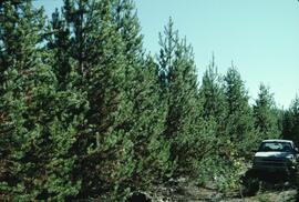
During Dr. Sanborn's years with the Ministry of Forests research program (1991-2002), he worked on forest fertilization research with silviculturist Rob Brockley (retired; formerly at Kalamalka Research Station, Vernon, BC). Brockley’s work in the 1980s and early 1990s had documented the widespread pattern of sulphur deficiencies across the BC interior, and the superior response of managed stands to fertilization treatments involving sulphur (S) and nitrogen (N) rather than nitrogen alone.

To progress farther, different methods for understanding the fate of sulphur fertilizers in forests and soils were needed. Sanborn contacted the stable isotope group at the University of Calgary which had done important work on the fate of pollutant sulphur emitted by oil and gas extraction and processing in Alberta, using natural abundances of sulphur stable isotopes as a tracer. This was the beginning of a collaboration with Dr. Bernhard Mayer of the University of Calgary, and also with his German soil scientist colleague, Dr. Joerg Prietzel (Munich Technical University).

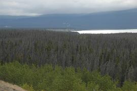
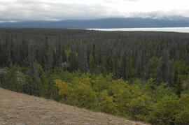
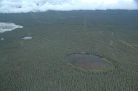
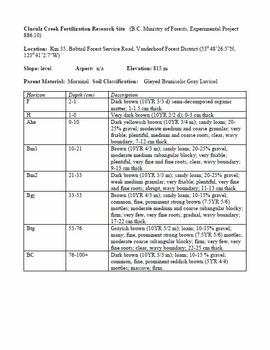
The research team engaged in the Cluculz retrospective study (E.P. 886.10) for the BC Ministry of Forests.

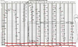
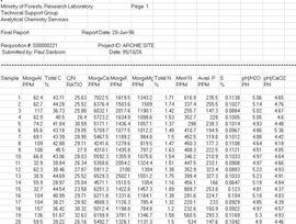
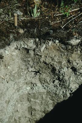
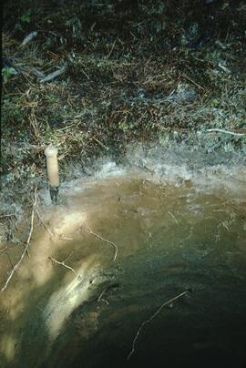
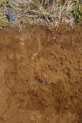
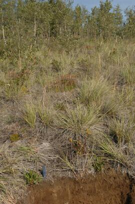
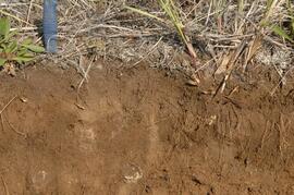
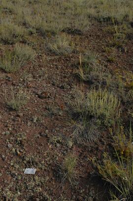
An ancillary project involved resampling (2002 - foliage, 2003 - soil) of a previously fertilized (1990) installation (E.P. 886.10) south of Cluculz Lake in order to compare the longer-term effects of different fertilizer sulphur forms on soil and foliage chemical properties. Results were published as a journal article and a Ministry of Forests Extension Note:

Sanborn, P.T., J. Prietzel, R.P. Brockley. 2005. Soil and lodgepole pine foliar responses to two fertilizer sulphur forms in the Sub-Boreal Spruce zone, central interior British Columbia. Can. J. For. Res. 35 (10): 2316-2322. https://cdnsciencepub.com/doi/abs/10.1139/x05-138

Sanborn, P. and R. Brockley. 2005. Sulphur deficiencies in lodgepole pine: occurrence, diagnosis, and treatment. Ext. Note 71. B.C. Min. For., Res. Br., Victoria, B.C. https://www.for.gov.bc.ca/hfd/pubs/docs/en/En71.pdf