Print preview Close
Showing 59 results
Archival description
"Project Completion Report to the Science Council of British Columbia: Effects of Prescribed Fire on Sulphur in Forest Soils"
Extension Note 71: "Sulphur deficiencies in lodgepole pine: occurrence, diagnosis, and treatment"
"FRBC 2001 Sustainable Harvest Silviculture Study - Sulfur Fertilization Trial - Project# OPM 02408-720765 - Preliminary Final Report"
"Annual Operational Report - Forest Innovation Investment Project: R2003-0245 - Sulphur Fertilization of Lodgepole Pine: A Staple Isotope Tracer Study"
"Sulphur Fertilization of Lodgepole Pine: A Stable Isotope Tracer Study (Ministry of Forests E.P. 886.15) - Project Y051210 - Technical Report to the Forest Science Program"
"Sulphur Fertilization of Lodgepole Pine: A Stable Isotope Tracer Study (Ministry of Forests E.P. 886.15) - Project Y051210 - Final Technical Report to the Forest Science Program"
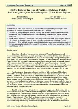
"Stable Isotope Tracing of Fertilizer Sulphur Uptake: Preliminary Data from Prince George and Nelson Forest Regions"
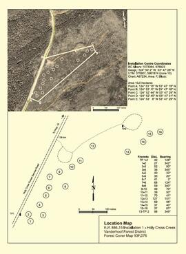
"Location Map - E.P. 886.15 Installation 1 - Holy Cross Creek"

"Location Map - E.P. 886.15 Installation 2 - Kenneth Creek"
"Mineralogy of clay and sand fractions of soils developed from till, glaciofluvial and glaciolacustrine deposits in central interior British Columbia"

Ministry of Forests internal memorandum "Re: Evaluation of BaCl₂ method for soil cations"
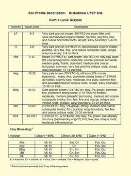
"Soil Profile Description: Kiskatinaw LTSP Site"
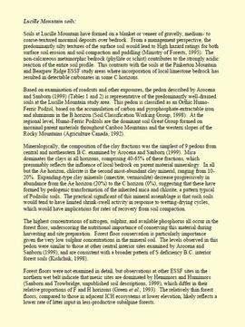
"Lucille Mountain soils"
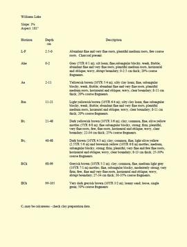
"Profile Descriptions"
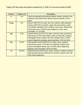
"Topley LTSP site pedon description"

"Paleosol Studies at Inlin Brook, NWT: August, 2004 - Report to the Geological Survey of Canada"
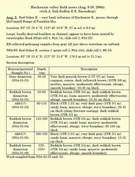
"Mackenzie valley field notes (Aug. 9-10, 2004)"
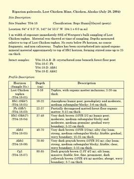
"Riparian paleosols, Lost Chicken Mine, Chicken, Alaska (July 20, 2004)"
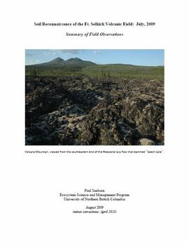
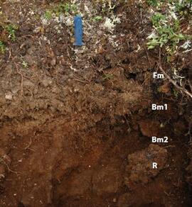
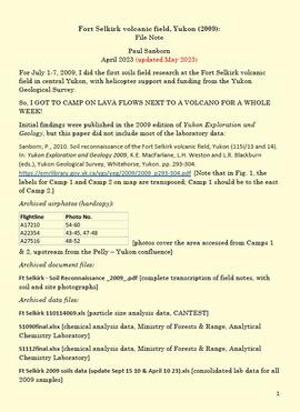
"Soil Reconnaissance of the Ft. Selkirk Volcanic Field: July, 2009 - Summary of Field Observations"
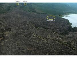
Holocene basalt flows south of Volcano Mountain
Site Y09-05 annotated profile
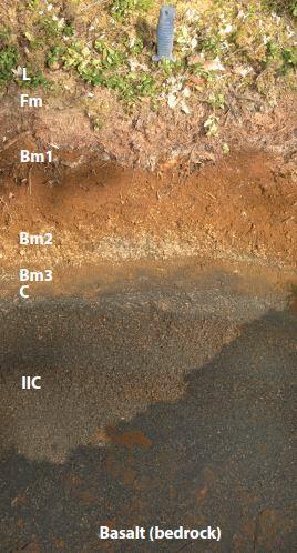
Site Y09-12 annotated profile
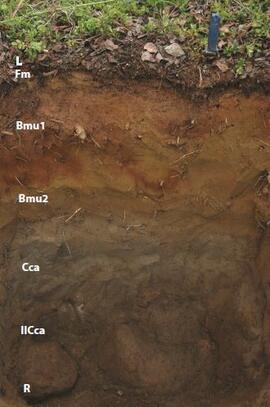
Site Y09-18 annotated profile
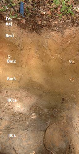
Site Y09-19 annotated profile

Site Y09-21 annotated profile
Fort Selkirk volcanic field, Yukon
"The Pedological Record of Loess Deposition, Fire, and Slope Processes: Kluane Lake, Yukon"
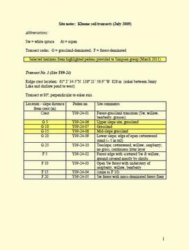
Site notes: Kluane soil transects
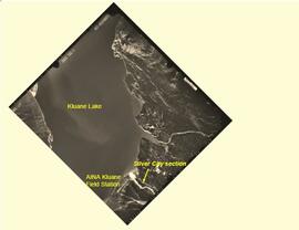
Silver City section (site Y03-11) soil charcoal samples

"AMS Radiocarbon Dates for Soil Charcoal in Holocene Loess - Kluane Lake, Yukon Territory - 2004 Samples"
"AMS Radiocarbon Dates for Soil Charcoal in Holocene Loess - Kluane Lake, Yukon Territory - 2008 Samples"

Forest Research Note #PG-12: "Experimental Project 660 - Overview of Three Experimental Installations - A 30-year Progress Report"

Forest Research Note #PG-12-1: "Experimental Project 660 - 30-year Progress Report - Buckhorn Installation"
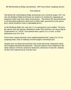
EP 660 Buckhorn Ridge installation: 1997 forest floor sampling details
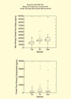
EP 660 Buckhorn 1997 forest floor graphs
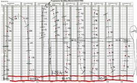
Archie Creek plot layout sketch map
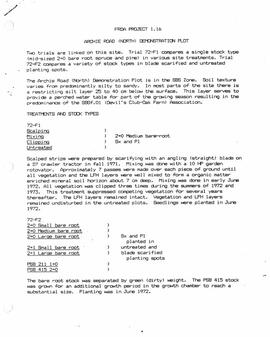
"FRDA Project 1.16 - Archie Road (North) Demonstration Plot"
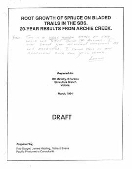
"Root Growth of Spruce on Bladed Trails in the SBS: 20-year results from Archie Creek"
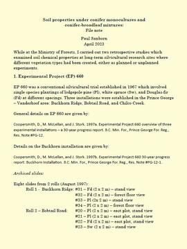
Soil properties under conifer monocultures and conifer-broadleaf mixtures
"Final Report on Seed Project: Plant-Derived Opal as a Soil Indicator of Vegetation Change in Response to Prescribed Burning - Project M-K-2001-2002-81"

MK Soils Project - 2001 - General Vegetation Descriptions
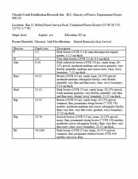
Cluculz Creek Fertilization Research Site
Forest soil sulphur research
Regional soil mineralogy study
Descriptions and Properties of Riparian Paleosols, Gold Bottom, Yukon Territory

Paleosols at the Goldbottom site, Klondike goldfields
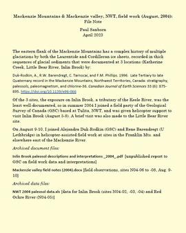
Mackenzie Mountains and Mackenzie Valley, NWT field work

Paleosols at the Lost Chicken Mine, Chicken, Alaska
Agriculture Canada pedological research in the central Yukon
Soils research at Kluane Lake, Yukon