2020.4.8.2.003
·
Item
·
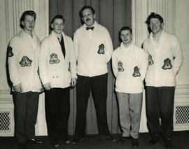
1956
Part of G. Gary Runka fonds
Photograph depicts the 1956 High School Curling Peace River District champions of the Peace Curling Association. Coach at centre. G. Gary Runka at far right.