File consists of records created and accumulated by Gary Runka over the course of his consultancy work for Transport Canada for the "Drainage and Integrated Land Use Investigation - Boundary Bay Airport" project in Vancouver. This file was numbered as G.G. Runka Land Sense Ltd. client file #131; that client number may be seen referenced elsewhere in the G. Gary Runka fonds. The Land Sense Ltd. client files generally include records such as correspondence, contracts, invoices, project reports, publications, ephemera, memoranda, maps or map excerpts, legal documents, meeting materials, clippings, and handwritten notes. File also includes an accompanying oversize aerial photograph.
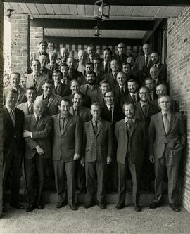
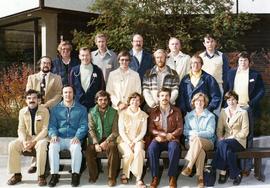
File consists of records created and accumulated by Gary Runka over the course of his consultancy work for Boundary Bay Farms Ltd. for the "Boundary Bay Airport Farmland" project in Delta. This file was numbered as G.G. Runka Land Sense Ltd. client file #122; that client number may be seen referenced elsewhere in the G. Gary Runka fonds. The Land Sense Ltd. client files generally include records such as correspondence, contracts, invoices, project reports, publications, ephemera, memoranda, maps or map excerpts, legal documents, meeting materials, clippings, and handwritten notes. File also includes 5 accompanying photographs.
Photograph depicts Gary Runka receiving a Agricultural Institute of Canada Fellow award at the 1990 AIC Convention at the Penticton Conference Centre.
Subseries consists of publications, manuscripts, and drafts of worked written, co-written, or edited by G. Gary Runka over the course of his career. Also includes conference proceedings that contain contributions by G. Gary Runka.
This fonds illustrates the life and work of G. Gary Runka and his contributions to the province of British Columbia. Gary Runka was the first General Manager of British Columbia's Agricultural Land Commission and helped establish the provincial Agricultural Land Reserve. After transitioning from a government career to private consulting, Runka provided comprehensive professional services through his land consultancy business, G.G. Runka Land Sense Ltd., offering land capability and environmental assessments, integrated resource management, land and water use conflict resolution, and interdisciplinary land use planning. Described by colleagues as one of BC's most highly respected agrologists and influential land use planners, Runka had a 52-year career working on (or against) an incredible number of landmark projects in British Columbia, such as the Site C Project. Gary Runka’s partner in life and vocation, Joan M. Sawicki, worked with Gary on many of these projects—as well as her own; her contributions are also represented throughout the records of this fonds.
Gary Runka's deep connection to the land is evident from his earliest papers on aerial photo interpretation, his work with the Canada Land Inventory, through his speeches and his work establishing the BC Agricultural Land Reserve and in his subsequent consulting career through G.G. Runka Land Sense Ltd. Gary Runka's influence and legacy was recognized in the tributes paid after his death, including the post-humus award as the Real Estate Foundation's "Land Champion" for 2014.
The G. Gary Runka fonds has been divided into the following nine series:
1) Personal Records
2) Speeches & Publications
3) Professional Records
4) Agricultural Land Commission
5) Land Sense Ltd.
6) Client Files
7) Maps
8) Photographs
9) Digital Records
Photograph is a group portrait of the attendees at the Federal-Provincial Canada Land Inventory Coordinators Meeting in Victoria, March 31-April 1, 1971. Starting from the back row, left to right, attendees included: John Senyk, B.C.; Jim Allin, B.C.; Fred Frederickson, B.C.; Red Ward, Ontario; George Rathwell, Saskatchewan; John Foster, Ottawa, Charlie Rowles, B.C.; David Glover, Ottawa; Bill Yeomans, B.C.; Don Coombs, Ottawa; Harold Hoyt, N.B.; Brian King, Ottawa; Art Benson, B.C.; Scott Johnston, Ottawa; Dan Blower, B.C.; Vic Solman, Ottawa; Don Benn, B.C.; Dick Spilsbury, B.C.; Les Lavkulich, B.C.; Doug Lacate, B.C.; John Wilcox, B.C.; Alf Leahey, B.C.; Mike Romaine, Ottawa; Dick Marshall, B.C.; Gary Runka, B.C.; Norm Sprout, B.C.; Ken Beanlands, Newfoundland; Mick Roberts, Ottawa; Paul Lajoie, Ottawa; Pat Duffy, Ottawa; Bert Brink, B.C.; Merv McKay, Manitoba; Rich Goulden, Manitoba; Reg McCormack, Ottawa; Gerry Howell-Jones, B.C.; Marcel Belzile, Quebec; Paul Deane, Ottawa; Laurie Farstad, B.C.; Stu Scott, Alberta.
Slide depicts two eagles in an enclosure. The photograph was taken in Kaleden, BC. Original slide index description: "Eagles, Kaleden."
Photograph depicts a curling team at a Feb. 1964 Summerland Curling Club event. Trophy at centre reads "L.A. Smith Ltd. Event". From left to right: Unknown, Brian McCormick, Gary Runka, Art (surname unknown).
Series consists of the client file project records of G.G. Runka Land Sense Ltd., Gary Runka's consultancy business (co-owned with Joan Sawicki until 1991). G.G. Runka Land Sense Limited was incorporated as a company on 30 Nov. 1978 and dissolved on 30 Nov. 2018. Most business activity ceased after Gary Runka's death in July 2013. The company provided comprehensive professional services in land inventory, environmental assessment, integrated resource management, land and water use conflict resolution and interdisciplinary land use planning. Over the course of the company's operation, Gary Runka and his firm consulted on 681 assignments ranging from very large projects (such as the Site C project) to small residential/commercial land capability assessments.
The Land Sense Ltd. client files generally include records such as correspondence, contracts, invoices, project reports, publications, ephemera, memoranda, map excerpts, legal documents, meeting materials, clippings, and handwritten notes. Some client files are accompanied by related maps, photographs, aerial photographs, and/or digital records on storage media.
Slide depicts cherry trees blossoming in an orchard. Original slide index description: "Cherry blossoms Lakeview Heights."
Slide depicts a close up of cherry blossoms on a branch. Original slide index description: "Cherry blossoms Kel."
Photograph is a group portrait of the attendees at a Canada National Land Use meeting. Back row, left to right: Gary Runka, Bruce Chambers, Frank Heaps, Vern Spencer, Peter Whiting. Middle row, left to right: Bob Scace, Lee Munn, Bill Bourgeois, Jim Murphy, Gerry Acott, Dave Rochefort. Front row, left to right: Mike Simmons, Les Cooke, John Hetherington, Betty McGregor, Daniel Paquette, Peggy Thompson, Patsy Murphy.
Photograph is a group portrait of the Canada Land Inventory team , possibly related to the National Soil Survey. Individuals identified: Norm Sprout (back row, 5th from left); Les Lavkulich (back row, 6th from left); Dr. Charlie Rowles (back row, 6th from right); Pat Duffy (3rd row back, 6th from right); Gary Runka (3rd row back, 5th from right).
Slide depicts a close up of a camel behind a fence. The photograph was taken in Kaleden, BC. Original slide index description: "Camel, Kaleden."
Slide depicts a camel and two llamas in an enclosed pasture. The photograph was taken in Kaleden, BC. Original slide index description: "Camel & Llamas in pasture, Kaleden."
Slide depicts a mixture of bighorn sheep and fallow deer around a trough. The photograph was taken in Kaleden, BC. Original slide index description: "illegible sheep & fallow deer, Kaleden."
Photograph is a group portrait of the British Columbia Canada Land Inventory team. Back row, left to right: Rob Hawes, unknown, Ivan Cotic, Terje Vold, John Wilcox [?], Keith Valentine, unknown, Alec Green [?], Horst Baender, Dick Marshall, unknown, John Senyk, Bill Watt, Neville Gough, Dan Blower, unknown, Gavin Young, Craig Brownlee. Middle row, left to right: unknown, Peter Murtha, unknown, unknown, John Harris, Al Aldred, Gary Runka, Ed Oswald, Mary Redmond. Front row, left to right: Rick Williams, Gerry Howell-Jones, Chris Stanley-Jones, Larry Lacelle, John Jungen, Tom Pierce, Jim Van Barneveld.
Photograph is a group portrait of BC Agricultural Land Commission staff members at a Christmas party. Back row, left to right: Patti, Terry Lewis, unknown, Julie Glover, Gordon Gram, Gary Holisko, Kirk Miller, unknown, Shirley Brightman. Middle row, left to right: Eve Lew, Jim Plotnikoff (Santa). Front row, left to right: Verona Hoosen, unknown, Jane Perch, Denise Jankovich, unknown, unknown.
Series consists of records created and collected by Gary Runka during and after his time with the British Columbia Agricultural Land Commission. In the early 1970s, Runka served as the first general manager of the BC Agricultural Land Commission, the independent provincial body that has administered BC's Agricultural Land Reserve (ALR) for over 40 years. As the first manager, Runka spearheaded the establishment of the ALR undertaking the technical tasks of setting ALR agricultural use boundaries, policies and procedures, as well as the building awareness and support for farmland preservation within government and with the public. He later served as Commission chair. Records include correspondence, informational material, publications, clippings, news releases, memoranda, symposium/conference material, reports, speech notes, and other textual material. Also includes seven maps, two buttons, six floppies, eighty slides, and one audio cassette tape.
Slide depicts an apple tree blossoming in a backyard. The yard is surrounded by a wooden fence. Original slide index description: "Apple blossoms Kelowna."
Slide depicts a tree with apple blossoms in a backyard of a brown house. The yard is surrounded by a wooden fence. The neighbor's white house can be seen next door. Photographed in Kelowna, BC. Original slide description: "Apple Blossom bkyd. Kel."
Photograph depicts recipients of the 1990 Agricultural Institute of Canada Fellow award at the 1990 AIC Convention at the Penticton Conference Centre. Gary Runka is third from right.
Air photograph depicts a segment of the West Coast Trail showing the beach area around Tsusiat Point Hole in the Wall. Coding on aerial is "BCO 389".
Air photograph depicts a segment of the West Coast Trail showing the beach area around Tsusiat Falls. Coding on aerial is "BCO 387".
Air photograph depicts a segment of the West Coast Trail showing the beach area around Tsusiat Falls. Coding on aerial is "BCO 388".
Air photograph depicts a segment of the West Coast Trail showing the beach area around the cabins at Nitinat Narrows. Coding on aerial is "BCO 390".
Air photograph depicts a segment of the West Coast Trail showing the beach area around the Carmanah Point Light Station. Coding on aerial is "BCO 391".
Annotated air photograph depicts Scout Island Nature Centre in Williams Lake and surrounding areas.
Photograph depicts the 1956 High School Curling Peace River District champions of the Peace Curling Association. Coach at centre. G. Gary Runka at far right.