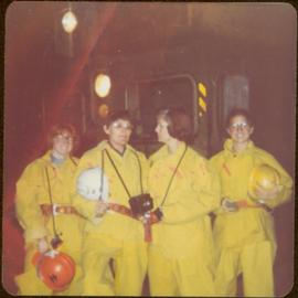
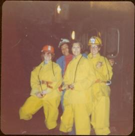
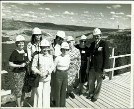
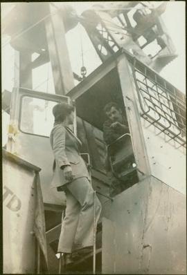
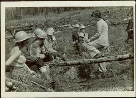
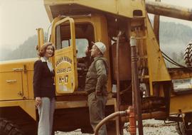
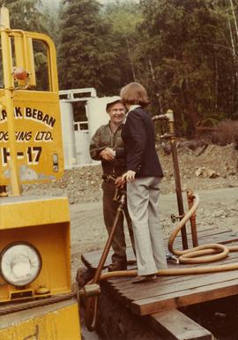
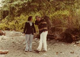
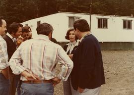
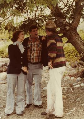
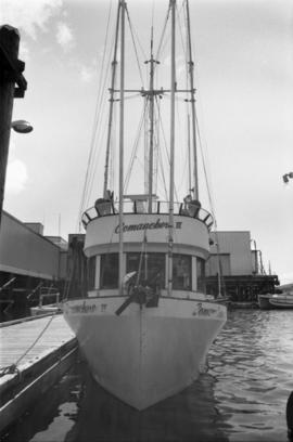
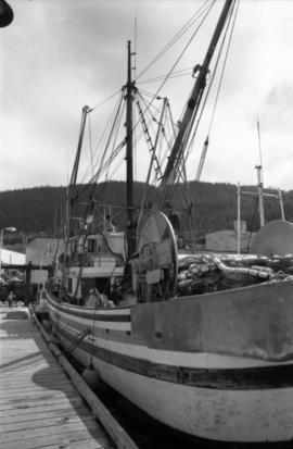
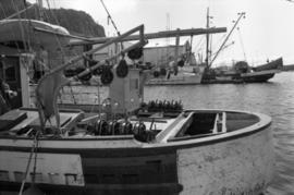
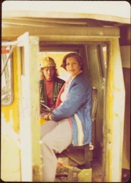
Handwritten annotations on verso read: “Granisle Mine,” and “woman operators on strip mine”.
Semi-visible sign reads: “Supertanks - Pipelines S.O.S.”
Sign in foreground reads: “Stop Bull Shitting, [Phoney (crossed out)] Ioney”.
Handwritten annotation on verso reads: “The Kitimat Oil Port Environmental Lobby, didn’t believe I killed it. I did!”
Photograph depicts crowd with individuals holding protest signs.
Machinery visible in background.
Handwritten annotations on verso read: “Stewart, B.C.,” and “Bottom: at Granduc Copper mine with Mary Schindel, I drove the ‘Mitzie’”.
Machinery visible in background.
Handwritten annotation on verso reads: “John Lundquist, Mary Schindel”.
Campagnolo stands on ladder of machine.
Iona leans against a fallen tree and rests her own hardhat on her knee.
Subseries consists of documents and correspondence regarding the Department of Energy, Mines and Resources and issues about mining, energy generation, and pipelines in northern British Columbia. Includes correspondence about the state of energy in Canada; wind, solar, and other forms of alternative energy; conservation of energy; use of nuclear power, coal, oil, and natural gas in Canada; and general inquiries about the oil and gas industry. Also includes correspondence regarding proposed mining projects, particularly in northern BC; the development of pipelines in Canada; the environmental impacts of mining and pipelines; and inquiries and statements of opinion about proposed pipelines such as the Kitimat-Edmonton pipeline, the Mackenzie Delta pipeline, and the Alaska Alcan pipeline. Supplemental records accompany much of the correspondence and include reference material, newspaper articles, and informational reports.
Subseries consists of correspondence relating to the Department of Environment (Environment Canada), the Department of Fisheries and Oceans (Fisheries and Oceans Canada), and environmental issues. Includes correspondence regarding Ministry of Environment programs and procedures; the Canadian forestry industry; forestry licenses; pollution and legislation controls for industry pollution; oil spills; polychlorinated biphenyl pollution; floods and flood control mechanisms; dams and stream diversions; trapping legislation; and wildlife conservation. Also includes correspondence regarding inquiries intro fisheries management legislation and policies; fisheries licensing; salmon fisheries issues; inquiries and statements of opinion about the yearly seal hunt; whale conservation; the economic zone off-shore fishing limits; small craft harbours; sport fishing; and the roe herring fishery. Contains speeches given by the Minister of Environment or given on his behalf and news releases from Fisheries and Oceans Canada.
Subseries consists of correspondence and accompanying informational material related to the Department of Industry, Trade and Commerce and northern British Columbia commercial issues. Records include press releases, reports, informational pamphlets, brochures, and newspaper clippings. Includes correspondence regarding industrial research and development in northern BC; Cassiar Asbestos mine improvements; the Vancouver Trade and Convention Centre; conversion to the metric system; Trident Trigull aircraft; the Federal Business Development Bank; the Enterprise Development Program; and inquiries to the Ministry of State for Small Business.
Publication contains background paper for parliamentarians entitled "Mining in Canada: The Reality and the Promise" by John DeGrace of the Research Branch, Library of Parliament.
Publication contains booklet entitled "Canadian Crude Oil Supply-Demand Outlook and Related Issues" which was submitted to the West Coast Oil Ports Inquiry.
Publication contains an abridged version of the publication entitled "Termpol Assessment of the Navigational and Environmental Risks Associated with the Proposal of Kitimat Pipe Line Ltd. to Construct a Marine Oil Terminal at Kitimat, B.C." published by Transport Canada Coast Guard.
Publication contains an "Interim Submission of Kitimat Oil Coalition to West Coast Oil Ports Inquiry" published in Vancouver, BC.
Publication is entitled "West Coast Oil Ports Inquiry Statement of Proceedings", a summary of the proceedings of the inquiry commissioned by the Government of Canada into oil tanker ports and tanker traffic on the Canadian west coast.
Publication is entitled "Prince Rupert Bulk Loading Facility: Phase 2 Environmental Assessment of Alternatives" by the Northcoast Environmental Analysis Team.
Publication is entitled "Proposal for a New Grain Terminal at Prince Rupert", which outlines a grain shipping terminal at Prince Rupert, its design, a suggested site and estimated costs.
Publication contains report entitled "General Description of Ridley Island Coal Terminal Facilities, Prince Rupert, B.C." for Neptune Bulk Terminals Ltd.
Map depicts the whole of Canada and notes: gas pipelines, gas gathering lines, proposed gas pipelines, oil pipelines, oil gathering lines, proposed oil pipelines, gas fields, oil fields, refining centres, extraction plants, and oil sands. There is a smaller subsequent map of Alberta highlighting these features in greater detail.
Map depicts proven on & offshore oil & gas areas, and probable oil & gas areas in less then 1000' water. The map conveys the North Pole in the centre and spans out to include Canada, Europe and the "Union of Soviet Socialist Republics."
Map depicts producing mines and prospects in British Columbia and parts of Alberta.
Map depicts various gas projects across North America including: the "El Paso Project" along American and Mexican boarder; the "Arctic Gas Project" which runs from the Beaufort Sea through Alberta towards San Francisco and Chicago; the "Alcan Project" which runs through Alaska, British Columbia, Alberta and onwards to San Francisco and Chicago; the "Maple Leaf Project" which runs from the Beaufort Sea into Alberta; and the "Polar Gas Project" which runs from the Parry Islands and circles the Hudson Bay towards Quebec.
Map depicts existing oil lines, oil lines proposed or under construction, product lines, existing gas lines, gas lines proposed or under construction, LPG lines, and LPG lines proposed in Canada and Northern USA.
Map depicts the Coast of British Columbia and Federal and Provincial proposed fishing boundaries, including the 200 mile limit.
Map depicts the regional district of Kitmat, but is extensively annotated showing the proposed route of the Kitmat Truck Ferry, running through Terrace and up into the "Yukon Markets," and the Kispiox Connector, running from Prince Rupert to Hazelton and further East along Highway 16 and north along the Kispiox River.
Map depicts annotations of the freight-way routes throughout British Columbia. These routes include: the Garnet Enterprise Truck Haul from Vancouver to Terrace, the Canadian Freightways from Vancouver to Edmonton to Alaska; the Lindsay Transfer from Terrace to Dease Lake and Telegraph Creek; and the Northland Navigation roll-on and roll-off service.
Map depicts the shipping highway routes across Canada. Primary, secondary, and access routes are noted as-well as proposed routes.
Map depicts proposed industrial area outside of Terrace, British Columbia.
Map depicts existing harbour development in Stewart, with an enlargement of the west side of the harbour.
Satellite map of the district of Kitimat for the purpose of developing an industrial corridor.
Proposed master plan for the inner areas of Kitimat Port. Drawing includes proposed terminal area, industrial terminal, future forest products terminal, bulk terminal, and the industrial corridor.
Technical drawing of the proposed boat basin in Kitimat depicts the tailings opening into the port on the upper NE corner of the proposed port.
Technical drawings of the proposed boat basin in Kitimat depicts the tailings opening to be in the middle of the proposed port facing east.
Detailed floor plan for fish-processing plant in Port Simpson. The drawing includes production plan showing locations of the workers.
Photograph depicts a Dorosz Tool Company tri-cone rock bit on a Prince Rupert pamphlet.
Photograph depicts two fisherman on a boat--one holding a crab trap and another looking at the catch.
Photograph depicts Iona Campagnolo talking with an unidentified employee of Frank Beban Logging standing beside a large piece of heavy machinery.
Photograph depicts Iona Campagnolo talking with an unidentified employee of Frank Beban Logging while standing beside a large piece of heavy machinery.
Photograph depicts Iona Campagnolo shaking hands with an unidentified employee of Frank Beban Logging while standing beside a large piece of heavy machinery.
Photograph depicts Iona Campagnolo talking with a logging truck driver of Frank Beban Logging at Athili Gwaii (Lyell Island) during a 1978 Skeena riding tour.
Photograph depicts Iona Campagnolo talking with a group of logging truck drivers at the Frank Beban Logging camp in Athili Gwaii (Lyell Island) during a 1978 Skeena riding tour.
Photograph depicts Iona Campagnolo talking with two unidentified logging truck drivers at the Frank Beban Logging camp in Athili Gwaii (Lyell Island) during a 1978 Skeena riding tour.
Photograph depicts a shipping terminal in Prince Rupert. Shipping containers are in the distance.
Photograph depicts a shipping terminal in Prince Rupert. The ocean is visible in the background.
Photograph depicts a shipping terminal in Prince Rupert. The photo is taken from a hill, and several shipping containers sit in the almost empty lot. The ocean is visible in the background.
Photograph depicts the "Comanchero II" boat in the Prince Rupert Marina. Another building and boat are visible in the background.
Photograph depicts an unidentified fishing boat at the Prince Rupert marina. An unidentified person stands beside a building in the far background.
Photograph depicts an unidentified fishing boat at the Prince Rupert marina. Several other fishing boats are visible in the background.