2007.05.1.01
·
Item
·
[1937?]
Part of Charles Bedaux Expedition Collection
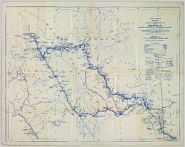
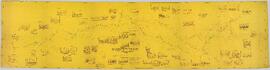
Northern BC Archives holds a photocopy and a more contemporary reproduction (exact date unknown) of Lamarque's "Plan of the region about the 58th parallel from longitude 124 30' to longitude 130 west, northern British Columbia, Canada" that documents the Bedaux Expedition route through northern BC. This very lengthy map includes inset sketches of various locations along the Bedaux Expedition route.