2008.2.041
·
Item
·
10 July 1981
Part of NBCA Maps and Plans Collection
27 results with digital objects
Show results with digital objects
2008.2.043
·
Item
·
[1943?]
Part of NBCA Maps and Plans Collection
This engineering plan shows, in detail, the planned route construction for the Alaska Highway by the U.S. Army Corps of Engineers.
2008.2.042
·
Item
·
1943
Part of NBCA Maps and Plans Collection
This engineering plan shows, in detail, the planned route construction for the Alaska Highway by the U.S. Army Corps of Engineers.
2008.2.049
·
Item
·
Aug. 1961
Part of NBCA Maps and Plans Collection
2008.2.050
·
Item
·
[196-?]
Part of NBCA Maps and Plans Collection
2008.2.020
·
Item
·
1937
Part of NBCA Maps and Plans Collection
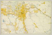
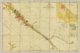
Colour-coded map depicts lands surveyed as alienated, available for purchase or lease under Taxation Act, or reserved. Depicts land district boundaries, land recording divisions, triangulation stations, telegraph/telephone lines, communities, bodies of water, and transport routes.
2008.2.037
·
Item
·
[after 1901]
Part of NBCA Maps and Plans Collection
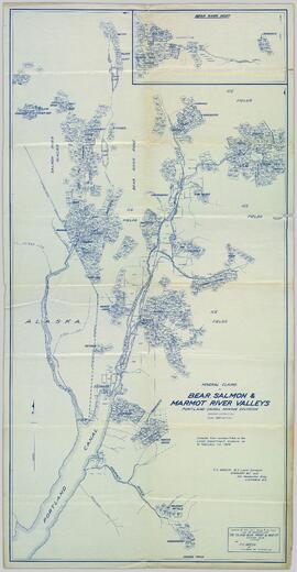
Original linen map depicts mining claims in the Cassiar District of British Columbia that were located in 1900-1901: L. 115 Princess Louise, L. 310 North Star, L. 311 Bonanza, L. 309 Emerald, and L. 312 Emma.
2008.2.021
·
Item
·
1 May 1940
Part of NBCA Maps and Plans Collection
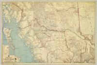
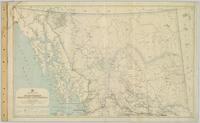
Topographic map depicts communities, bodies of water, transport routes, parks, game reserves, posts, ports, radio stations, power sites (figures in horse power), steamship routes (distance in nautical miles), and precipitation. Mineral resources summarized locally in red ink.
2008.2.007
·
Item
·
1923
Part of NBCA Maps and Plans Collection
Provincial map depicting communities, bodies of water, transport routes, land districts, parks, telegraph/telephone lines, and mining regions, offices, and engineers. Includes Distance Tables (“Coast,” “Roads,” “Railways,” and “World”) and Index of Post Offices.
2008.2.051
·
Item
·
July 1961
Part of NBCA Maps and Plans Collection
2008.2.012
·
Item
·
1926
Part of NBCA Maps and Plans Collection
Geological topographic map that the Geological Survey produced for the Department of Mines, Canada. Includes two detailed topographic cross sections.
2008.2.031
·
Item
·
1917
Part of NBCA Maps and Plans Collection
Colour-coded topographic map depicts forest stands of different heights.
2008.2.024
·
Item
·
3 January 1944
Part of NBCA Maps and Plans Collection
Colour-coded map depicting surveyed lands alienated, available for purchase or lease under Land Act, and available for pre-emption. Depicts land districts, land recording districts, provincial forests, parks, game reserves, communities, bodies of water, transport routes, communication lines, and triangulation stations.
2008.2.027
·
Item
·
1 May 1949
Part of NBCA Maps and Plans Collection
Colour-coded map depicts surveyed lands alienated, available for purchase or lease under Land Act, or available for pre-emption. Depicts land districts, land recording districts, provincial forests, parks, game reserves, communities, bodies of water, transport routes, communication lines, triangulation stations, and government reserves.
2008.2.038
·
Item
·
[ca. 1913]
Part of NBCA Maps and Plans Collection
Original oversize paper broadside published by British Columbia Estates Ltd. promotes land purchase in Fort George. Includes an "Application to Purchase", a price list, and a lot plan. Also includes a promotional article by S.S. Glass entitled "Fort George: A Commercial Centre".
2008.2.039
·
Item
·
1913
Part of NBCA Maps and Plans Collection
Original oversize paper broadside published by British Columbia Estates Ltd. promotes land purchase in Fort George. Includes a price list, a lot plan, and features of lots in the McGregor Addition and the Central Fort George Addition.
2008.2.030
·
Item
·
1917
Part of NBCA Maps and Plans Collection
Map depicts species of forest trees in British Columbia and their regional distribution.
2008.2.045
·
Item
·
1893
Part of NBCA Maps and Plans Collection
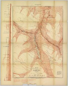
Consists of 1 topographical map with red colouring entitled "Map of Placer Mines & Quartz Locations in the Vicinity of Williams Creek, Cariboo District B.C." Surveyed and Drawn by Amos Bowman, Mining Engineer, Assisted by James McEvoy, B.A. Sc., printed by the Geological Survey Department, Canada.
2008.2.058
·
Item
·
[between 1925 and 1955]
Part of NBCA Maps and Plans Collection
2008.2
·
Collection
·
1893-2002
Collection consists of an assortment of cartographic materials and architectural plans concerning Northern BC. Included are topographic maps, pre-emptor’s and preliminary maps, physiographic maps, and resource (geological, game, etc.) maps.
2008.2.023
·
Item
·
1 December 1942
Part of NBCA Maps and Plans Collection
Colour-coded topographic map depicts surveyed lands alienated, available for purchase or lease under Land Act, and available for pre-emption. Depicts land districts, land recording districts, provincial forests, parks, triangulation stations, communities, bodies of water, transport routes, and communication lines.
2008.2.004
·
Item
·
4 April 1917
Part of NBCA Maps and Plans Collection
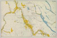
Regional map depicting land recording divisions, communities, bodies of water, transport routes, elevation, and lighthouses.
2008.2.018
·
Item
·
1 May 1933
Part of NBCA Maps and Plans Collection
Regional map depicting communities, parks, customs posts, airports, radio stations, hatcheries, bodies of water, transport routes, communication lines, elevation points, and lines of batholith contacts. Includes an inset of St. Elias Mountains. Includes “Special Note on the Mineralization of this Map Area” from Bureau of Mines, Victoria, B.C.
2008.2.055
·
Item
·
June 1965
Part of NBCA Maps and Plans Collection
Logging plan of TSX 69349 near Tezzeron Lake. Amended with logging inspection information, June 1965. Map printed in reverse on verso; annotations on the map on recto (map is correctly visible through the tracing paper).
2008.2.052
·
Item
·
July 1961
Part of NBCA Maps and Plans Collection
2008.2.053
·
Item
·
Aug. 1961
Part of NBCA Maps and Plans Collection
2008.2.054
·
Item
·
Aug. 1962
Part of NBCA Maps and Plans Collection
Logging plan of TSX 69349 near Tezzeron Lake. Amended with logging inspection information, Feb. 1964.

2008.2.025
·
Item
·
2 January 1945
Part of NBCA Maps and Plans Collection
Colour-coded topographic map depicting surveyed lands alienated, available for purchase or lease, or available for pre-emption. Depicts land districts, land recording districts, parks, communities, bodies of water, transport routes, communication lines, and triangulation stations.
2008.2.026
·
Item
·
1948
Part of NBCA Maps and Plans Collection
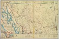
Colour-coded map dividing Northwestern British Columbia, the Western Northwest Territories, and the Yukon physiographically.
2008.2.044
·
Item
·
1991
Part of NBCA Maps and Plans Collection
Item consists of architectural plans created by Stuart C. Ross for the Powder King Ski Lodge, including Floor Plans; Elevations; Building Section; Building Section Details; Reflected Ceiling Plan, Window Schedule, Door Schedule, Room Finish Schedule; Millwork Details; and Roof Plan.

2008.2.002
·
Item
·
1916
Part of NBCA Maps and Plans Collection
Colour-coded map depicting lands open for pre-emption, lands in “University Reserve,” and lands reserved for public auction. Depicts land recording divisions, communities, bodies of water, transport routes, and game reserves.

2008.2.008
·
Item
·
15 February 1923
Part of NBCA Maps and Plans Collection
Colour-coded map depicting lands surveyed as alienated, reserved, Statutory Timber Lands, B.C. Land Settlement Board Area, or open for pre-emption. Depicts land districts, land recording divisions, communities, game reserves, bodies of water, transport routes, and communication lines.

2008.2.013
·
Item
·
1926
Part of NBCA Maps and Plans Collection
Colour-coded map depicting surveyed lands alienated, reserved, in B.C. Land Settlement Board Area, or open for preemption. Depicts land districts, land recording divisions, communities, bodies of water, transport routes, and communication lines.

2008.2.014
·
Item
·
1 February 1928
Part of NBCA Maps and Plans Collection
Colour-coded topographic map depicting lands surveyed as alienated, reserved, or open to preemption. Depicts land districts, land recording divisions, communities, bodies of water, communication lines, and transport routes.

2008.2.015
·
Item
·
1929
Part of NBCA Maps and Plans Collection
Colour-coded map depicting surveyed lands respectively open and closed to preemption. Depicts land recording divisions, land district boundaries, government reserves, communities, bodies of water, and transport routes. Includes topographical inset.

2008.2.001
·
Item
·
31 July 1914
Part of NBCA Maps and Plans Collection
Colour-coded map depicting lands open for preemption, in “University Reserve,” or reserved for public auction. Depicts land recording divisions, communities, bodies of water, and transport routes.

2008.2.009
·
Item
·
1 December 1923
Part of NBCA Maps and Plans Collection
Colour-coded topographic map depicting lands surveyed as alienated, reserved, or statutory timber land. Depicts land district boundaries, land recording divisions, HBC posts, triangulation stations, telephone lines, communities, bodies of water, and transport routes. Defines resource type areas (“Land Form,” “Soil,” “Forest Cover,” “Grazing,” “Geological & Mineralogical,” “Fur-Bearing Animals & Game”). Includes explanatory “Natural Resources Reference.”
2008.2.048
·
Item
·
1919
Part of NBCA Maps and Plans Collection
Map depicting surveyed lands, statutory timber lands, land recording divisions, game reserves, communities, bodies of water, and transport routes. Includes inset of McBride townsite.

2008.2.006
·
Item
·
1923
Part of NBCA Maps and Plans Collection
Map depicting surveyed lands, statutory timber lands, land recording divisions, game reserves, communities, bodies of water, and transport routes. Includes inset of McBride townsite.

2008.2.017
·
Item
·
1931
Part of NBCA Maps and Plans Collection
Colour-coded map depicting surveyed lands respectively open and closed to preemption. Depicts land recording divisions, game reserves, communities, bodies of water, and transport routes. Includes inset of McBride townsite.

2008.2.010
·
Item
·
1924
Part of NBCA Maps and Plans Collection
Colour-coded map depicting lands surveyed as alienated, reserved, and having a timber license, lease, or sale. Depicts land recording divisions, land district boundaries, communities, bodies of water, and transport routes. Includes insets of Stephens Island and Egeria Reach.
2008.2.036
·
Item
·
2002
Part of NBCA Maps and Plans Collection
2008.2.028
·
Item
·
31 December 1962
Part of NBCA Maps and Plans Collection
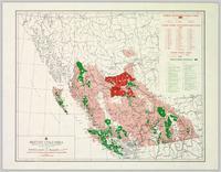
Colour-coded B.C. provincial map depicting sustained-yield units and tree-farm licenses. The area and company names of sustained-yield units (red) and tree-farm licences (green) are explicated in a table.
2008.2.019
·
Item
·
1935
Part of NBCA Maps and Plans Collection
Colour-coded geological topographic map. Geological Survey produced for the Bureau of Economic Geology, Department of Mines, Bureau of Economic Geology, Canada. Scale 1:126,720. Includes overview of "General Geology" and "Economic Geology."

2008.2.016
·
Item
·
1 June 1929
Part of NBCA Maps and Plans Collection
Topographic map depicting regions, communities, government posts. bodies of water, transport routes, surveyed areas, and reserves.

2008.2.022
·
Item
·
1 August 1940
Part of NBCA Maps and Plans Collection
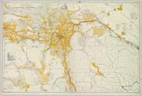
Colour-coded topographic map depicting lands surveyed as alienated, available for purchase or lease under Land Act, or reserved. Depicts land district boundaries, land recording divisions, provincial forest boundaries, HBC posts, triangulation stations, telephone lines, communities, bodies of water, and transport routes.
2008.2.056
·
Item
·
July 1961
Part of NBCA Maps and Plans Collection
2008.2.005
·
Item
·
1921
Part of NBCA Maps and Plans Collection
Colour-coded geological topographic map. Geological Survey produced for the Bureau of Economic Geology, Department of Mines, Bureau of Economic Geology, Canada. Includes detailed topographic cross section.